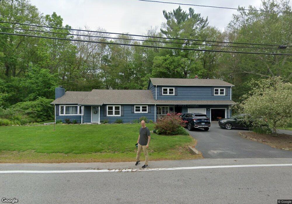
37 Pole Bridge Rd North Scituate, RI 02857
Estimated Value: $500,407 - $548,000
5
Beds
2
Baths
2,216
Sq Ft
$236/Sq Ft
Est. Value
About This Home
This home is located at 37 Pole Bridge Rd, North Scituate, RI 02857 and is currently estimated at $522,852, approximately $235 per square foot. 37 Pole Bridge Rd is a home located in Providence County with nearby schools including North Scituate School, Scituate Middle School, and Scituate High School.
Ownership History
Date
Name
Owned For
Owner Type
Purchase Details
Closed on
Dec 28, 2018
Sold by
62613 Doyle Ft
Bought by
Davis Josua and Davis Jessica
Current Estimated Value
Home Financials for this Owner
Home Financials are based on the most recent Mortgage that was taken out on this home.
Original Mortgage
$230,000
Outstanding Balance
$203,429
Interest Rate
4.9%
Mortgage Type
New Conventional
Estimated Equity
$319,423
Purchase Details
Closed on
Jun 6, 2013
Sold by
Nordquist Marshall E and Fnma
Bought by
Doyle Patrick M and Doyle Jean E
Create a Home Valuation Report for This Property
The Home Valuation Report is an in-depth analysis detailing your home's value as well as a comparison with similar homes in the area
Home Values in the Area
Average Home Value in this Area
Purchase History
| Date | Buyer | Sale Price | Title Company |
|---|---|---|---|
| Davis Josua | $287,500 | -- | |
| Doyle Patrick M | $138,000 | -- |
Source: Public Records
Mortgage History
| Date | Status | Borrower | Loan Amount |
|---|---|---|---|
| Open | Doyle Patrick M | $230,000 | |
| Previous Owner | Doyle Patrick M | $320,625 |
Source: Public Records
Tax History Compared to Growth
Tax History
| Year | Tax Paid | Tax Assessment Tax Assessment Total Assessment is a certain percentage of the fair market value that is determined by local assessors to be the total taxable value of land and additions on the property. | Land | Improvement |
|---|---|---|---|---|
| 2025 | $5,721 | $330,100 | $114,500 | $215,600 |
| 2024 | $5,721 | $330,100 | $114,500 | $215,600 |
| 2023 | $5,532 | $330,100 | $114,500 | $215,600 |
| 2022 | $5,407 | $330,100 | $114,500 | $215,600 |
| 2021 | $5,342 | $285,800 | $95,000 | $190,800 |
| 2020 | $5,222 | $285,800 | $95,000 | $190,800 |
| 2019 | $5,113 | $285,800 | $95,000 | $190,800 |
| 2018 | $4,471 | $230,600 | $83,600 | $147,000 |
| 2017 | $4,340 | $230,600 | $83,600 | $147,000 |
| 2016 | $4,160 | $230,600 | $83,600 | $147,000 |
| 2015 | $3,989 | $208,200 | $77,600 | $130,600 |
| 2014 | $3,952 | $208,200 | $77,600 | $130,600 |
Source: Public Records
Map
Nearby Homes
- 27 Sunnybrook Rd
- 219-221 Peeptoad Rd
- 219 Peeptoad Rd
- 4 Fair Oaks Ct N
- 110 Hopkins Ave
- 15 Chiswick Rd
- 0 Rocky Hill Rd Unit 1401626
- 10 Helena Way
- 62 Orchard Ave
- 66 Orchard Ave
- 389 Elmdale Rd
- 56 Pine Ledge Rd
- 112 Winsor Ave
- 18 Shady Brook Cove Rd
- 22 Liberty Ln
- 0 Country View Ln
- 2 Fairview Dr
- 94 Quaker Ln
- 28 Lakeview Dr
- 46 Woodsong Dr
- 33 Pole Bridge Rd
- 34 Pole Bridge Rd
- 44 Pole Bridge Rd
- 50 Pole Bridge Rd
- 47 Pole Bridge Rd
- 29 Pole Bridge Rd
- 4 Alfalfa Dr
- 7 Alfalfa Dr
- 12 S Woodland Rd
- 11 S Woodland Rd
- 28 Country Side Ln
- 8 Alfalfa Dr
- 56 Pole Bridge Rd
- 24 Country Side Ln
- 20 Pole Bridge Rd
- 33 Country Side Ln
- 29 Country Side Ln
- 18 S Woodland Rd
- 16 Country Side Ln
- 84 Countryside Dr