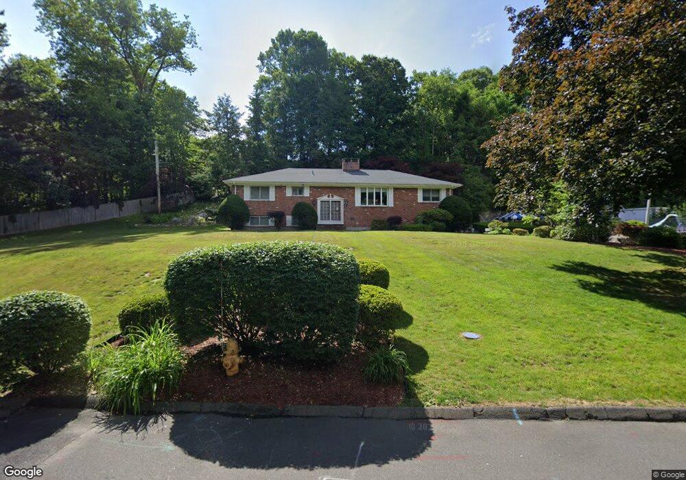
37 Rapids Rd Stamford, CT 06905
Turn of the River-Newfield NeighborhoodEstimated Value: $831,000 - $1,052,000
4
Beds
4
Baths
2,828
Sq Ft
$340/Sq Ft
Est. Value
About This Home
This home is located at 37 Rapids Rd, Stamford, CT 06905 and is currently estimated at $960,950, approximately $339 per square foot. 37 Rapids Rd is a home located in Fairfield County with nearby schools including Davenport Ridge Elementary School, Rippowam Middle School, and Stamford High School.
Ownership History
Date
Name
Owned For
Owner Type
Purchase Details
Closed on
Oct 23, 2025
Sold by
Terminating T T and Terminating Cavaliere
Bought by
Lois Ann Cavaliere Ret and Cavaliere
Current Estimated Value
Purchase Details
Closed on
Jun 30, 2023
Sold by
Cavaliere Lois A
Bought by
Lois A Cavaliere Ret and Cavaliere
Purchase Details
Closed on
May 18, 1967
Bought by
Cavaliere Dominick J
Create a Home Valuation Report for This Property
The Home Valuation Report is an in-depth analysis detailing your home's value as well as a comparison with similar homes in the area
Home Values in the Area
Average Home Value in this Area
Purchase History
| Date | Buyer | Sale Price | Title Company |
|---|---|---|---|
| Lois Ann Cavaliere Ret | -- | -- | |
| Lois Ann Cavaliere Ret | -- | -- | |
| Lois A Cavaliere Ret | -- | None Available | |
| Lois A Cavaliere Ret | -- | None Available | |
| Cavaliere Lois A | -- | None Available | |
| Cavaliere Lois A | -- | None Available | |
| Cavaliere Dominick J | -- | None Available | |
| Cavaliere Dominick J | -- | None Available | |
| Cavaliere Dominick J | -- | -- |
Source: Public Records
Mortgage History
| Date | Status | Borrower | Loan Amount |
|---|---|---|---|
| Previous Owner | Cavaliere Dominick J | $500,000 | |
| Previous Owner | Cavaliere Dominick J | $240,000 |
Source: Public Records
Tax History
| Year | Tax Paid | Tax Assessment Tax Assessment Total Assessment is a certain percentage of the fair market value that is determined by local assessors to be the total taxable value of land and additions on the property. | Land | Improvement |
|---|---|---|---|---|
| 2025 | $13,100 | $553,660 | $258,570 | $295,090 |
| 2024 | $12,812 | $553,660 | $258,570 | $295,090 |
| 2023 | $13,764 | $553,660 | $258,570 | $295,090 |
| 2022 | $12,011 | $449,190 | $191,900 | $257,290 |
| 2021 | $11,881 | $449,190 | $191,900 | $257,290 |
| 2020 | $11,576 | $449,190 | $191,900 | $257,290 |
| 2019 | $11,576 | $449,190 | $191,900 | $257,290 |
| 2018 | $11,149 | $449,190 | $191,900 | $257,290 |
| 2017 | $11,268 | $419,030 | $176,550 | $242,480 |
| 2016 | $10,589 | $419,030 | $176,550 | $242,480 |
| 2015 | $10,312 | $419,030 | $176,550 | $242,480 |
| 2014 | $9,969 | $419,030 | $176,550 | $242,480 |
Source: Public Records
Map
Nearby Homes
- 15 Four Brooks Cir
- 48 Briarwood Ln
- 136 Shadow Ridge Rd
- 865 High Ridge Rd Unit 1
- 7 the Reserve at Sterling Ridge
- 95 Intervale Rd Unit 46
- 55 Merriman Rd
- 78 Vine Rd
- 14 Barmore Dr
- 53 Waterview Way
- 53 Waterview Way Unit 53
- 210 Red Fox Rd
- 156 Intervale Rd
- 47 Wood Ridge Dr
- 62 Ridge Park Ave
- 281 Roxbury Rd
- 511 Den Rd
- 107 Deepwood Rd
- 677 W Hill Rd
- 1215 Westover Rd
Your Personal Tour Guide
Ask me questions while you tour the home.