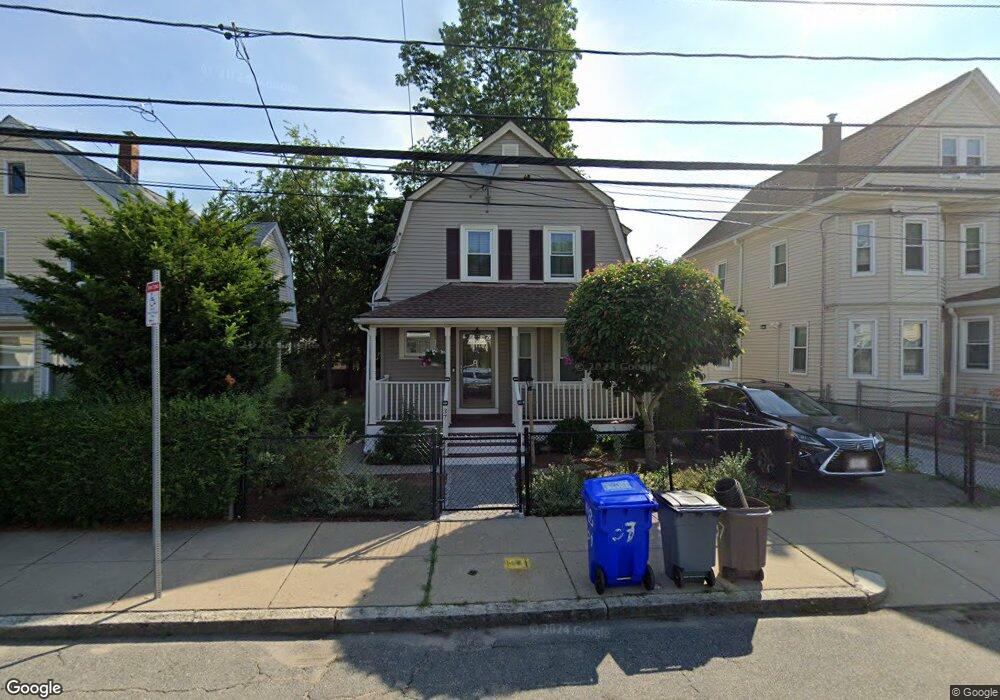
37 Rector Rd Mattapan, MA 02126
Southern Mattapan NeighborhoodEstimated Value: $552,000 - $627,000
3
Beds
1
Bath
1,284
Sq Ft
$456/Sq Ft
Est. Value
About This Home
This home is located at 37 Rector Rd, Mattapan, MA 02126 and is currently estimated at $584,888, approximately $455 per square foot. 37 Rector Rd is a home located in Suffolk County with nearby schools including KIPP Academy Boston Charter School, Berea Sda Academy, and St. Mary of the Hills School.
Ownership History
Date
Name
Owned For
Owner Type
Purchase Details
Closed on
Apr 30, 2022
Sold by
Bennett Ciola A
Bought by
Bennett Rt
Current Estimated Value
Purchase Details
Closed on
May 31, 2002
Sold by
Daly John J
Bought by
Bennett Ciola A
Home Financials for this Owner
Home Financials are based on the most recent Mortgage that was taken out on this home.
Original Mortgage
$182,400
Interest Rate
7%
Mortgage Type
Purchase Money Mortgage
Create a Home Valuation Report for This Property
The Home Valuation Report is an in-depth analysis detailing your home's value as well as a comparison with similar homes in the area
Home Values in the Area
Average Home Value in this Area
Purchase History
| Date | Buyer | Sale Price | Title Company |
|---|---|---|---|
| Bennett Rt | -- | None Available | |
| Bennett Ciola A | $192,000 | -- |
Source: Public Records
Mortgage History
| Date | Status | Borrower | Loan Amount |
|---|---|---|---|
| Previous Owner | Bennett Ciola A | $181,500 | |
| Previous Owner | Bennett Ciola A | $25,500 | |
| Previous Owner | Bennett Ciola A | $182,400 |
Source: Public Records
Tax History
| Year | Tax Paid | Tax Assessment Tax Assessment Total Assessment is a certain percentage of the fair market value that is determined by local assessors to be the total taxable value of land and additions on the property. | Land | Improvement |
|---|---|---|---|---|
| 2025 | $5,234 | $452,000 | $143,500 | $308,500 |
| 2024 | $4,677 | $429,100 | $154,100 | $275,000 |
| 2023 | $4,387 | $408,500 | $146,700 | $261,800 |
| 2022 | $4,116 | $378,300 | $135,900 | $242,400 |
| 2021 | $3,727 | $349,300 | $129,400 | $219,900 |
| 2020 | $3,519 | $333,200 | $125,300 | $207,900 |
| 2019 | $3,377 | $320,400 | $93,900 | $226,500 |
| 2018 | $3,138 | $299,400 | $93,900 | $205,500 |
| 2017 | $2,909 | $274,700 | $93,900 | $180,800 |
| 2016 | $2,747 | $249,700 | $93,900 | $155,800 |
| 2015 | $2,817 | $232,600 | $92,600 | $140,000 |
| 2014 | $2,683 | $213,300 | $92,600 | $120,700 |
Source: Public Records
Map
Nearby Homes
- 23 Caton St
- 645 River St
- 640 River St
- 27 Ralwood Rd
- 30 Massasoit St
- 853 Cummins Hwy
- 7 Winborough St
- 16 Blue Hill Ave
- 770 Cummins Hwy Unit 1
- 770 Cummins Hwy Unit 22
- 24 Belnel Rd
- 80 Blue Hills Pkwy
- 18 Rugby Rd
- 82 Blue Hill Ave
- 10 Brockton St
- 839-843 Cummins Hwy
- 52 Taunton Ave
- 95 Woodhaven St
- 16 Concord Ave Unit 1
- 34 Ridlon Rd
- 39 Rector Rd
- 35 Rector Rd
- 107 Rosewood St
- 41 Rector Rd
- 33 Rector Rd
- 108 Hollingsworth St
- 103 Rosewood St
- 102-104 Hollingsworth St Unit 104
- 102 Hollingsworth St Unit 104
- 99 Rosewood St
- 38 Rector Rd
- 40 Rector Rd Unit 42
- 36 Rector Rd
- 95A Rosewood St
- 27 Rector Rd
- 34 Rector Rd
- 98 Hollingsworth St Unit 2
- 98 Hollingsworth St Unit 100
- 98 Hollingsworth St Unit 98
- 98 Hollingsworth St Unit 1
Your Personal Tour Guide
Ask me questions while you tour the home.