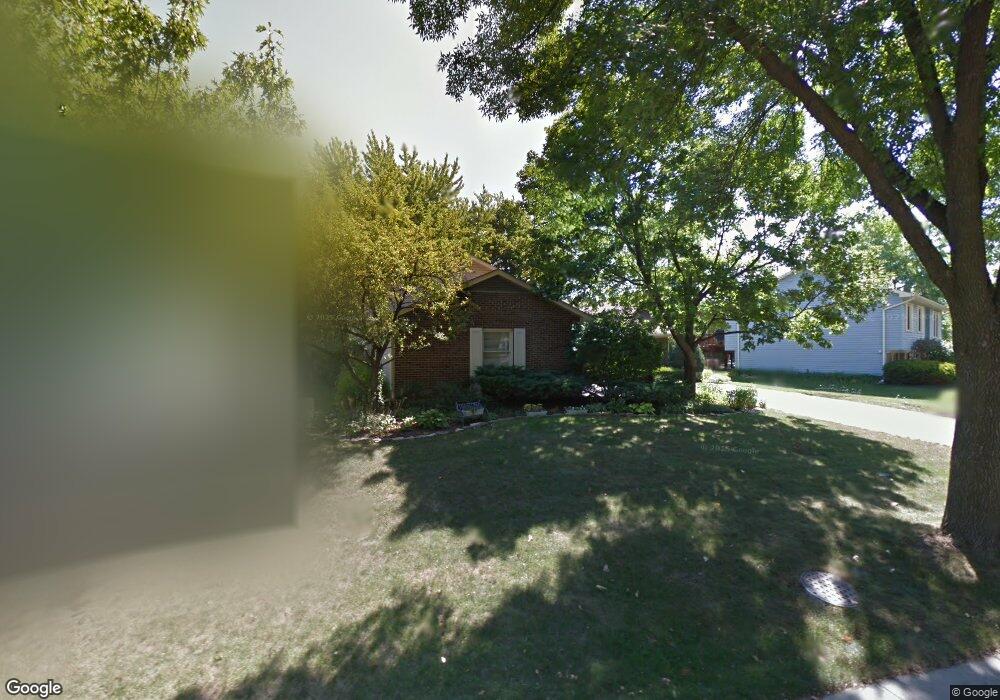
37 Red Haw Ln Lake Zurich, IL 60047
Estimated Value: $427,955 - $499,000
--
Bed
3
Baths
1,724
Sq Ft
$276/Sq Ft
Est. Value
About This Home
This home is located at 37 Red Haw Ln, Lake Zurich, IL 60047 and is currently estimated at $476,489, approximately $276 per square foot. 37 Red Haw Ln is a home located in Lake County with nearby schools including Sarah Adams Elementary School, Lake Zurich Middle School - South Campus, and Lake Zurich High School.
Ownership History
Date
Name
Owned For
Owner Type
Purchase Details
Closed on
Jul 21, 2021
Sold by
Struck John D and Struck Jane P
Bought by
Struck John D and Struck Jane P
Current Estimated Value
Purchase Details
Closed on
Sep 20, 1996
Sold by
Campbell G Montgomery
Bought by
Struck John D and Pabich Jane E
Home Financials for this Owner
Home Financials are based on the most recent Mortgage that was taken out on this home.
Original Mortgage
$171,000
Outstanding Balance
$14,385
Interest Rate
7.97%
Estimated Equity
$462,104
Create a Home Valuation Report for This Property
The Home Valuation Report is an in-depth analysis detailing your home's value as well as a comparison with similar homes in the area
Home Values in the Area
Average Home Value in this Area
Purchase History
| Date | Buyer | Sale Price | Title Company |
|---|---|---|---|
| Struck John D | -- | Attorney | |
| Struck John D | $190,000 | -- |
Source: Public Records
Mortgage History
| Date | Status | Borrower | Loan Amount |
|---|---|---|---|
| Open | Struck John D | $171,000 |
Source: Public Records
Tax History Compared to Growth
Tax History
| Year | Tax Paid | Tax Assessment Tax Assessment Total Assessment is a certain percentage of the fair market value that is determined by local assessors to be the total taxable value of land and additions on the property. | Land | Improvement |
|---|---|---|---|---|
| 2024 | $8,715 | $133,049 | $22,641 | $110,408 |
| 2023 | $8,715 | $118,786 | $20,214 | $98,572 |
| 2022 | $8,758 | $117,165 | $15,850 | $101,315 |
| 2021 | $8,453 | $114,163 | $15,444 | $98,719 |
| 2020 | $8,300 | $114,163 | $15,444 | $98,719 |
| 2019 | $8,174 | $113,167 | $15,309 | $97,858 |
| 2018 | $7,169 | $100,326 | $16,468 | $83,858 |
| 2017 | $7,120 | $99,117 | $16,270 | $82,847 |
| 2016 | $6,976 | $95,979 | $15,755 | $80,224 |
| 2015 | $6,871 | $91,417 | $15,006 | $76,411 |
| 2014 | $6,032 | $80,145 | $18,132 | $62,013 |
| 2012 | $6,341 | $80,314 | $18,170 | $62,144 |
Source: Public Records
Map
Nearby Homes
- 533 Surryse Rd
- 600 Ivy Ct
- 429 Grand Ave
- 795 Harvest Dr
- 898 S Rand Rd
- 155 Canterbury Way
- 890 June Terrace Unit 140
- 54 Mionske Dr
- 77 Mionske Dr
- 21839 Cambridge Dr
- 21742 N Ashley St
- 21763 Deerpath Rd
- 20992 W Preserve Dr
- 21186 W Preserve Dr
- 461 N Newberry Ct
- 21031 N Quentin Rd
- 21041-51 N Quentin Rd
- 27 Maple Ave
- 99 Quentin Rd
- 10 Pine Ave
- 35 Red Haw Ln
- 39 Red Haw Ln
- 610 Surryse Rd
- 33 Red Haw Ln
- 40 Red Haw Ln
- 345 Red Bridge Rd
- 355 Red Bridge Rd Unit 2
- 36 Red Haw Ln
- 38 Red Haw Ln
- 34 Red Haw Ln
- 601 Surryse Rd
- 31 Red Haw Ln
- 335 Red Bridge Rd
- 550 Surryse Rd
- 607 Surryse Rd
- 28 Red Haw Ln
- 363 Red Bridge Rd
- 540 Surryse Rd
- 591 Surryse Rd
- 5 Black Twig Cir