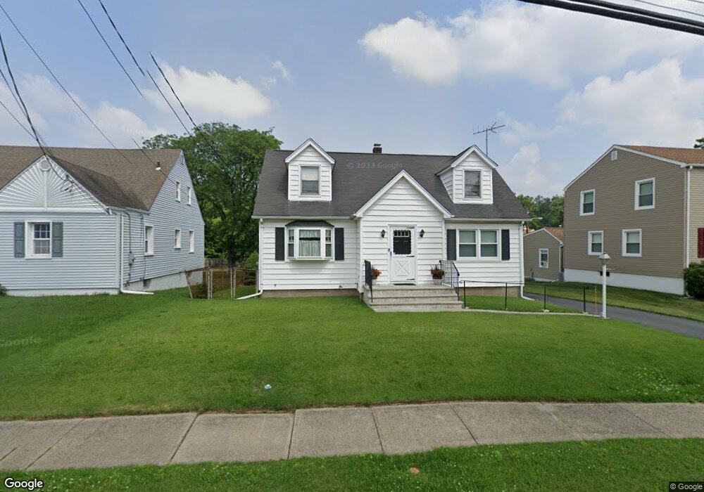
37 Reynolds Ave Whippany, NJ 07981
Estimated Value: $522,659 - $626,000
--
Bed
--
Bath
1,382
Sq Ft
$420/Sq Ft
Est. Value
About This Home
This home is located at 37 Reynolds Ave, Whippany, NJ 07981 and is currently estimated at $580,415, approximately $419 per square foot. 37 Reynolds Ave is a home located in Morris County with nearby schools including Whippany Park High School, Arrow Academy, and The Morristown-Beard School.
Ownership History
Date
Name
Owned For
Owner Type
Purchase Details
Closed on
Oct 23, 2019
Sold by
Vnencak Albert and Estate Of Albert P Vnencak
Bought by
Vnencak Robert P and Vnencak Marilyn
Current Estimated Value
Home Financials for this Owner
Home Financials are based on the most recent Mortgage that was taken out on this home.
Original Mortgage
$206,200
Outstanding Balance
$181,010
Interest Rate
3.6%
Mortgage Type
New Conventional
Estimated Equity
$399,405
Create a Home Valuation Report for This Property
The Home Valuation Report is an in-depth analysis detailing your home's value as well as a comparison with similar homes in the area
Home Values in the Area
Average Home Value in this Area
Purchase History
| Date | Buyer | Sale Price | Title Company |
|---|---|---|---|
| Vnencak Robert P | $300,000 | Fidelity National Ttl Ins Co |
Source: Public Records
Mortgage History
| Date | Status | Borrower | Loan Amount |
|---|---|---|---|
| Open | Vnencak Robert P | $206,200 |
Source: Public Records
Tax History Compared to Growth
Tax History
| Year | Tax Paid | Tax Assessment Tax Assessment Total Assessment is a certain percentage of the fair market value that is determined by local assessors to be the total taxable value of land and additions on the property. | Land | Improvement |
|---|---|---|---|---|
| 2025 | $6,514 | $309,000 | $166,800 | $142,200 |
| 2024 | $6,444 | $309,000 | $166,800 | $142,200 |
| 2023 | $6,444 | $307,000 | $166,800 | $140,200 |
| 2022 | $5,894 | $307,000 | $166,800 | $140,200 |
| 2021 | $5,894 | $286,400 | $166,800 | $119,600 |
| 2020 | $5,402 | $286,400 | $166,800 | $119,600 |
| 2019 | $5,419 | $286,400 | $166,800 | $119,600 |
| 2018 | $5,324 | $286,400 | $166,800 | $119,600 |
| 2017 | $5,167 | $286,400 | $166,800 | $119,600 |
| 2016 | $5,092 | $286,400 | $166,800 | $119,600 |
| 2015 | $4,639 | $286,400 | $166,800 | $119,600 |
| 2014 | $4,533 | $286,400 | $166,800 | $119,600 |
Source: Public Records
Map
Nearby Homes
- 39 Lefke Ln
- 96 Parsippany Rd
- 72 Reynolds Ave
- 67 Branford Rd
- 67 Parsippany Rd
- 11 Nemic Ln
- 100 Louis St
- 36 Gladstone Ct
- 23 Gladstone Ct
- 39 Gladstone Ct
- 42 Gladstone Ct
- 34 Gladstone Ct
- 16 Gladstone Ct
- 14 Gladstone Ct
- 47 Gladstone Ct
- 37 Gladstone Ct
- Monterey Plan at The Grove - The Monterey Collection
- Pershing Plan at The Grove - The Pershing Collection
- 304 Beaverbrook Terrace Unit 304
- 20 Gladstone Ct