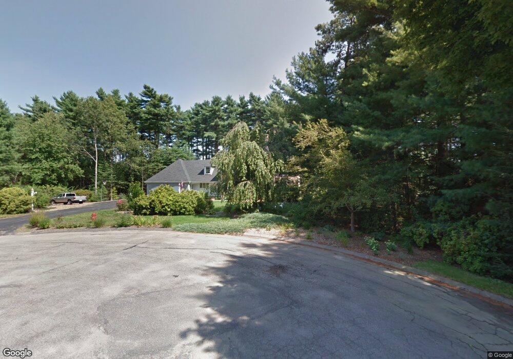
37 Robin Rd Norfolk, MA 02056
Estimated Value: $950,921 - $1,131,000
4
Beds
3
Baths
3,635
Sq Ft
$285/Sq Ft
Est. Value
About This Home
This home is located at 37 Robin Rd, Norfolk, MA 02056 and is currently estimated at $1,036,980, approximately $285 per square foot. 37 Robin Rd is a home located in Norfolk County with nearby schools including H. Olive Day School, Freeman-Kennedy School, and Clifford Academy.
Ownership History
Date
Name
Owned For
Owner Type
Purchase Details
Closed on
May 28, 2010
Sold by
Gregory Janis M
Bought by
Anderson David M and Anderson Jennifer L
Current Estimated Value
Home Financials for this Owner
Home Financials are based on the most recent Mortgage that was taken out on this home.
Original Mortgage
$417,000
Outstanding Balance
$281,659
Interest Rate
5.13%
Mortgage Type
Purchase Money Mortgage
Estimated Equity
$755,321
Purchase Details
Closed on
Jun 30, 2006
Sold by
Gregory James and Gregory Janis
Bought by
Gregory James T and Gregory Janis M
Home Financials for this Owner
Home Financials are based on the most recent Mortgage that was taken out on this home.
Original Mortgage
$275,000
Interest Rate
6.58%
Purchase Details
Closed on
Jun 1, 2000
Sold by
Sawyer Martha C and Sawyer John C
Bought by
Leach Tr Ruth E
Create a Home Valuation Report for This Property
The Home Valuation Report is an in-depth analysis detailing your home's value as well as a comparison with similar homes in the area
Home Values in the Area
Average Home Value in this Area
Purchase History
| Date | Buyer | Sale Price | Title Company |
|---|---|---|---|
| Anderson David M | $551,887 | -- | |
| Gregory James T | -- | -- | |
| Leach Tr Ruth E | $437,000 | -- |
Source: Public Records
Mortgage History
| Date | Status | Borrower | Loan Amount |
|---|---|---|---|
| Open | Anderson David M | $417,000 | |
| Previous Owner | Gregory James T | $275,000 |
Source: Public Records
Tax History
| Year | Tax Paid | Tax Assessment Tax Assessment Total Assessment is a certain percentage of the fair market value that is determined by local assessors to be the total taxable value of land and additions on the property. | Land | Improvement |
|---|---|---|---|---|
| 2025 | $13,368 | $837,100 | $199,600 | $637,500 |
| 2024 | $12,819 | $823,300 | $216,400 | $606,900 |
| 2023 | $12,196 | $743,200 | $216,400 | $526,800 |
| 2022 | $11,593 | $637,000 | $203,200 | $433,800 |
| 2021 | $11,434 | $635,600 | $209,800 | $425,800 |
| 2020 | $11,956 | $641,400 | $210,800 | $430,600 |
| 2019 | $11,497 | $628,600 | $210,800 | $417,800 |
| 2018 | $11,178 | $600,300 | $220,700 | $379,600 |
| 2017 | $11,027 | $605,200 | $220,700 | $384,500 |
| 2016 | $11,061 | $611,800 | $235,600 | $376,200 |
| 2015 | $10,124 | $573,300 | $221,300 | $352,000 |
| 2014 | $9,937 | $570,100 | $221,300 | $348,800 |
Source: Public Records
Map
Nearby Homes
- 8 Ridgefield Rd
- 23 Fredrickson Rd
- 0 W Birch Rd
- 7 Keeney Pond Rd
- 246 Forest Grove Ave
- 18 Keeney Pond Rd
- 45 Meetinghouse Rd Unit 45
- 16 Keeney Pond Rd
- 45 Joshua Rd
- 30 Weber Farm Rd Unit 30
- 3 Elliot Mills Unit 2
- 6 Elliot Mills Unit 31
- 0 Toils End Rd
- 11 Weber Farm Rd Unit 11
- 11 Sharon Ave
- 292 Main St
- 8 Weber Farm Rd Unit 8
- 9 Sharon Ave
- 298 Main St
- 33 Boydes Crossing Unit 33
Your Personal Tour Guide
Ask me questions while you tour the home.