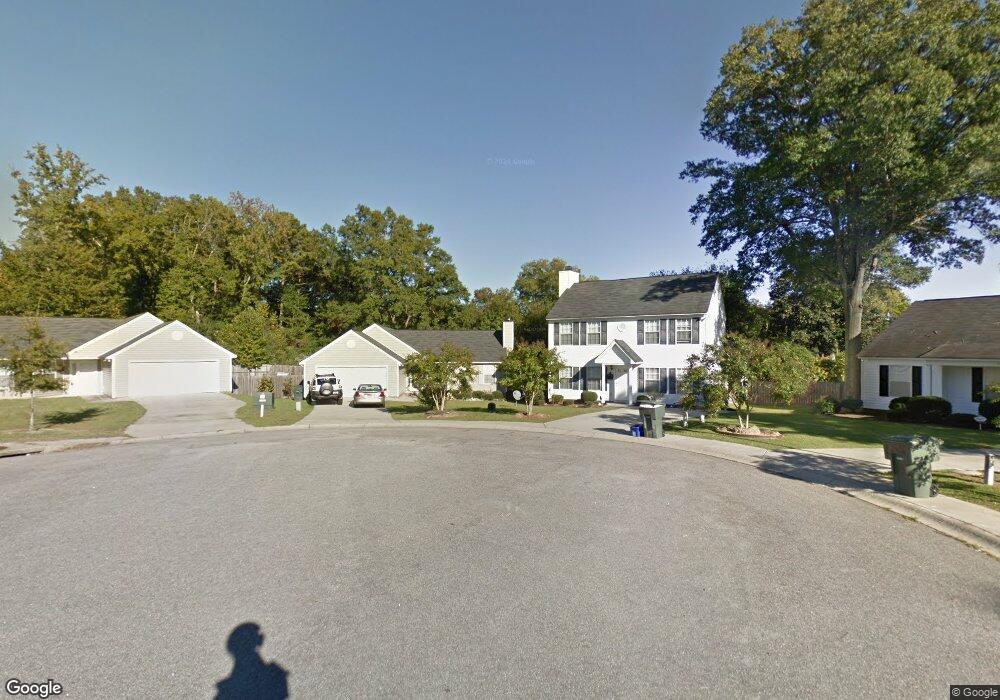
37 S Silas Brook Ct Columbia, SC 29203
Burton Heights NeighborhoodEstimated Value: $187,814 - $224,000
4
Beds
2
Baths
1,489
Sq Ft
$140/Sq Ft
Est. Value
About This Home
This home is located at 37 S Silas Brook Ct, Columbia, SC 29203 and is currently estimated at $209,204, approximately $140 per square foot. 37 S Silas Brook Ct is a home located in Richland County with nearby schools including Burton Pack Elementary School, W. A. Perry Middle School, and C. A. Johnson High School.
Ownership History
Date
Name
Owned For
Owner Type
Purchase Details
Closed on
Dec 2, 2016
Sold by
Four Roses Llc
Bought by
Eubanks Raynard A
Current Estimated Value
Home Financials for this Owner
Home Financials are based on the most recent Mortgage that was taken out on this home.
Original Mortgage
$115,373
Outstanding Balance
$93,162
Interest Rate
3.52%
Mortgage Type
New Conventional
Estimated Equity
$116,042
Purchase Details
Closed on
Dec 14, 2011
Sold by
Vip Developers Inc
Bought by
Four Roses Llc
Home Financials for this Owner
Home Financials are based on the most recent Mortgage that was taken out on this home.
Original Mortgage
$185,000
Interest Rate
4.06%
Mortgage Type
Purchase Money Mortgage
Create a Home Valuation Report for This Property
The Home Valuation Report is an in-depth analysis detailing your home's value as well as a comparison with similar homes in the area
Home Values in the Area
Average Home Value in this Area
Purchase History
| Date | Buyer | Sale Price | Title Company |
|---|---|---|---|
| Eubanks Raynard A | $115,500 | None Available | |
| Four Roses Llc | -- | -- |
Source: Public Records
Mortgage History
| Date | Status | Borrower | Loan Amount |
|---|---|---|---|
| Open | Eubanks Raynard A | $115,373 | |
| Previous Owner | Four Roses Llc | $185,000 |
Source: Public Records
Tax History Compared to Growth
Tax History
| Year | Tax Paid | Tax Assessment Tax Assessment Total Assessment is a certain percentage of the fair market value that is determined by local assessors to be the total taxable value of land and additions on the property. | Land | Improvement |
|---|---|---|---|---|
| 2024 | $567 | $132,300 | $0 | $0 |
| 2023 | $567 | $4,604 | $0 | $0 |
| 2022 | $471 | $115,100 | $17,500 | $97,600 |
| 2021 | $486 | $4,600 | $0 | $0 |
| 2020 | $513 | $4,600 | $0 | $0 |
| 2019 | $517 | $4,600 | $0 | $0 |
| 2018 | $533 | $4,620 | $0 | $0 |
| 2017 | $519 | $4,620 | $0 | $0 |
| 2016 | $2,885 | $6,100 | $0 | $0 |
| 2015 | $2,868 | $6,100 | $0 | $0 |
| 2014 | $2,842 | $101,600 | $0 | $0 |
| 2013 | -- | $6,100 | $0 | $0 |
Source: Public Records
Map
Nearby Homes
- 1833 Isabel St
- 1731 Columbia College Dr
- 4008 Farrow Rd
- 1605 Charles St
- 4321 Colonial Dr
- 1519 Cleveland St
- 1515 Cleveland St
- S/S Seaboard Ave
- 5140 Floran St
- 2428 Chappelle St
- 2261 Chappelle St
- 4214 Grand St
- 5008 Holmes Ave
- 72 Madera Dr
- 3902 Surrey St
- 5018 N Main St
- 3526 Randolph St
- 4915 Rhett St
- 4306 Windemere Ave
- N3504 W Beltline Blvd
- 40 S Silas Brook Ct
- 33 S Silas Brook Ct
- 4821 Norman St
- 4829 Norman St
- 4900 Roberts St
- 4817 Norman St
- 36 S Silas Brook Ct
- 4833 Norman St
- 4813 Norman St
- 21 S Silas Brook Ct
- 4837 Norman St
- 32 S Silas Brook Ct
- 4805 Roberts St
- 4809 Norman St
- 41 Blanchelle Ct
- 28 S Silas Brook Ct
- 4826 Norman St
- 4830 Norman St
- 4838 Norman St
- 4822 Norman St