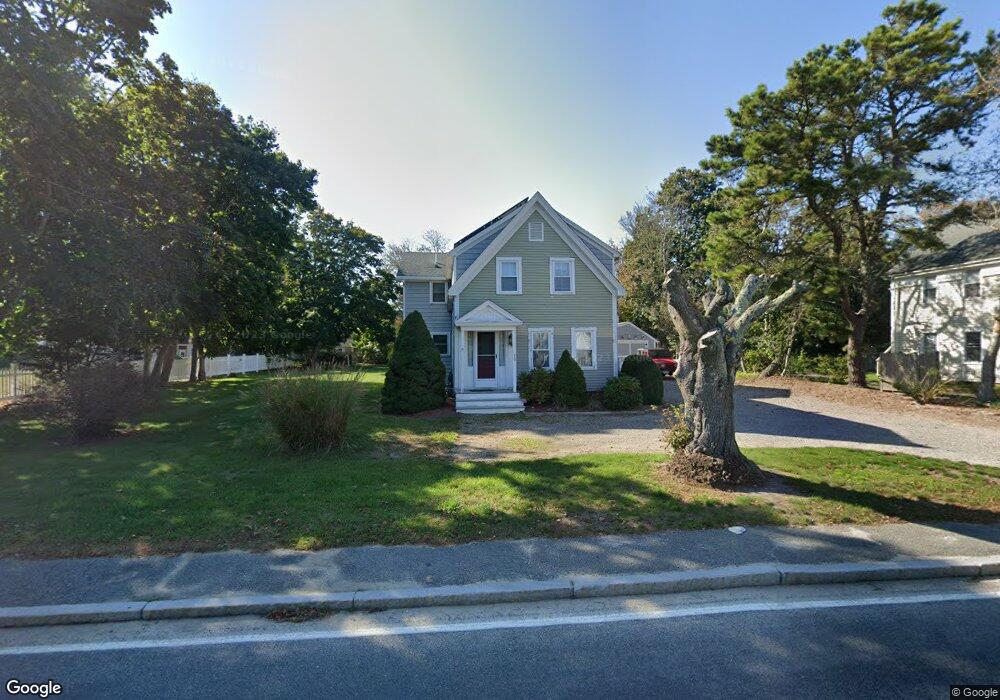
37 School St West Dennis, MA 02670
West Dennis NeighborhoodEstimated Value: $1,556,000 - $2,155,000
3
Beds
2
Baths
1,226
Sq Ft
$1,501/Sq Ft
Est. Value
About This Home
This home is located at 37 School St, West Dennis, MA 02670 and is currently estimated at $1,840,760, approximately $1,501 per square foot. 37 School St is a home located in Barnstable County with nearby schools including Dennis-Yarmouth Regional High School and St. Pius X. School.
Ownership History
Date
Name
Owned For
Owner Type
Purchase Details
Closed on
May 11, 2020
Sold by
Burkhard Janet B and Burkhard Mark
Bought by
37 School Street Rt
Current Estimated Value
Purchase Details
Closed on
Jan 31, 2019
Sold by
Jeanne H Linxweiler Lt and Linxweiler
Bought by
Burkhard Mark and Barnard-Burkhard Janet
Home Financials for this Owner
Home Financials are based on the most recent Mortgage that was taken out on this home.
Original Mortgage
$200,000
Interest Rate
4.6%
Mortgage Type
New Conventional
Purchase Details
Closed on
May 31, 2006
Sold by
Carol Rollet Marital T and Carol Rollet
Bought by
Rollet Daniel N and Rollet John
Purchase Details
Closed on
Aug 28, 1996
Sold by
Hodson Gertrude S
Bought by
Jeanne H Linxweiler Lt and Linxweiler
Create a Home Valuation Report for This Property
The Home Valuation Report is an in-depth analysis detailing your home's value as well as a comparison with similar homes in the area
Home Values in the Area
Average Home Value in this Area
Purchase History
| Date | Buyer | Sale Price | Title Company |
|---|---|---|---|
| 37 School Street Rt | -- | None Available | |
| Burkhard Mark | $1,145,000 | -- | |
| Burkhard Mark | $1,145,000 | -- | |
| Burkhard Mark | $1,145,000 | -- | |
| Rollet Daniel N | -- | -- | |
| Jeanne H Linxweiler Lt | $160,000 | -- | |
| Rollet Daniel N | -- | -- | |
| Jeanne H Linxweiler Lt | $160,000 | -- |
Source: Public Records
Mortgage History
| Date | Status | Borrower | Loan Amount |
|---|---|---|---|
| Previous Owner | Burkhard Mark | $200,000 |
Source: Public Records
Tax History Compared to Growth
Tax History
| Year | Tax Paid | Tax Assessment Tax Assessment Total Assessment is a certain percentage of the fair market value that is determined by local assessors to be the total taxable value of land and additions on the property. | Land | Improvement |
|---|---|---|---|---|
| 2025 | $7,884 | $1,820,900 | $593,600 | $1,227,300 |
| 2024 | $7,843 | $1,786,500 | $570,900 | $1,215,600 |
| 2023 | $7,587 | $1,624,600 | $519,000 | $1,105,600 |
| 2022 | $7,167 | $1,279,800 | $467,500 | $812,300 |
| 2021 | $6,740 | $1,117,700 | $458,300 | $659,400 |
| 2020 | $7,485 | $1,227,000 | $513,300 | $713,700 |
| 2019 | $7,078 | $1,147,200 | $503,300 | $643,900 |
| 2018 | $7,198 | $1,135,400 | $513,300 | $622,100 |
| 2017 | $6,772 | $1,101,200 | $479,100 | $622,100 |
| 2016 | $6,870 | $1,052,100 | $521,900 | $530,200 |
| 2015 | $6,733 | $1,052,100 | $521,900 | $530,200 |
| 2014 | $6,719 | $1,058,100 | $521,900 | $536,200 |
Source: Public Records
Map
Nearby Homes
- 23 Doric Ave
- 401 Main St Unit 201
- 401 Main St Unit 101
- 14 Schoolhouse Ln
- 209 Main St Unit 3
- 209 Main St Unit 6
- 209 Main St Unit 1
- 209 Main St Unit 2
- 209 Main St Unit 4
- 209 Main St Unit 5
- 178 School St
- 467 Main St
- 428 Main St Unit 1-11
- 61 Trotters Ln
- 2 Rita Mary Way
- 45 Seth Ln
- 40 Kelley Rd
- 29 Bass River Rd
- 18 Turner Ln
- 15 Woodside Park Rd
- 37 School St
- 25 School St
- 51 School St
- 51 School St
- 51 School St Unit 2
- 55 School St
- 152 Pond St
- 38 Doric Ave
- 46 Doric Ave
- 50 School St
- 34 School St Unit 9
- 34 School St Unit 8
- 34 School St Unit 7
- 34 School St Unit 6
- 34 School St Unit 5
- 34 School St Unit 4
- 34 School St Unit 3
- 34 School St Unit 2
- 34 School St Unit 1
- 34 School St