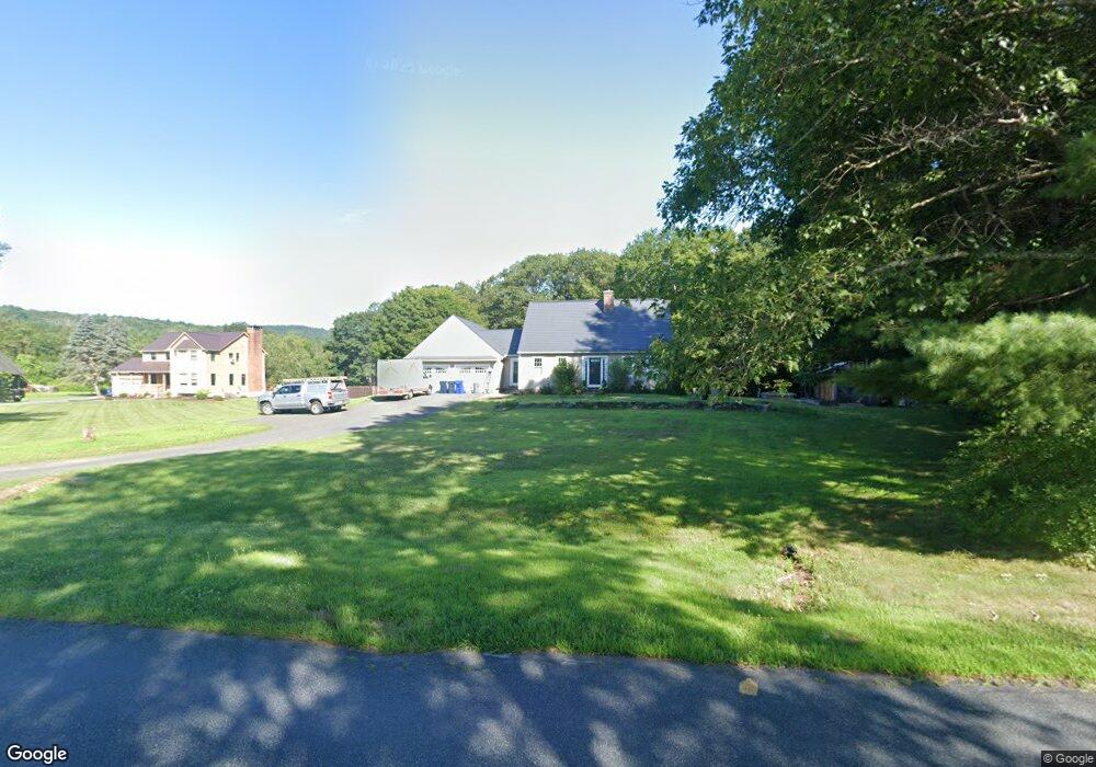
37 Swamp Rd Whately, MA 01093
Estimated Value: $450,000 - $583,000
3
Beds
2
Baths
2,092
Sq Ft
$249/Sq Ft
Est. Value
About This Home
This home is located at 37 Swamp Rd, Whately, MA 01093 and is currently estimated at $520,515, approximately $248 per square foot. 37 Swamp Rd is a home located in Franklin County with nearby schools including Whately Elementary School and Frontier Regional School.
Ownership History
Date
Name
Owned For
Owner Type
Purchase Details
Closed on
Jul 31, 2020
Sold by
Nadolski Lindsay
Bought by
Nadolski Lindsay and Nadolski Andrew
Current Estimated Value
Home Financials for this Owner
Home Financials are based on the most recent Mortgage that was taken out on this home.
Original Mortgage
$230,000
Outstanding Balance
$178,143
Interest Rate
3%
Mortgage Type
New Conventional
Estimated Equity
$342,372
Purchase Details
Closed on
Aug 24, 2009
Sold by
Labato Clinton and Lambert-Labato Kim
Bought by
Helems Lindsay
Home Financials for this Owner
Home Financials are based on the most recent Mortgage that was taken out on this home.
Original Mortgage
$283,221
Interest Rate
5.19%
Mortgage Type
Purchase Money Mortgage
Purchase Details
Closed on
Sep 21, 1998
Sold by
Bellino Mark and Bellino Judith
Bought by
Labato Clinto and Lambert-Labato Kim
Create a Home Valuation Report for This Property
The Home Valuation Report is an in-depth analysis detailing your home's value as well as a comparison with similar homes in the area
Home Values in the Area
Average Home Value in this Area
Purchase History
We collect this data history from publicly available records. To have your information removed, we recommend requesting removal directly through your county’s website.
| Date | Buyer | Sale Price | Title Company |
|---|---|---|---|
| Nadolski Lindsay | -- | None Available | |
| Helems Lindsay | $293,000 | -- | |
| Helems Lindsay L | $293,000 | -- | |
| Labato Clinto | $37,000 | -- |
Source: Public Records
Mortgage History
We collect this data history from publicly available records. To have your information removed, we recommend requesting removal directly through your county’s website.
| Date | Status | Borrower | Loan Amount |
|---|---|---|---|
| Open | Nadolski Lindsay | $230,000 | |
| Previous Owner | Labato Clinto | $278,500 | |
| Previous Owner | Helems Lindsay L | $283,221 | |
| Previous Owner | Labato Clinto | $118,460 |
Source: Public Records
Tax History
| Year | Tax Paid | Tax Assessment Tax Assessment Total Assessment is a certain percentage of the fair market value that is determined by local assessors to be the total taxable value of land and additions on the property. | Land | Improvement |
|---|---|---|---|---|
| 2025 | $5,565 | $417,200 | $118,000 | $299,200 |
| 2024 | $5,128 | $374,600 | $101,500 | $273,100 |
| 2023 | $4,797 | $337,800 | $96,700 | $241,100 |
| 2022 | $4,631 | $337,800 | $96,700 | $241,100 |
| 2021 | $4,585 | $307,300 | $96,700 | $210,600 |
| 2020 | $4,695 | $299,600 | $94,000 | $205,600 |
| 2019 | $4,648 | $299,500 | $94,000 | $205,500 |
| 2018 | $4,594 | $299,500 | $94,000 | $205,500 |
| 2017 | $4,672 | $299,500 | $94,000 | $205,500 |
| 2016 | $4,317 | $288,600 | $94,000 | $194,600 |
| 2015 | $4,597 | $284,300 | $89,700 | $194,600 |
| 2014 | $4,483 | $284,300 | $89,700 | $194,600 |
Source: Public Records
Map
Nearby Homes
- 0 North St Unit 73407299
- 79 State Rd
- 92 Masterson Rd
- 0 Greenfield Rd Unit 73472322
- 14 Sugarloaf St
- Lot 1 N Hatfield Rd
- Lot 2 N Hatfield Rd
- 74 N Hatfield Rd
- 117 N Main St
- 0 Straits Rd
- 0 Old Stage Rd Unit 73494659
- 26 Gore Ave
- 136 Main St
- 37 N Farms Rd
- 277 River Dr
- 555 Coles Meadow Rd
- 70 Stillwater Rd Unit B
- 58 Main St Unit 3
- 6 Duncan Dr Unit B
- 0 Pocumtuck Dr Unit 73379330
- 25 Swamp Rd
- 31 Swamp Rd
- 9 Swamp Rd
- 14 Swamp Rd
- 15 Swamp Rd
- 340 Haydenville Rd
- 339 Haydenville Rd
- 348 Haydenville Rd
- 348 Haydenville Rd
- Lot 13 Chestnut Mountain Rd
- 00 I-91 B&m Rr
- 31 Grey Oak Ln
- 197 Chestnut Plain Rd
- 19 Lot
- W/S Mt Esther Rd
- 123 Confidential Rd
- 168 Chestnut Plain Rd
- 298 Haydenville Rd
- 200 Chestnut Plain Rd
- 203 Chestnut Plain Rd
Your Personal Tour Guide
Ask me questions while you tour the home.