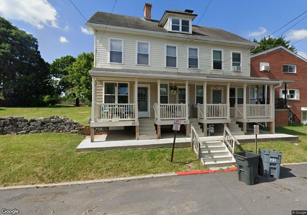
37 W Maple St Funkstown, MD 21734
Estimated Value: $160,000 - $200,000
--
Bed
1
Bath
1,344
Sq Ft
$131/Sq Ft
Est. Value
About This Home
This home is located at 37 W Maple St, Funkstown, MD 21734 and is currently estimated at $175,539, approximately $130 per square foot. 37 W Maple St is a home located in Washington County with nearby schools including Ruth Ann Monroe Primary School, Eastern Elementary School, and E. Russell Hicks Middle School.
Ownership History
Date
Name
Owned For
Owner Type
Purchase Details
Closed on
Mar 10, 2006
Sold by
Mills Melissa Jean
Bought by
Jean Mills Darren and Jean Melissa
Current Estimated Value
Purchase Details
Closed on
Feb 22, 2006
Sold by
Mills Melissa Jean
Bought by
Jean Mills Darren and Jean Melissa
Purchase Details
Closed on
Jul 11, 2000
Sold by
Strother Charles M
Bought by
Mills Melissa Jean
Create a Home Valuation Report for This Property
The Home Valuation Report is an in-depth analysis detailing your home's value as well as a comparison with similar homes in the area
Home Values in the Area
Average Home Value in this Area
Purchase History
| Date | Buyer | Sale Price | Title Company |
|---|---|---|---|
| Jean Mills Darren | -- | -- | |
| Jean Mills Darren | -- | -- | |
| Mills Melissa Jean | $33,000 | -- |
Source: Public Records
Mortgage History
| Date | Status | Borrower | Loan Amount |
|---|---|---|---|
| Closed | Jean Mills Darren | -- |
Source: Public Records
Tax History Compared to Growth
Tax History
| Year | Tax Paid | Tax Assessment Tax Assessment Total Assessment is a certain percentage of the fair market value that is determined by local assessors to be the total taxable value of land and additions on the property. | Land | Improvement |
|---|---|---|---|---|
| 2025 | $994 | $133,400 | $0 | $0 |
| 2024 | $994 | $109,100 | $35,000 | $74,100 |
| 2023 | $985 | $108,100 | $0 | $0 |
| 2022 | $943 | $107,100 | $0 | $0 |
| 2021 | $877 | $106,100 | $35,000 | $71,100 |
| 2020 | $877 | $100,600 | $0 | $0 |
| 2019 | $839 | $95,100 | $0 | $0 |
| 2018 | $798 | $89,600 | $35,000 | $54,600 |
| 2017 | $764 | $89,267 | $0 | $0 |
| 2016 | -- | $88,933 | $0 | $0 |
| 2015 | $547 | $88,600 | $0 | $0 |
| 2014 | $547 | $88,600 | $0 | $0 |
Source: Public Records
Map
Nearby Homes
- 24 W Cemetery St
- 1432 Oak Ridge Place
- 104 Bethlehem Ct
- 12.3 AC Southern Blvd
- 701 Beaver Creek Rd
- 206 Winding Oak Dr
- 1203 Peppercorn Dr
- 202 S Fork Dr
- 90 Charlotte St
- 628 Knightsbridge Dr
- 147 Buttercup Dr
- 137 Sunflower Dr
- 622 Knightsbridge Dr
- 10378 Lantern Ln
- 0 Kenly Ave
- 1026 302 Brinker Dr
- 1002 Brinker Dr Unit 302
- 315 Emmert Rd
- 27 Hebb Rd
- 10348 Bridle Ct
- 35 W Maple St
- 39 W Maple St
- 47 W Maple St
- 49 Maple St
- 49 W Maple St
- 101 S Westside Ave
- 34 W Cemetery St
- 19 W Maple St
- 19 W Maple St Unit 3
- 36 W Cemetery St
- 30 W Maple St
- 119 S Westside Ave
- 17 W Maple St
- 102 S Westside Ave
- 102 S Westside Ave
- 106 S Westside Ave
- 17 W Maple St
- 118 S Westside Ave
- 16 W Cemetery St
- 16 S Westside Ave