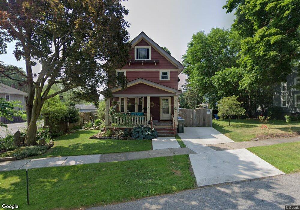
37 Wall St Rochester, NY 14620
Strong NeighborhoodEstimated Value: $252,000 - $314,000
3
Beds
2
Baths
1,338
Sq Ft
$206/Sq Ft
Est. Value
About This Home
This home is located at 37 Wall St, Rochester, NY 14620 and is currently estimated at $275,760, approximately $206 per square foot. 37 Wall St is a home located in Monroe County with nearby schools including School 2 Clara Barton, School 19 Dr Charles T Lunsford, and George Mather Forbes School No. 4.
Ownership History
Date
Name
Owned For
Owner Type
Purchase Details
Closed on
Jan 13, 2021
Sold by
Irving Ian E
Bought by
Irving Ian E and Miller Nicole M
Current Estimated Value
Purchase Details
Closed on
Mar 16, 2005
Sold by
Clemont Curtis
Bought by
Karp Jeffrey M and Karp Nicole R
Home Financials for this Owner
Home Financials are based on the most recent Mortgage that was taken out on this home.
Original Mortgage
$113,781
Outstanding Balance
$57,799
Interest Rate
5.64%
Mortgage Type
FHA
Estimated Equity
$217,961
Purchase Details
Closed on
Aug 3, 2001
Sold by
Elmer Trentini Diane M
Bought by
Clemont Curtis
Create a Home Valuation Report for This Property
The Home Valuation Report is an in-depth analysis detailing your home's value as well as a comparison with similar homes in the area
Home Values in the Area
Average Home Value in this Area
Purchase History
| Date | Buyer | Sale Price | Title Company |
|---|---|---|---|
| Irving Ian E | -- | Rochester Abstract Corp | |
| Karp Jeffrey M | $115,500 | None Available | |
| Clemont Curtis | $73,000 | Richard Mayberry |
Source: Public Records
Mortgage History
| Date | Status | Borrower | Loan Amount |
|---|---|---|---|
| Open | Karp Jeffrey M | $113,781 |
Source: Public Records
Tax History Compared to Growth
Tax History
| Year | Tax Paid | Tax Assessment Tax Assessment Total Assessment is a certain percentage of the fair market value that is determined by local assessors to be the total taxable value of land and additions on the property. | Land | Improvement |
|---|---|---|---|---|
| 2024 | $1,779 | $190,000 | $7,700 | $182,300 |
| 2023 | $1,876 | $165,000 | $7,400 | $157,600 |
| 2022 | $1,884 | $165,000 | $7,400 | $157,600 |
| 2021 | $1,907 | $162,300 | $7,400 | $154,900 |
| 2020 | $1,770 | $162,300 | $7,400 | $154,900 |
| 2019 | $1,714 | $135,000 | $7,400 | $127,600 |
| 2018 | $2,828 | $135,000 | $7,400 | $127,600 |
| 2017 | $0 | $135,000 | $7,400 | $127,600 |
| 2016 | $1,714 | $135,000 | $7,400 | $127,600 |
| 2015 | $2,827 | $129,700 | $7,400 | $122,300 |
| 2014 | $2,827 | $129,700 | $7,400 | $122,300 |
Source: Public Records
Map
Nearby Homes
- 1078 Mount Hope Ave Unit UN21
- 24 Gold St
- 16 Gold St
- 10 Gold St
- 73 Gold St
- 192 Laney Rd
- 29 Menlo Place
- 64 Rosemount St
- 151 Cypress St
- 21 Boothe St
- 61 David Ave
- 1564 Mount Hope Ave
- 1570 Mount Hope Ave
- 77 Highland Pkwy
- 102 Cottage St
- 106 Cottage St
- 23 Benton St
- 120 Cottage St
- 12 Summit Dr
- 1038-1040 S Plymouth Ave