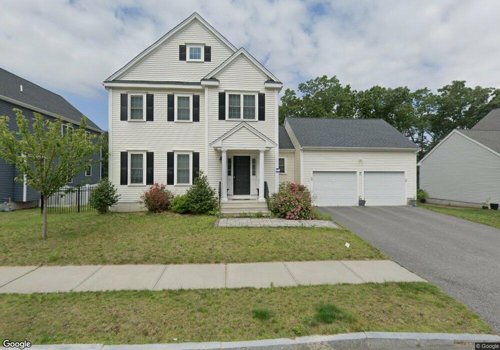
37 Westview Ave Millbury, MA 01527
Estimated Value: $746,000 - $823,000
4
Beds
4
Baths
2,626
Sq Ft
$295/Sq Ft
Est. Value
About This Home
This home is located at 37 Westview Ave, Millbury, MA 01527 and is currently estimated at $773,745, approximately $294 per square foot. 37 Westview Ave is a home with nearby schools including Elmwood Street Elementary School, Raymond E. Shaw Elementary School, and Millbury Junior/Senior High School.
Ownership History
Date
Name
Owned For
Owner Type
Purchase Details
Closed on
May 1, 2017
Sold by
Hayr Llc
Bought by
Oyinsan Oluwagbemisola and Oguntubi Ayodele C
Current Estimated Value
Home Financials for this Owner
Home Financials are based on the most recent Mortgage that was taken out on this home.
Original Mortgage
$403,700
Outstanding Balance
$335,972
Interest Rate
4.3%
Mortgage Type
New Conventional
Estimated Equity
$437,773
Create a Home Valuation Report for This Property
The Home Valuation Report is an in-depth analysis detailing your home's value as well as a comparison with similar homes in the area
Home Values in the Area
Average Home Value in this Area
Purchase History
| Date | Buyer | Sale Price | Title Company |
|---|---|---|---|
| Oyinsan Oluwagbemisola | $425,850 | -- | |
| Oyinsan Oluwagbemisola | $425,850 | -- |
Source: Public Records
Mortgage History
| Date | Status | Borrower | Loan Amount |
|---|---|---|---|
| Open | Oyinsan Oluwagbemisola | $403,700 | |
| Closed | Oyinsan Oluwagbemisola | $403,700 |
Source: Public Records
Tax History
| Year | Tax Paid | Tax Assessment Tax Assessment Total Assessment is a certain percentage of the fair market value that is determined by local assessors to be the total taxable value of land and additions on the property. | Land | Improvement |
|---|---|---|---|---|
| 2025 | $9,871 | $737,200 | $127,300 | $609,900 |
| 2024 | $9,061 | $684,900 | $117,900 | $567,000 |
| 2023 | $8,553 | $591,900 | $82,700 | $509,200 |
| 2022 | $7,140 | $476,000 | $79,400 | $396,600 |
| 2021 | $2,904 | $455,300 | $79,400 | $375,900 |
| 2020 | $6,872 | $448,300 | $79,400 | $368,900 |
| 2019 | $6,583 | $415,300 | $60,100 | $355,200 |
| 2018 | $982 | $60,100 | $60,100 | $0 |
| 2017 | $296 | $18,030 | $18,030 | $0 |
Source: Public Records
Map
Nearby Homes
- 8 Nightview Place
- 12 Irene Ct
- 7 Barbara St
- 2 Diane St
- 1459 Grafton Rd
- 300 Millbury Ave
- 11 Maplewood Rd
- 6 Nathaniel St
- 25 Upton St
- 7 Clarissa St
- 9 Marissa Cir
- 1195 Grafton St Unit 29
- 1195 Grafton St Unit 19
- 1195 Grafton St Unit 39
- 12 Bruce St
- 330 Sunderland Rd Unit 80
- 3 Julien Ave
- 47 Pointe Rok Dr Unit 47,G
- 2 Wilson Rd Unit B
- 2 Wilson Rd Unit A
- 35 Westview Ave
- 39 Westview Ave
- 36 Westview Ave
- 38 Westview Ave
- 33 Westview Ave
- 34 Westview Ave
- 24 Nightview Place
- 32 Westview Ave
- 26 Skyview Dr
- Lot 28 Skyview Dr
- Lot 34 Skyview Dr
- Lot 30 Skyview Dr
- 24 Nightview Place
- 26 Nightview Place
- 22 Nightview Place
- 41 Westview Ave
- 40 Westview Ave
- 20 Nightview Place
- 30 Westview Ave
- 30 Nightview Place
Your Personal Tour Guide
Ask me questions while you tour the home.