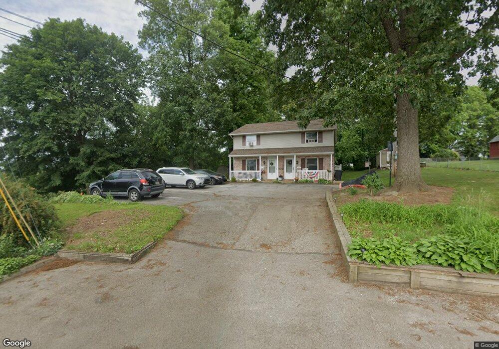
370 E King St Dallastown, PA 17313
Estimated Value: $155,000 - $331,000
4
Beds
2
Baths
1,920
Sq Ft
$121/Sq Ft
Est. Value
About This Home
This home is located at 370 E King St, Dallastown, PA 17313 and is currently estimated at $231,612, approximately $120 per square foot. 370 E King St is a home located in York County with nearby schools including Dallastown Elementary School, Dallastown Area Middle School, and Dallastown Area High School.
Ownership History
Date
Name
Owned For
Owner Type
Purchase Details
Closed on
May 1, 2024
Sold by
Leiphart Brett L and Leiphart Melissa L
Bought by
Maple Street Property Management Llc
Current Estimated Value
Purchase Details
Closed on
Jul 8, 1992
Sold by
Leiphart Brett L
Bought by
Leiphart Brett L and Leiphart Melissa L
Purchase Details
Closed on
Nov 18, 1987
Bought by
Leiphart Brett L
Create a Home Valuation Report for This Property
The Home Valuation Report is an in-depth analysis detailing your home's value as well as a comparison with similar homes in the area
Home Values in the Area
Average Home Value in this Area
Purchase History
| Date | Buyer | Sale Price | Title Company |
|---|---|---|---|
| Maple Street Property Management Llc | $160,000 | None Listed On Document | |
| Leiphart Brett L | -- | -- | |
| Leiphart Brett L | -- | -- |
Source: Public Records
Tax History
| Year | Tax Paid | Tax Assessment Tax Assessment Total Assessment is a certain percentage of the fair market value that is determined by local assessors to be the total taxable value of land and additions on the property. | Land | Improvement |
|---|---|---|---|---|
| 2025 | $3,659 | $105,330 | $26,580 | $78,750 |
| 2024 | $3,659 | $105,330 | $26,580 | $78,750 |
| 2023 | $3,659 | $105,330 | $26,580 | $78,750 |
| 2022 | $3,542 | $105,330 | $26,580 | $78,750 |
| 2021 | $3,340 | $105,330 | $26,580 | $78,750 |
| 2020 | $3,340 | $105,330 | $26,580 | $78,750 |
| 2019 | $3,329 | $105,330 | $26,580 | $78,750 |
| 2018 | $3,329 | $105,330 | $26,580 | $78,750 |
| 2017 | $3,200 | $105,330 | $26,580 | $78,750 |
| 2016 | $0 | $105,330 | $26,580 | $78,750 |
| 2015 | -- | $105,330 | $26,580 | $78,750 |
| 2014 | -- | $105,330 | $26,580 | $78,750 |
Source: Public Records
Map
Nearby Homes
- 356 E Main St
- 39 W George St
- 165 April Ln
- 240 Palomino Way
- 314 S Pleasant Ave
- 99 Furlong Way Unit 99
- 353 W Chestnut St Unit 16
- 695 Oak Rd
- 129 Heather Glen Dr Unit 78
- 127 Heather Glen Dr Unit 80
- 150 Yoe Dr
- 727 Blossom Hill Ln
- 510 Katonah Dr Unit 6
- 400 Carriage Ln Unit 400
- 156 Country Ridge Dr
- 170 Hudson Blvd
- 417 Frederick Dr
- 6 Hudson Blvd
- 320 Avon Dr
- 431 N Main St
Your Personal Tour Guide
Ask me questions while you tour the home.