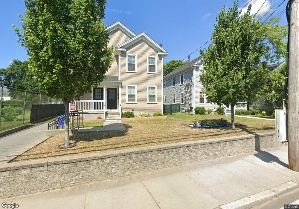
370 Lonsdale Ave Pawtucket, RI 02860
Estimated Value: $527,000 - $645,000
6
Beds
2
Baths
2,288
Sq Ft
$256/Sq Ft
Est. Value
About This Home
This home is located at 370 Lonsdale Ave, Pawtucket, RI 02860 and is currently estimated at $586,478, approximately $256 per square foot. 370 Lonsdale Ave is a home with nearby schools including Blackstone Valley Prep Junior High School.
Ownership History
Date
Name
Owned For
Owner Type
Purchase Details
Closed on
Nov 9, 2018
Sold by
Blackstone Valley Comm
Bought by
Jaiman Steven
Current Estimated Value
Purchase Details
Closed on
Oct 15, 2010
Sold by
Act Blackstone Vly Com
Bought by
Agcy Pawtucket Redev
Create a Home Valuation Report for This Property
The Home Valuation Report is an in-depth analysis detailing your home's value as well as a comparison with similar homes in the area
Home Values in the Area
Average Home Value in this Area
Purchase History
| Date | Buyer | Sale Price | Title Company |
|---|---|---|---|
| Jaiman Steven | $170,000 | -- | |
| Agcy Pawtucket Redev | -- | -- |
Source: Public Records
Tax History Compared to Growth
Tax History
| Year | Tax Paid | Tax Assessment Tax Assessment Total Assessment is a certain percentage of the fair market value that is determined by local assessors to be the total taxable value of land and additions on the property. | Land | Improvement |
|---|---|---|---|---|
| 2025 | $7,030 | $534,600 | $129,000 | $405,600 |
| 2024 | $6,597 | $534,600 | $129,000 | $405,600 |
| 2023 | $5,976 | $352,800 | $58,000 | $294,800 |
| 2022 | $5,849 | $352,800 | $58,000 | $294,800 |
| 2021 | $5,849 | $352,800 | $58,000 | $294,800 |
| 2020 | $5,411 | $259,000 | $58,800 | $200,200 |
| 2019 | $5,411 | $259,000 | $58,800 | $200,200 |
| 2018 | $5,214 | $259,000 | $58,800 | $200,200 |
| 2017 | $1,402 | $61,700 | $61,700 | $0 |
| 2016 | $1,351 | $61,700 | $61,700 | $0 |
| 2015 | $1,351 | $61,700 | $61,700 | $0 |
| 2014 | $1,347 | $58,400 | $58,400 | $0 |
Source: Public Records
Map
Nearby Homes
- 376 Lonsdale Ave
- 380 Lonsdale Ave
- 375 Lonsdale Ave
- 364 Lonsdale Ave
- 388 Lonsdale Ave
- 371 Lonsdale Ave
- 367 Lonsdale Ave Unit 1
- 362 Lonsdale Ave
- 384 Lonsdale Ave
- 394 Lonsdale Ave
- 105 Carpenter St
- 387 Lonsdale Ave
- 356 Lonsdale Ave
- 389 Lonsdale Ave
- 357 Lonsdale Ave
- 357 Lonsdale Ave Unit 3
- 39 Florence St
- 33 Florence St
- 27 Florence St
- 99 Carpenter St