Estimated Value: $180,000 - $299,997
--
Bed
1
Bath
1,123
Sq Ft
$200/Sq Ft
Est. Value
About This Home
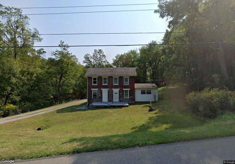
This home is located at 370 N Main St, Cadiz, OH 43907 and is currently estimated at $224,332, approximately $199 per square foot. 370 N Main St is a home located in Harrison County with nearby schools including Harrison Central Elementary School and Harrison Central Junior/Senior High School.
Ownership History
Date
Name
Owned For
Owner Type
Purchase Details
Closed on
Aug 23, 2018
Sold by
Bower Dean and Bower Helen
Bought by
Ann Hughinbaugh Terry and Ann Hughinbaugh
Current Estimated Value
Purchase Details
Closed on
Apr 1, 2016
Sold by
A J T Rentals Llc
Bought by
Habig Richard A and Habig Elizabeth A
Purchase Details
Closed on
Mar 25, 2016
Sold by
Habig Richard A and Habig Elizabeth A
Bought by
Ajt Rentals Llc
Purchase Details
Closed on
Jun 14, 2013
Sold by
Kirkland Jonathan L and Kirkland Susan J
Bought by
A J T Rentals Llc
Purchase Details
Closed on
Jan 8, 1989
Purchase Details
Closed on
Jan 12, 1987
Purchase Details
Closed on
Apr 16, 1986
Create a Home Valuation Report for This Property
The Home Valuation Report is an in-depth analysis detailing your home's value as well as a comparison with similar homes in the area
Home Values in the Area
Average Home Value in this Area
Purchase History
| Date | Buyer | Sale Price | Title Company |
|---|---|---|---|
| Ann Hughinbaugh Terry | $175,000 | Nomad Title | |
| Habig Richard A | $34,000 | Premier Land Title | |
| Ajt Rentals Llc | $25,992 | Premier Land Title | |
| A J T Rentals Llc | $11,000 | None Available | |
| -- | -- | -- | |
| -- | -- | -- | |
| -- | -- | -- |
Source: Public Records
Tax History Compared to Growth
Tax History
| Year | Tax Paid | Tax Assessment Tax Assessment Total Assessment is a certain percentage of the fair market value that is determined by local assessors to be the total taxable value of land and additions on the property. | Land | Improvement |
|---|---|---|---|---|
| 2024 | $904 | $22,750 | $5,780 | $16,970 |
| 2023 | $911 | $22,750 | $5,780 | $16,970 |
| 2022 | $916 | $21,310 | $4,960 | $16,350 |
| 2021 | $875 | $21,310 | $4,960 | $16,350 |
| 2020 | $872 | $21,310 | $4,960 | $16,350 |
| 2019 | $748 | $18,060 | $4,200 | $13,860 |
| 2018 | $748 | $18,060 | $4,200 | $13,860 |
| 2017 | $1,173 | $18,060 | $4,200 | $13,860 |
| 2016 | $749 | $16,680 | $3,120 | $13,560 |
| 2015 | $748 | $16,680 | $3,120 | $13,560 |
| 2014 | $621 | $16,330 | $3,150 | $13,180 |
| 2013 | $621 | $16,330 | $3,150 | $13,180 |
Source: Public Records
Map
Nearby Homes
- 388 N Main St
- 608 Kerr Ave
- 265 Old Steubenville Pike
- 273 Old Steubenville Pike
- 545 E Market St
- 254 S Buffalo St
- 0 N Main St Unit 5153554
- 102 Cadiz Ave
- 413 Saint Clair Ave
- 419 Saint Clair Ave
- 804 E Market St
- 0 E Market St
- 390 Oak Park Rd
- 0 Brewer Rd
- 78791 Kanoski Rd
- 39000 Lees Run Rd
- 200 Cross St
- 77900 Slater Rd
- 324 Central St
- 315 Euclid Ave