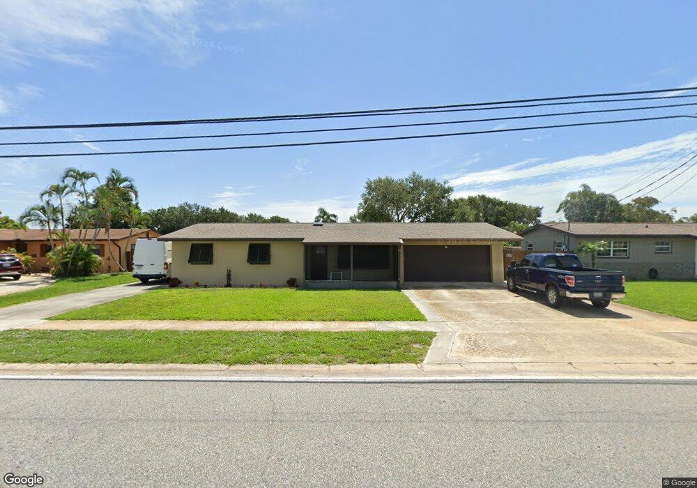
370 Newfound Harbor Dr Merritt Island, FL 32952
Estimated Value: $353,863 - $463,000
3
Beds
2
Baths
1,641
Sq Ft
$250/Sq Ft
Est. Value
About This Home
This home is located at 370 Newfound Harbor Dr, Merritt Island, FL 32952 and is currently estimated at $410,216, approximately $249 per square foot. 370 Newfound Harbor Dr is a home located in Brevard County with nearby schools including Tropical Elementary School, Thomas Jefferson Middle School, and Merritt Island High School.
Ownership History
Date
Name
Owned For
Owner Type
Purchase Details
Closed on
Jul 2, 2014
Sold by
Buchanan Donald R and Farris Kimberly A
Bought by
Farris Kimberly A
Current Estimated Value
Purchase Details
Closed on
Apr 26, 2005
Sold by
Buchanan Donald R and Buchanan Jack
Bought by
Buchanan Donald R and Farris Kimberly A
Purchase Details
Closed on
Oct 7, 2001
Sold by
Buchanan Jack and Buchanan Mildred S
Bought by
Buchanan Donald R and Buchanan Jack
Create a Home Valuation Report for This Property
The Home Valuation Report is an in-depth analysis detailing your home's value as well as a comparison with similar homes in the area
Home Values in the Area
Average Home Value in this Area
Purchase History
| Date | Buyer | Sale Price | Title Company |
|---|---|---|---|
| Farris Kimberly A | -- | Attorney | |
| Buchanan Donald R | -- | -- | |
| Buchanan Donald R | $10,000 | -- |
Source: Public Records
Tax History Compared to Growth
Tax History
| Year | Tax Paid | Tax Assessment Tax Assessment Total Assessment is a certain percentage of the fair market value that is determined by local assessors to be the total taxable value of land and additions on the property. | Land | Improvement |
|---|---|---|---|---|
| 2025 | $1,762 | $135,980 | -- | -- |
| 2024 | $1,729 | $132,150 | -- | -- |
| 2023 | $1,729 | $128,310 | $0 | $0 |
| 2022 | $1,610 | $124,580 | $0 | $0 |
| 2021 | $1,644 | $120,960 | $0 | $0 |
| 2020 | $1,587 | $119,290 | $0 | $0 |
| 2019 | $1,526 | $116,610 | $0 | $0 |
| 2018 | $1,520 | $114,440 | $0 | $0 |
| 2017 | $1,519 | $112,090 | $0 | $0 |
| 2016 | $1,530 | $109,790 | $25,000 | $84,790 |
| 2015 | $1,558 | $109,030 | $20,000 | $89,030 |
| 2014 | $1,690 | $101,850 | $20,000 | $81,850 |
Source: Public Records
Map
Nearby Homes
- 365 Newfound Harbor Dr
- 335 Newfound Harbor Dr
- 1125 Newfound Harbor Dr
- 472 Newfound Harbor Dr
- 474 Newfound Harbor Dr
- 513 Summers Creek Dr
- 115 S Marjorie Ct
- 1784 N Merrimac Dr
- 50 N Lee Ct
- 200 S Banana River Dr Unit B-3
- 200 S Banana River Dr Unit C-18
- 200 S Banana River Dr Unit D-17
- 200 S Banana River Dr Unit H-12
- 200 S Banana River Dr Unit E1
- 200 S Banana River Dr Unit D-18
- 200 S Banana River Dr Unit F12
- 200 S Banana River Dr Unit A12
- 200 S Banana River Dr
- 200 S Banana River Dr Unit A18
- 550 S Banana River Dr Unit 101
- 380 Newfound Harbor Dr
- 360 Newfound Harbor Dr
- 393 Summers Creek Dr
- 403 Summers Creek Dr
- 350 Newfound Harbor Dr
- 383 Summers Creek Dr
- 390 Newfound Harbor Dr
- 375 Newfound Harbor Dr
- 413 Summers Creek Dr
- 373 Summers Creek Dr
- 340 Newfound Harbor Dr
- 395 Newfound Harbor Dr
- 355 Newfound Harbor Dr
- 410 Newfound Harbor Dr
- 432 Summers Creek Dr
- 363 Summers Creek Dr
- 423 Summers Creek Dr
- 330 Newfound Harbor Dr
- 382 Summers Creek Dr
- 420 Newfound Harbor Dr