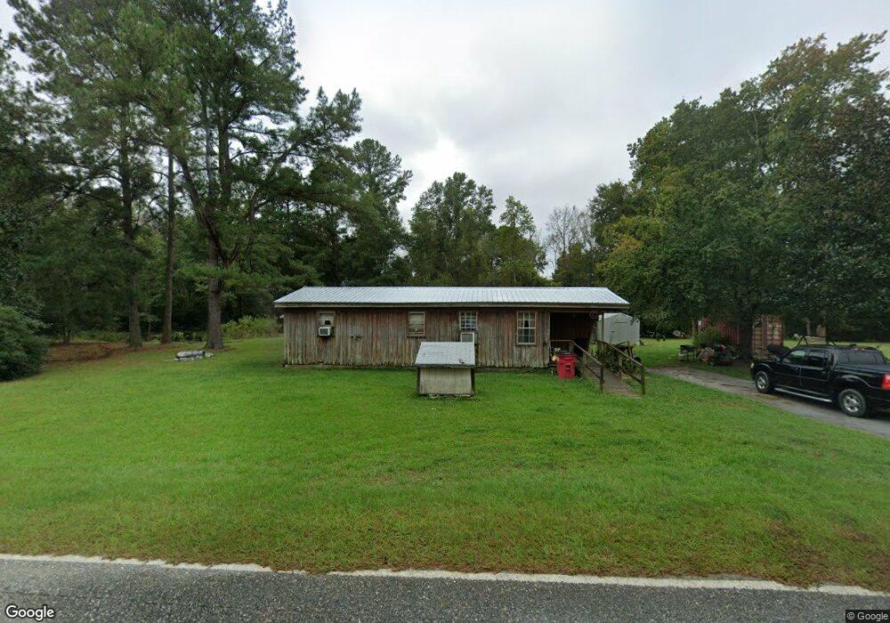
370 Sumner Rd Surrency, GA 31563
Estimated Value: $70,125 - $341,000
2
Beds
1
Bath
857
Sq Ft
$226/Sq Ft
Est. Value
About This Home
This home is located at 370 Sumner Rd, Surrency, GA 31563 and is currently estimated at $193,708, approximately $226 per square foot. 370 Sumner Rd is a home.
Ownership History
Date
Name
Owned For
Owner Type
Purchase Details
Closed on
Nov 16, 2012
Sold by
Lord Dianne
Bought by
Lord Jimmy Ray
Current Estimated Value
Purchase Details
Closed on
Jan 22, 2010
Sold by
Prescott Lois
Bought by
Lord Dianne
Purchase Details
Closed on
Mar 4, 1997
Sold by
Prescott David Burton
Bought by
Prescott Jack
Purchase Details
Closed on
Aug 4, 1994
Bought by
Prescott David Burton
Purchase Details
Closed on
Aug 7, 1993
Bought by
Smith Pauline P
Purchase Details
Closed on
Jul 10, 1991
Bought by
Smith Pauline P
Purchase Details
Closed on
Aug 30, 1974
Bought by
Smith Pauline P
Create a Home Valuation Report for This Property
The Home Valuation Report is an in-depth analysis detailing your home's value as well as a comparison with similar homes in the area
Purchase History
| Date | Buyer | Sale Price | Title Company |
|---|---|---|---|
| Lord Jimmy Ray | -- | -- | |
| Lord Dianne | -- | -- | |
| Prescott Jack | -- | -- | |
| Prescott David Burton | -- | -- | |
| Prescott David Burton | $12,000 | -- | |
| Smith Pauline P | -- | -- | |
| Smith Pauline P | -- | -- | |
| Smith Pauline P | -- | -- |
Source: Public Records
Tax History
| Year | Tax Paid | Tax Assessment Tax Assessment Total Assessment is a certain percentage of the fair market value that is determined by local assessors to be the total taxable value of land and additions on the property. | Land | Improvement |
|---|---|---|---|---|
| 2025 | $227 | $19,372 | $6,360 | $13,012 |
| 2024 | $227 | $15,220 | $3,240 | $11,980 |
| 2023 | $226 | $15,229 | $3,249 | $11,980 |
| 2022 | $139 | $11,389 | $3,249 | $8,140 |
| 2021 | $137 | $11,389 | $3,249 | $8,140 |
| 2020 | $146 | $11,389 | $3,249 | $8,140 |
| 2019 | $151 | $11,389 | $3,249 | $8,140 |
| 2018 | $155 | $11,389 | $3,249 | $8,140 |
| 2017 | $155 | $11,389 | $3,249 | $8,140 |
| 2016 | $155 | $11,389 | $3,249 | $8,140 |
| 2015 | $155 | $11,389 | $3,249 | $8,140 |
| 2014 | $156 | $11,389 | $3,249 | $8,140 |
| 2013 | -- | $9,720 | $1,580 | $8,140 |
Source: Public Records
Map
Nearby Homes
- 286 Carter Bight Landing Rd
- 0 Luther Surrency Road Cir
- 0 Lee Woods Rd Unit 18062646
- 2264 Carter Bight Landing Rd
- 2286 Carter Bight Landing Rd
- 0 Mills Rd
- 315 Getaway Ln
- 7946 Old Surrency Rd
- 0 Lee Woods Rd Unit 11355226
- Lot 2 Brentwood Rd
- Tract 4 Brentwood Rd
- Lot 1 Brentwood Rd
- 0 Eagles Point (Lot 12) Unit 23776
- 0 Eagles Point (Lot 11) Unit 23775
- 0 Eagles Point (Lot 8) Unit 23774
- 163 High Bluff Rd
- 290 ACRES Georgia 121
- 1564 Eagles Point
- 0 Eagles Point Unit LOT 8
- 0 Eagles Point Unit LOT 12
- 225 Murray Rd
- 517 Sumner Rd
- 134 Sumner Rd
- 595 Ernest Obrien Rd
- 46 Sumner Rd
- 434 Orville Knight Rd
- 10689 Ga Highway 144 NE
- 880 Ernest Obrien Rd
- 9883 Ga Highway 144 NE
- 0 Georgia 144
- 250 Orville Knight Rd
- 903 Ernest Obrien Rd
- 1043 Ernest Obrien Rd
- 891 Sumner Rd
- 10097 Ga Highway 144 NE
- 9968 Georgia 144
- 1224 Sumner Rd
- 1257 Sumner Rd
- 9774 Highway Hwy
