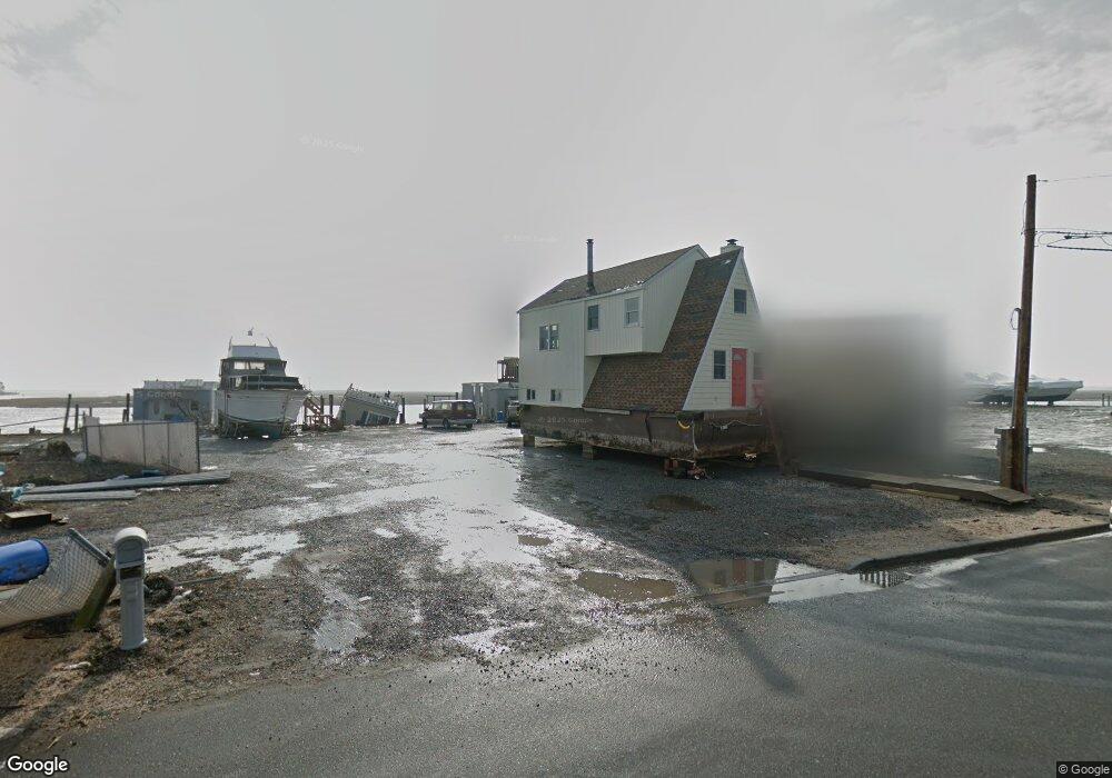
3700 Ocean Ave Unit 3700 Seaford, NY 11783
Estimated Value: $566,000 - $1,176,126
4
Beds
3
Baths
3,200
Sq Ft
$272/Sq Ft
Est. Value
About This Home
This home is located at 3700 Ocean Ave Unit 3700, Seaford, NY 11783 and is currently estimated at $871,063, approximately $272 per square foot. 3700 Ocean Ave Unit 3700 is a home located in Nassau County with nearby schools including Seaford Middle School, Seaford Senior High School, and Maplewood School.
Ownership History
Date
Name
Owned For
Owner Type
Purchase Details
Closed on
Sep 29, 2017
Sold by
Wpi Ventures Ii Llc
Bought by
D & E Ocean Property Llc
Current Estimated Value
Purchase Details
Closed on
May 1, 2017
Sold by
Li Premier Holdings Llc
Bought by
Maldonado Edgar A
Home Financials for this Owner
Home Financials are based on the most recent Mortgage that was taken out on this home.
Original Mortgage
$638,520
Interest Rate
4.14%
Mortgage Type
New Conventional
Purchase Details
Closed on
Sep 16, 2015
Sold by
Wpi Ventures Ii Llc
Bought by
Li Premier Holdings Llc
Purchase Details
Closed on
Aug 10, 2015
Sold by
Oceans Cove Llc
Bought by
Wpi Ventures Ii Llc
Create a Home Valuation Report for This Property
The Home Valuation Report is an in-depth analysis detailing your home's value as well as a comparison with similar homes in the area
Home Values in the Area
Average Home Value in this Area
Purchase History
| Date | Buyer | Sale Price | Title Company |
|---|---|---|---|
| D & E Ocean Property Llc | $380,000 | -- | |
| Maldonado Edgar A | $939,000 | Commonwealth Land Title Ins | |
| Li Premier Holdings Llc | $342,500 | Commonwealth Land Title | |
| Wpi Ventures Ii Llc | -- | Commonwealth Land Title |
Source: Public Records
Mortgage History
| Date | Status | Borrower | Loan Amount |
|---|---|---|---|
| Previous Owner | Maldonado Edgar A | $638,520 |
Source: Public Records
Tax History Compared to Growth
Tax History
| Year | Tax Paid | Tax Assessment Tax Assessment Total Assessment is a certain percentage of the fair market value that is determined by local assessors to be the total taxable value of land and additions on the property. | Land | Improvement |
|---|---|---|---|---|
| 2025 | $21,524 | $732 | $216 | $516 |
| 2024 | $5,613 | $813 | $240 | $573 |
| 2023 | $23,339 | $900 | $266 | $634 |
| 2022 | $23,339 | $926 | $273 | $653 |
| 2021 | $31,688 | $955 | $282 | $673 |
| 2020 | $23,171 | $1,314 | $633 | $681 |
| 2019 | $23,764 | $1,408 | $678 | $730 |
| 2018 | $24,171 | $980 | $0 | $0 |
| 2017 | $10,925 | $980 | $980 | $0 |
| 2016 | $15,203 | $980 | $980 | $0 |
| 2015 | $3,993 | $980 | $980 | $0 |
| 2014 | $3,993 | $980 | $980 | $0 |
| 2013 | $3,745 | $980 | $980 | $0 |
Source: Public Records
Map
Nearby Homes
- 3692 Ocean Ave
- 3651 Marinor St
- 2905 Ocean Ave
- 3695 Somerset Dr
- 3609 Somerset Dr
- 3717 Somerset Dr
- 7 Crescent Cove Dr
- 220 Shore Rd
- 2701 S Seamans Neck Rd
- 3570 Plover Place
- 2655 Ocean Ave
- 2573 Harvard Ln
- 2601 Ocean Ave
- 0 Island Place Unit 3107575
- 75 Forest Ave
- 94 Forest Ave
- 3663 Roanoke St
- 2437 Archer St
- 65 Jefferson Place
- 3495 Roanoke St
- 3700 Ocean Ave
- 3696 Ocean Ave
- 3704 Ocean Ave Unit 3704
- 3708 Ocean Ave
- 3692 Ocean Ave Unit 3692
- 3710 Ocean Ave
- 3688 Ocean Ave Unit 3688
- 3688 Ocean Ave
- 3690 Nimrod St
- 3684 Ocean Ave
- 3716 Ocean Ave
- 3677 Marinor St
- 3684 Nimrod St
- 3678 Nimrod St
- 3720 Ocean Ave
- 3720 Ocean Ave Unit B
- 3674 Ocean Ave
- 3671 Marinor St
- 3672 Nimrod St
- 3665 Marinor St