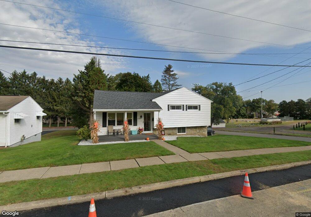
3700 Wylam Ave Unit BLK Moosic, PA 18507
Estimated Value: $220,000 - $249,622
--
Bed
--
Bath
--
Sq Ft
0.28
Acres
About This Home
This home is located at 3700 Wylam Ave Unit BLK, Moosic, PA 18507 and is currently estimated at $240,906. 3700 Wylam Ave Unit BLK is a home located in Lackawanna County with nearby schools including Willard Middle School, Riverside Junior/Senior High School, and Marian Catholic Primary Campus.
Ownership History
Date
Name
Owned For
Owner Type
Purchase Details
Closed on
Sep 2, 2025
Sold by
Connolly Gerald S and Connolly Jane E
Bought by
Heinle Ronald Paul
Current Estimated Value
Home Financials for this Owner
Home Financials are based on the most recent Mortgage that was taken out on this home.
Original Mortgage
$175,000
Outstanding Balance
$175,000
Interest Rate
6.74%
Mortgage Type
New Conventional
Estimated Equity
$65,906
Purchase Details
Closed on
Mar 30, 2012
Sold by
Sweeney William and Thomas Amy
Bought by
Connolly Gerald S and Connolly Jane E
Home Financials for this Owner
Home Financials are based on the most recent Mortgage that was taken out on this home.
Original Mortgage
$124,755
Interest Rate
3.75%
Mortgage Type
FHA
Create a Home Valuation Report for This Property
The Home Valuation Report is an in-depth analysis detailing your home's value as well as a comparison with similar homes in the area
Home Values in the Area
Average Home Value in this Area
Purchase History
| Date | Buyer | Sale Price | Title Company |
|---|---|---|---|
| Heinle Ronald Paul | $249,000 | None Listed On Document | |
| Connolly Gerald S | $128,000 | None Available |
Source: Public Records
Mortgage History
| Date | Status | Borrower | Loan Amount |
|---|---|---|---|
| Open | Heinle Ronald Paul | $175,000 | |
| Previous Owner | Connolly Gerald S | $124,755 |
Source: Public Records
Tax History Compared to Growth
Tax History
| Year | Tax Paid | Tax Assessment Tax Assessment Total Assessment is a certain percentage of the fair market value that is determined by local assessors to be the total taxable value of land and additions on the property. | Land | Improvement |
|---|---|---|---|---|
| 2025 | $4,245 | $17,500 | $3,500 | $14,000 |
| 2024 | $3,754 | $17,500 | $3,500 | $14,000 |
| 2023 | $3,754 | $17,500 | $3,500 | $14,000 |
| 2022 | $3,693 | $17,500 | $3,500 | $14,000 |
| 2021 | $3,649 | $17,500 | $3,500 | $14,000 |
| 2020 | $3,575 | $17,500 | $3,500 | $14,000 |
| 2019 | $3,348 | $17,500 | $3,500 | $14,000 |
| 2018 | $3,286 | $17,500 | $3,500 | $14,000 |
| 2017 | $3,223 | $17,500 | $3,500 | $14,000 |
| 2016 | $1,993 | $17,500 | $3,500 | $14,000 |
| 2015 | -- | $17,500 | $3,500 | $14,000 |
| 2014 | -- | $17,500 | $3,500 | $14,000 |
Source: Public Records
Map
Nearby Homes
- 3742 Laurel Ave
- 3411 Pittston Ave
- 100 Ryan Dr
- 807 Marion Ln
- Parcel B Railroad St
- LOT # 6 Railroad St
- 902 Johns Dr
- 3268-3270 Pittston Ave
- 0 Cooper St Unit GSBSC255606
- 136 E Grove St
- 3258 Greenwood Ave
- Lot 1 Railroad St
- 112 E Taylor St
- Lot 2 Railroad St
- Lot 10 Railroad St
- Lot 9 Railroad St
- 320 N Third St
- Parcel B Davis Ct
- 103 Davis St
- 115 W High St