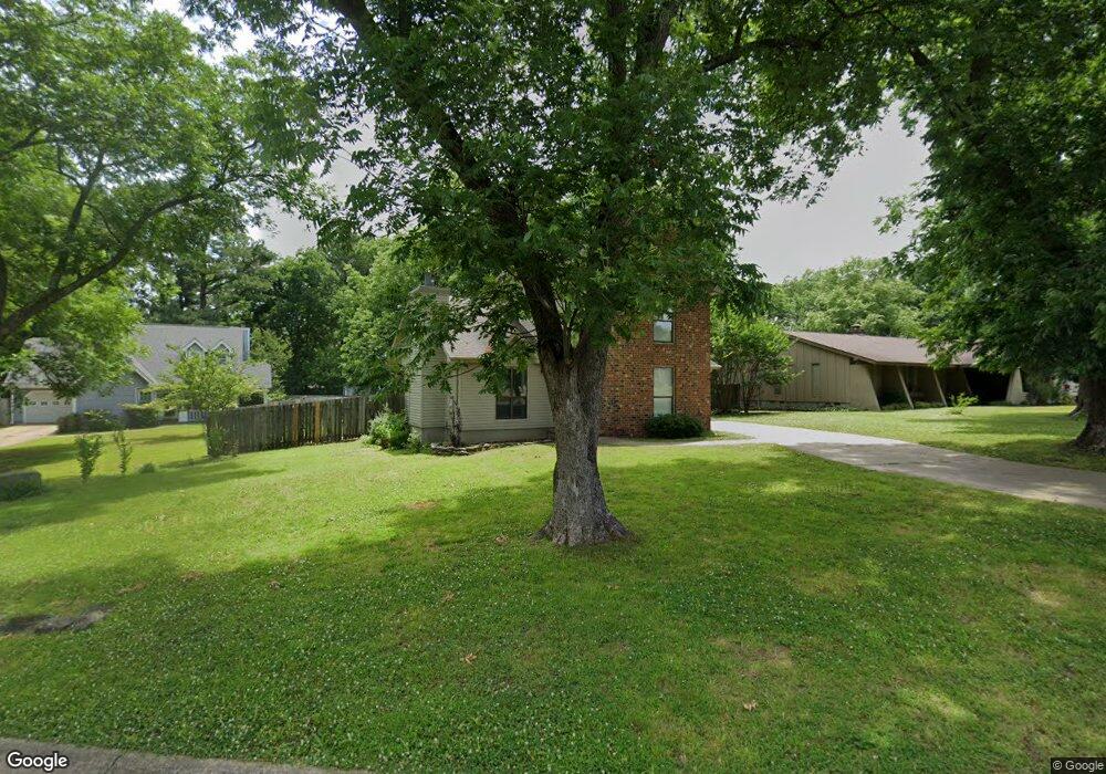
3701 Blueridge Cir Jonesboro, AR 72401
Estimated Value: $170,963 - $210,000
--
Bed
2
Baths
1,732
Sq Ft
$111/Sq Ft
Est. Value
About This Home
This home is located at 3701 Blueridge Cir, Jonesboro, AR 72401 and is currently estimated at $192,491, approximately $111 per square foot. 3701 Blueridge Cir is a home located in Craighead County with nearby schools including Nettleton High School, Montessori School of Jonesboro, and Blessed Sacrament School.
Ownership History
Date
Name
Owned For
Owner Type
Purchase Details
Closed on
Mar 4, 2019
Sold by
Nichols Geneva M
Bought by
Nichols Sandra S
Current Estimated Value
Purchase Details
Closed on
Jun 25, 1999
Bought by
Nichols
Purchase Details
Closed on
Mar 25, 1999
Bought by
Hud
Purchase Details
Closed on
Jul 13, 1998
Bought by
Chase Mortg
Purchase Details
Closed on
Jun 28, 1993
Bought by
Gann
Purchase Details
Closed on
Dec 10, 1992
Bought by
Thompson
Purchase Details
Closed on
Sep 20, 1990
Bought by
Davis
Purchase Details
Closed on
Aug 29, 1986
Bought by
Dombroski
Purchase Details
Closed on
Oct 11, 1985
Bought by
Stem
Create a Home Valuation Report for This Property
The Home Valuation Report is an in-depth analysis detailing your home's value as well as a comparison with similar homes in the area
Home Values in the Area
Average Home Value in this Area
Purchase History
| Date | Buyer | Sale Price | Title Company |
|---|---|---|---|
| Nichols Sandra S | -- | None Available | |
| Nichols | -- | -- | |
| Hud | -- | -- | |
| Chase Mortg | -- | -- | |
| Gann | $77,000 | -- | |
| Thompson | $68,000 | -- | |
| Davis | $148,000 | -- | |
| Dombroski | $71,000 | -- | |
| Stem | $63,000 | -- |
Source: Public Records
Tax History Compared to Growth
Tax History
| Year | Tax Paid | Tax Assessment Tax Assessment Total Assessment is a certain percentage of the fair market value that is determined by local assessors to be the total taxable value of land and additions on the property. | Land | Improvement |
|---|---|---|---|---|
| 2025 | $1,058 | $26,833 | $3,500 | $23,333 |
| 2024 | $1,058 | $26,833 | $3,500 | $23,333 |
| 2023 | $603 | $26,833 | $3,500 | $23,333 |
| 2022 | $653 | $26,833 | $3,500 | $23,333 |
| 2021 | $683 | $25,180 | $3,500 | $21,680 |
| 2020 | $683 | $25,180 | $3,500 | $21,680 |
| 2019 | $683 | $25,180 | $3,500 | $21,680 |
| 2018 | $708 | $25,180 | $3,500 | $21,680 |
| 2017 | $708 | $25,180 | $3,500 | $21,680 |
| 2016 | $708 | $22,020 | $4,200 | $17,820 |
| 2015 | $708 | $22,020 | $4,200 | $17,820 |
| 2014 | $708 | $22,020 | $4,200 | $17,820 |
Source: Public Records
Map
Nearby Homes
- 208 Lake Dr
- 3708 Aggie Rd
- 3522 Bess Dr
- 208 Mark St
- 3426 Aggie Rd
- 500 N Airport
- 4110 Willow Ridge Dr
- 4012 Willow Pointe Dr
- 4110 Tealwood Dr
- 610 Airport Rd
- 4064 Gabriel Ct
- 4007 Sandra Ln
- 3502 Burdyshaw Dr
- 4500 Willow Pointe Dr
- 341 Wolf Den Dr
- 4400 Aggie Rd
- 20 Canera Dr
- 4141 Bobcat Meadow Ln
- 4145 Bobcat Meadow Ln
- 0 Carnaby St
- 3629 Blueridge Cir
- 3703 Blueridge Cir
- 3705 Blueridge Cir
- 209 Lake Dr
- 3627 Blueridge Cir
- 0 Blueridge Cir
- 3702 Blueridge Cir
- 301 Lake Dr
- 3704 Blueridge Cir
- 303 Lake Dr
- 3706 Blueridge Cir
- 3630 Blueridge Cir
- 207 Lake Dr
- 305 Lake Dr
- 3628 Blueridge Cir
- 205 Lake Dr
- 3625 Blueridge Cir
- 307 Lake Dr
- 3624 Blueridge Cir
- 212 Lake Dr