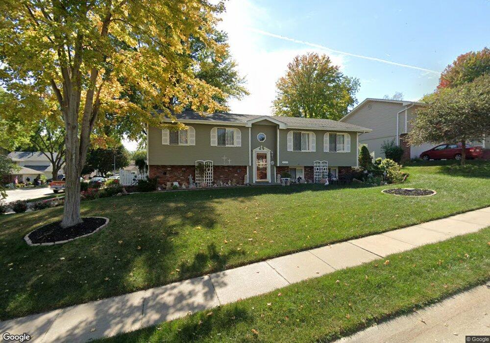
3701 Falcon Dr Bellevue, NE 68123
Estimated Value: $296,571 - $314,000
3
Beds
4
Baths
2,294
Sq Ft
$134/Sq Ft
Est. Value
About This Home
This home is located at 3701 Falcon Dr, Bellevue, NE 68123 and is currently estimated at $306,643, approximately $133 per square foot. 3701 Falcon Dr is a home located in Sarpy County with nearby schools including Bellevue Elementary School, Lewis & Clark Middle School, and Bellevue West High School.
Ownership History
Date
Name
Owned For
Owner Type
Purchase Details
Closed on
Jul 13, 2015
Sold by
Phillips Jimmy G and Phillips Sandra K
Bought by
Conley Billy J and Conley Sabrina D
Current Estimated Value
Purchase Details
Closed on
Jul 23, 2003
Sold by
Jennings James P and Jennings Patrice K
Bought by
Phillips Jimmy G and Phillips Sandra K
Home Financials for this Owner
Home Financials are based on the most recent Mortgage that was taken out on this home.
Original Mortgage
$152,500
Interest Rate
5.24%
Mortgage Type
VA
Create a Home Valuation Report for This Property
The Home Valuation Report is an in-depth analysis detailing your home's value as well as a comparison with similar homes in the area
Home Values in the Area
Average Home Value in this Area
Purchase History
| Date | Buyer | Sale Price | Title Company |
|---|---|---|---|
| Conley Billy J | $175,000 | Nebraska Title Company Om | |
| Phillips Jimmy G | $153,000 | -- |
Source: Public Records
Mortgage History
| Date | Status | Borrower | Loan Amount |
|---|---|---|---|
| Previous Owner | Phillips Jimmy G | $152,500 |
Source: Public Records
Tax History Compared to Growth
Tax History
| Year | Tax Paid | Tax Assessment Tax Assessment Total Assessment is a certain percentage of the fair market value that is determined by local assessors to be the total taxable value of land and additions on the property. | Land | Improvement |
|---|---|---|---|---|
| 2025 | -- | $269,492 | $43,000 | $226,492 |
| 2024 | -- | $258,007 | $40,000 | $218,007 |
| 2023 | -- | $234,016 | $36,000 | $198,016 |
| 2022 | $0 | $214,576 | $31,000 | $183,576 |
| 2021 | $0 | $195,638 | $31,000 | $164,638 |
| 2020 | $0 | $194,381 | $31,000 | $163,381 |
| 2019 | $3,112 | $188,521 | $29,000 | $159,521 |
| 2018 | $0 | $174,889 | $26,000 | $148,889 |
| 2017 | $0 | $167,521 | $26,000 | $141,521 |
| 2016 | $0 | $159,282 | $24,000 | $135,282 |
| 2015 | $3,112 | $150,452 | $24,000 | $126,452 |
| 2014 | $3,081 | $148,019 | $24,000 | $124,019 |
| 2012 | -- | $153,354 | $22,000 | $131,354 |
Source: Public Records
Map
Nearby Homes
- 3728 Schuemann Dr
- 3738 Falcon Dr
- 3716 Lookingglass Dr
- 3506 Lynnwood Dr
- 3504 Sheridan Cir
- 3508 Jason Cir
- 4411 Schilling Dr
- 12741 Ridgeview Cir
- 12750 Forestdale Dr
- 3309 Lookingglass Dr
- 13602 S 36th St
- 3108 Mirror Cir
- 3107 Mirror Cir
- 13069 S 42nd Ave Unit Lot 49
- 13065 S 42nd Ave Unit Lot 50
- 3105 Mirror Cir
- 13061 S 42nd Ave Unit Lot 51
- 13057 S 42nd Ave Unit Lot 52
- 3105 Leawood Dr
- 4369 Lookingglass Dr
- 3705 Falcon Dr
- 3704 Schuemann Dr
- 3704 Schuemann Dr
- 3709 Falcon Dr
- 13205 Brookside Dr
- 13201 Brookside Dr
- 3702 Falcon Dr
- 13209 Brookside Dr
- 13119 Brookside Dr
- 3706 Falcon Dr
- 3713 Falcon Dr
- 13115 Brookside Dr
- 3710 Falcon Dr
- 13213 Brookside Dr
- 3716 Schuemann Dr
- 13111 Brookside Dr
- 3714 Falcon Dr
- 3703 Pinehill Rd
- 3703 Schuemann Dr
- 3717 Falcon Dr