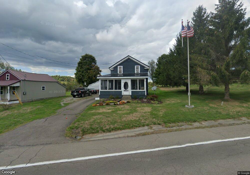
3701 State Route 206 Unit NYS Chenango Forks, NY 13746
Estimated Value: $84,000 - $123,000
4
Beds
1
Bath
1,184
Sq Ft
$87/Sq Ft
Est. Value
About This Home
This home is located at 3701 State Route 206 Unit NYS, Chenango Forks, NY 13746 and is currently estimated at $102,717, approximately $86 per square foot. 3701 State Route 206 Unit NYS is a home located in Broome County with nearby schools including Caryl E. Adams Primary School, Tioughnioga Riverside Academy, and Whitney Point Senior High School.
Ownership History
Date
Name
Owned For
Owner Type
Purchase Details
Closed on
Feb 13, 2012
Sold by
Smith Gary and Smith Kim
Bought by
Smith Jason L and Smith Melanie B
Current Estimated Value
Home Financials for this Owner
Home Financials are based on the most recent Mortgage that was taken out on this home.
Original Mortgage
$35,000
Outstanding Balance
$24,059
Interest Rate
3.96%
Mortgage Type
Seller Take Back
Estimated Equity
$78,658
Purchase Details
Closed on
Jul 10, 1996
Purchase Details
Closed on
Feb 1, 1996
Create a Home Valuation Report for This Property
The Home Valuation Report is an in-depth analysis detailing your home's value as well as a comparison with similar homes in the area
Home Values in the Area
Average Home Value in this Area
Purchase History
| Date | Buyer | Sale Price | Title Company |
|---|---|---|---|
| Smith Jason L | $35,000 | None Available | |
| -- | $11,100 | -- | |
| -- | -- | -- |
Source: Public Records
Mortgage History
| Date | Status | Borrower | Loan Amount |
|---|---|---|---|
| Open | Smith Jason L | $35,000 |
Source: Public Records
Tax History Compared to Growth
Tax History
| Year | Tax Paid | Tax Assessment Tax Assessment Total Assessment is a certain percentage of the fair market value that is determined by local assessors to be the total taxable value of land and additions on the property. | Land | Improvement |
|---|---|---|---|---|
| 2024 | $2,032 | $67,300 | $24,000 | $43,300 |
| 2023 | $2,085 | $67,300 | $24,000 | $43,300 |
| 2022 | $2,091 | $67,300 | $24,000 | $43,300 |
| 2021 | $2,111 | $67,300 | $24,000 | $43,300 |
| 2020 | $1,561 | $67,300 | $24,000 | $43,300 |
| 2019 | $0 | $67,300 | $24,000 | $43,300 |
| 2018 | $1,519 | $67,300 | $24,000 | $43,300 |
| 2017 | $1,421 | $67,300 | $24,000 | $43,300 |
| 2016 | $1,503 | $67,300 | $24,000 | $43,300 |
| 2015 | -- | $67,300 | $24,000 | $43,300 |
| 2014 | -- | $67,300 | $24,000 | $43,300 |
Source: Public Records
Map
Nearby Homes
- 3686 New York 206
- 3494 New York 206
- 375 Ticknor Brook Rd
- 29 Parsons Rd
- 152 Ingraham Rd
- 277 Ticknor Brook Rd
- L20.2 Indian Brook Rd
- 313 South St
- 314 Sapbush Rd
- 7674 State Route 79
- 15 Mill St
- 156 Hemingway Road Lot 2
- 156 Hemingway Road Lot 1
- 949 Page Brook Rd
- 7800 New York 79
- 330 Indian Brook Rd
- 2748 E Main St
- 3492-3494 New York 206
- 1321 Hyde St
- 2723 Hickory St
- 120 Fuller Road Lot Unit WP002
- 3697 State Route 206
- 890 South St
- 3687 State Route 206
- 884 South St
- 883 South St
- 23 Wheelbarrow Ave
- 3682 State Route 206
- 879 South St
- 878 South St
- 3677 State Route 206
- 875 South St
- 15 Wheelbarrow Ave
- 3722 State Route 206 Unit NYS
- 18 Wheelbarrow Ave
- 4 Wheelbarrow Ave
- 12 Wheelbarrow Ave
- 3669 State Route 206
- 867 South St
- 3666 New York 206