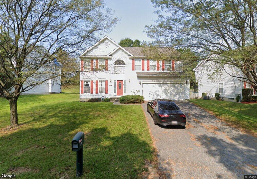
3702 Burmont Ave Randallstown, MD 21133
Estimated Value: $476,000 - $486,000
--
Bed
3
Baths
2,222
Sq Ft
$217/Sq Ft
Est. Value
About This Home
This home is located at 3702 Burmont Ave, Randallstown, MD 21133 and is currently estimated at $482,916, approximately $217 per square foot. 3702 Burmont Ave is a home located in Baltimore County with nearby schools including Randallstown Elementary School, Deer Park Middle Magnet School, and Randallstown High School.
Ownership History
Date
Name
Owned For
Owner Type
Purchase Details
Closed on
Dec 6, 2004
Sold by
Merritt Kimberly Roshelle
Bought by
Ramsey Edward and Ramsey Akeem
Current Estimated Value
Purchase Details
Closed on
May 28, 2004
Sold by
Secretary Of Housing
Bought by
Merritt Kimberly Roshelle
Purchase Details
Closed on
Nov 7, 2003
Sold by
Evans Pamela A
Bought by
Secretary Of Housing
Purchase Details
Closed on
Feb 5, 1999
Sold by
P & E Holding Inc
Bought by
Evans Pamela A
Purchase Details
Closed on
Oct 20, 1998
Sold by
Pikeswood Development Corp
Bought by
P & E Holding Inc
Create a Home Valuation Report for This Property
The Home Valuation Report is an in-depth analysis detailing your home's value as well as a comparison with similar homes in the area
Home Values in the Area
Average Home Value in this Area
Purchase History
| Date | Buyer | Sale Price | Title Company |
|---|---|---|---|
| Ramsey Edward | $355,000 | -- | |
| Merritt Kimberly Roshelle | $250,151 | -- | |
| Secretary Of Housing | $219,100 | -- | |
| Evans Pamela A | $176,430 | -- | |
| P & E Holding Inc | $45,000 | -- |
Source: Public Records
Tax History Compared to Growth
Tax History
| Year | Tax Paid | Tax Assessment Tax Assessment Total Assessment is a certain percentage of the fair market value that is determined by local assessors to be the total taxable value of land and additions on the property. | Land | Improvement |
|---|---|---|---|---|
| 2025 | $5,666 | $377,200 | -- | -- |
| 2024 | $5,666 | $343,600 | $69,500 | $274,100 |
| 2023 | $2,542 | $331,033 | $0 | $0 |
| 2022 | $4,807 | $318,467 | $0 | $0 |
| 2021 | $5,038 | $305,900 | $69,500 | $236,400 |
| 2020 | $5,038 | $298,900 | $0 | $0 |
| 2019 | $4,727 | $291,900 | $0 | $0 |
| 2018 | $4,803 | $284,900 | $69,500 | $215,400 |
| 2017 | $4,139 | $278,033 | $0 | $0 |
| 2016 | $3,766 | $271,167 | $0 | $0 |
| 2015 | $3,766 | $264,300 | $0 | $0 |
| 2014 | $3,766 | $264,300 | $0 | $0 |
Source: Public Records
Map
Nearby Homes
- 9406 Painted Tree Dr
- 9208A Liberty Rd
- 9210 Liberty Rd
- 9202 Samoset Rd
- 9401 Summer Squal Dr
- 9302 Silver Charm Dr
- 3816 Cassandra Rd
- 3805 Terka Cir
- 9112 Meadow Heights Rd
- 4108 Brown Bark Cir
- 3903 Red Deer Cir
- 9519 Branchleigh Rd
- 9044 Allenswood Rd
- 3402 Offutt Rd
- 3506 Bayer Ave
- 3705 Allenswood Ct
- 9012 Allenswood Rd
- 3332 Offutt Rd
- 3418 Carroll Ave
- 3320 Offutt Rd
- 3704 Burmont Ave
- 3700 Burmont Ave
- 3706 Burmont Ave
- 9319 Samoset Rd
- 3701 Tall Grass Ct
- 3703 Tall Grass Ct
- 3629 Burmont Ave
- 3705 Tall Grass Ct
- 3707 Tall Grass Ct
- 3709 Tall Grass Ct
- 3708 Burmont Ave
- 3711 Tall Grass Ct
- 3625 Burmont Ave
- 3701 Burmont Ave
- 9317 Samoset Rd
- 3713 Tall Grass Ct
- 3715 Tall Grass Ct
- 3710 Burmont Ave
- 9315 Samoset Rd
- 3717 Tall Grass Ct