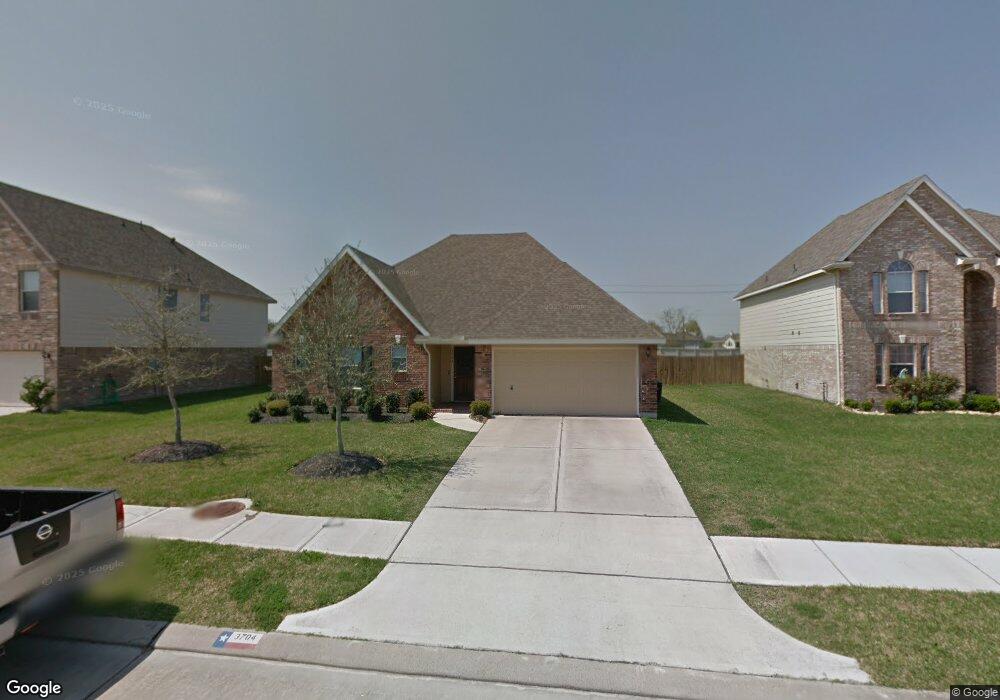
3704 Burwood Ct Pearland, TX 77584
Estimated Value: $306,890 - $321,000
--
Bed
1
Bath
1,820
Sq Ft
$173/Sq Ft
Est. Value
About This Home
This home is located at 3704 Burwood Ct, Pearland, TX 77584 and is currently estimated at $315,473, approximately $173 per square foot. 3704 Burwood Ct is a home located in Brazoria County with nearby schools including Magnolia Elementary School, Pearland Junior High School South, and Sam Jamison Middle School.
Ownership History
Date
Name
Owned For
Owner Type
Purchase Details
Closed on
Dec 4, 2019
Sold by
Cox Shawn M and Cox Tiffany M
Bought by
Cox Robert Lee and Cox Sharon K
Current Estimated Value
Home Financials for this Owner
Home Financials are based on the most recent Mortgage that was taken out on this home.
Original Mortgage
$219,622
Outstanding Balance
$194,194
Interest Rate
3.75%
Mortgage Type
VA
Estimated Equity
$121,279
Purchase Details
Closed on
Feb 22, 2008
Sold by
K Hovnanian Of Houston Ii Llc
Bought by
Cox Shawn and Cox Tiffany
Home Financials for this Owner
Home Financials are based on the most recent Mortgage that was taken out on this home.
Original Mortgage
$127,800
Interest Rate
5.88%
Mortgage Type
Purchase Money Mortgage
Create a Home Valuation Report for This Property
The Home Valuation Report is an in-depth analysis detailing your home's value as well as a comparison with similar homes in the area
Home Values in the Area
Average Home Value in this Area
Purchase History
| Date | Buyer | Sale Price | Title Company |
|---|---|---|---|
| Cox Robert Lee | -- | Startex Title Company | |
| Cox Shawn | -- | Alamo Title Company |
Source: Public Records
Mortgage History
| Date | Status | Borrower | Loan Amount |
|---|---|---|---|
| Open | Cox Robert Lee | $219,622 | |
| Closed | Cox Shawn | $127,800 |
Source: Public Records
Tax History Compared to Growth
Tax History
| Year | Tax Paid | Tax Assessment Tax Assessment Total Assessment is a certain percentage of the fair market value that is determined by local assessors to be the total taxable value of land and additions on the property. | Land | Improvement |
|---|---|---|---|---|
| 2025 | $3,624 | $291,800 | $42,500 | $249,300 |
| 2023 | $3,624 | $254,790 | $42,500 | $255,030 |
| 2022 | $7,332 | $231,627 | $28,330 | $228,650 |
| 2021 | $7,152 | $210,570 | $28,330 | $182,240 |
| 2020 | $7,479 | $212,590 | $28,330 | $184,260 |
| 2019 | $6,624 | $188,250 | $28,330 | $159,920 |
| 2018 | $6,204 | $176,920 | $28,330 | $148,590 |
| 2017 | $6,555 | $186,220 | $28,330 | $157,890 |
| 2016 | $5,808 | $165,000 | $28,330 | $136,670 |
| 2014 | $5,494 | $152,500 | $28,330 | $124,170 |
Source: Public Records
Map
Nearby Homes
- 3703 Canterbury Park Dr
- 3705 Canterbury Park Dr
- 3804 Parry Fields Ct
- 3806 Canterbury Park Dr
- 4015 Cedarwood Dr
- 3910 Greenwood Dr
- 3509 Pentland Downs St
- 4806 Chaperel Dr
- 4013 Ivywood Dr
- 3307 Norma Ln
- 3911 Spring Garden Dr
- 4967 Millican Dr
- 5101 Big Spring Dr
- 16622 Mclean Rd
- 5205 Spring Branch Dr
- 16719 Mclean Rd
- 3224 Woodrose Orchard
- 4004 Green Anjou Ln
- 4013 Green Anjou Ln
- 7206 Williams Rd
- 3702 Burwood Ct
- 4207 Canterbury Park Ln
- 3708 Burwood Ct
- 3614 Burwood Ct
- 3701 Burwood Ct
- 3703 Burwood Ct
- 4209 Canterbury Park Ln
- 3612 Burwood Ct
- 3710 Burwood Ct
- 3705 Burwood Ct
- 3707 Burwood Ct
- 4211 Canterbury Park Ln
- 3610 Burwood Ct
- 3712 Burwood Ct
- 3611 Burwood Ct
- 3702 Canterbury Park Dr
- 3704 Canterbury Park Dr
- 3903 Ashwood Dr
- 3706 Canterbury Park Dr
- 3614 Canterbury Park Dr