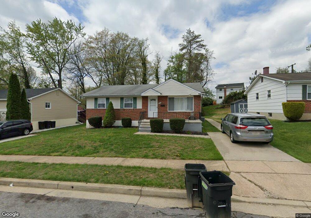
3704 Lamoine Rd Randallstown, MD 21133
Estimated Value: $338,095 - $401,000
Studio
2
Baths
1,336
Sq Ft
$279/Sq Ft
Est. Value
About This Home
This home is located at 3704 Lamoine Rd, Randallstown, MD 21133 and is currently estimated at $373,365, approximately $279 per square foot. 3704 Lamoine Rd is a home located in Baltimore County with nearby schools including Randallstown Elementary School, Deer Park Middle Magnet School, and Randallstown High School.
Ownership History
Date
Name
Owned For
Owner Type
Purchase Details
Closed on
Feb 17, 2022
Sold by
Margaret Bosson Castagna Trust
Bought by
Center For Social Change Inc
Current Estimated Value
Purchase Details
Closed on
Feb 15, 2000
Sold by
Stevens Dale
Bought by
Center For Social
Purchase Details
Closed on
Jun 10, 1999
Sold by
Federal Home Loan Mortgage Corporation
Bought by
Stevens Dale
Purchase Details
Closed on
Apr 8, 1999
Sold by
Depetris Dominic J
Bought by
Federal Home Loan Mortgage Corporation and Corporation
Create a Home Valuation Report for This Property
The Home Valuation Report is an in-depth analysis detailing your home's value as well as a comparison with similar homes in the area
Home Values in the Area
Average Home Value in this Area
Purchase History
| Date | Buyer | Sale Price | Title Company |
|---|---|---|---|
| Center For Social Change Inc | $4,000 | Stein Aaron Lee | |
| Center For Social | $121,500 | -- | |
| Stevens Dale | $42,000 | -- | |
| Federal Home Loan Mortgage Corporation | $60,000 | -- |
Source: Public Records
Tax History
| Year | Tax Paid | Tax Assessment Tax Assessment Total Assessment is a certain percentage of the fair market value that is determined by local assessors to be the total taxable value of land and additions on the property. | Land | Improvement |
|---|---|---|---|---|
| 2025 | $1,190 | $273,633 | -- | -- |
| 2024 | $1,190 | $245,100 | $73,800 | $171,300 |
| 2023 | $534 | $236,433 | $0 | $0 |
| 2022 | $1,058 | $227,767 | $0 | $0 |
| 2021 | $2,910 | $219,100 | $55,800 | $163,300 |
| 2020 | $2,910 | $219,100 | $55,800 | $163,300 |
| 2019 | $1,946 | $219,100 | $55,800 | $163,300 |
| 2018 | $2,049 | $223,600 | $55,800 | $167,800 |
| 2017 | $1,015 | $203,300 | $0 | $0 |
| 2016 | $720 | $183,000 | $0 | $0 |
| 2015 | $720 | $162,700 | $0 | $0 |
| 2014 | $720 | $162,700 | $0 | $0 |
Source: Public Records
Map
Nearby Homes
- 3723 Eastman Rd
- 9063 Meadow Heights Rd
- 9202 Samoset Rd
- 9112 Meadow Heights Rd
- 9208A Liberty Rd
- 3506 Bayer Ave
- 3 Dajobe Ct
- 1205/99 Winands Rd
- 8829 Sigrid Rd
- 3332 Offutt Rd
- 3320 Offutt Rd
- 9401 Summer Squal Dr
- 4048 Carthage Rd
- 4112 Spider Lily Way
- 9301 Silver Charm Dr
- 4228 Brookside Oaks
- 4226 Huntshire Rd
- 4108 Brown Bark Cir
- 3715 Peace Chance Dr
- 8541 Lucerne Rd
- 3702 Lamoine Rd
- 3705 Hamor Ct
- 3708 Lamoine Rd
- 9018 Hamor Rd
- 9020 Hamor Rd
- 3703 Hamor Ct
- 3700 Lamoine Rd
- 3709 Lamoine Rd
- 3705 Lamoine Rd
- 3707 Lamoine Rd
- 3707 Hamor Ct
- 3710 Lamoine Rd
- 3701 Hamor Ct
- 3703 Lamoine Rd
- 3701 Lamoine Rd
- 3711 Lamoine Rd
- 3708 Hamor Ct
- 3712 Lamoine Rd
- 9035 Allenswood Rd
- 9037 Allenswood Rd
Your Personal Tour Guide
Ask me questions while you tour the home.