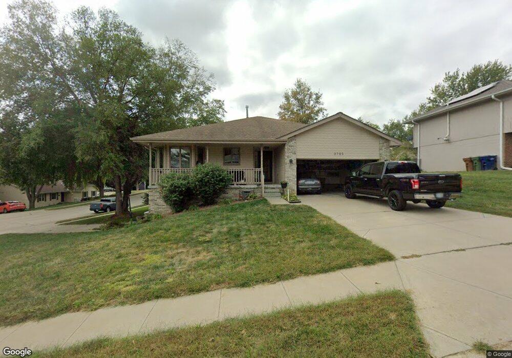
3705 Burr Oak Dr Bellevue, NE 68123
Estimated Value: $317,000 - $333,000
3
Beds
5
Baths
2,582
Sq Ft
$126/Sq Ft
Est. Value
About This Home
This home is located at 3705 Burr Oak Dr, Bellevue, NE 68123 and is currently estimated at $324,569, approximately $125 per square foot. 3705 Burr Oak Dr is a home located in Sarpy County with nearby schools including Bellevue Elementary School, Lewis & Clark Middle School, and Bellevue West High School.
Ownership History
Date
Name
Owned For
Owner Type
Purchase Details
Closed on
Mar 31, 2021
Sold by
Blink Patience
Bought by
Blink Shawn
Current Estimated Value
Purchase Details
Closed on
Sep 29, 2000
Sold by
Michele Olson Karyn and Bradley David
Bought by
Blink Shawn M and Blink Patience N
Home Financials for this Owner
Home Financials are based on the most recent Mortgage that was taken out on this home.
Original Mortgage
$123,600
Interest Rate
7.99%
Create a Home Valuation Report for This Property
The Home Valuation Report is an in-depth analysis detailing your home's value as well as a comparison with similar homes in the area
Home Values in the Area
Average Home Value in this Area
Purchase History
| Date | Buyer | Sale Price | Title Company |
|---|---|---|---|
| Blink Shawn | -- | None Listed On Document | |
| Blink Shawn M | $155,000 | -- |
Source: Public Records
Mortgage History
| Date | Status | Borrower | Loan Amount |
|---|---|---|---|
| Previous Owner | Blink Shawn M | $123,600 |
Source: Public Records
Tax History Compared to Growth
Tax History
| Year | Tax Paid | Tax Assessment Tax Assessment Total Assessment is a certain percentage of the fair market value that is determined by local assessors to be the total taxable value of land and additions on the property. | Land | Improvement |
|---|---|---|---|---|
| 2025 | $4,894 | $316,308 | $43,000 | $273,308 |
| 2024 | $5,406 | $280,331 | $40,000 | $240,331 |
| 2023 | $5,406 | $256,004 | $36,000 | $220,004 |
| 2022 | $4,911 | $228,225 | $31,000 | $197,225 |
| 2021 | $4,575 | $210,304 | $31,000 | $179,304 |
| 2020 | $4,561 | $209,030 | $31,000 | $178,030 |
| 2019 | $4,521 | $208,468 | $2,610 | $205,858 |
| 2018 | $4,274 | $202,387 | $26,000 | $176,387 |
| 2017 | $4,191 | $197,079 | $26,000 | $171,079 |
| 2016 | $3,914 | $188,128 | $24,000 | $164,128 |
| 2015 | $3,815 | $184,455 | $24,000 | $160,455 |
| 2014 | $3,638 | $174,746 | $24,000 | $150,746 |
| 2012 | -- | $166,397 | $22,000 | $144,397 |
Source: Public Records
Map
Nearby Homes
- 3716 Lookingglass Dr
- 3728 Schuemann Dr
- 3738 Falcon Dr
- 3504 Sheridan Cir
- 3508 Jason Cir
- 3506 Lynnwood Dr
- 13602 S 36th St
- 3309 Lookingglass Dr
- 4411 Schilling Dr
- 12741 Ridgeview Cir
- 12750 Forestdale Dr
- 13069 S 42nd Ave Unit Lot 49
- 13065 S 42nd Ave Unit Lot 50
- 13061 S 42nd Ave Unit Lot 51
- 13057 S 42nd Ave Unit Lot 52
- 3108 Mirror Cir
- 13609 S 42nd Ave
- 3105 Mirror Cir
- 4369 Lookingglass Dr
- 4409 Lookingglass Dr
- 3709 Burr Oak Dr
- 3704 Looking Glass Dr
- 3704 Lookingglass Dr
- 3708 Looking Glass Dr
- 13303 Brookside Dr
- 3713 Burr Oak Dr
- 3706 Burr Oak Dr
- 13267 Brookside Dr
- 3702 Burr Oak Dr
- 3710 Burr Oak Dr
- 13307 Brookside Dr
- 3712 Looking Glass Dr
- 3712 Lookingglass Dr
- 3717 Burr Oak Dr
- 3714 Burr Oak Dr
- 13263 Brookside Dr
- 3716 Looking Glass Dr
- 3718 Burr Oak Dr
- 3711 Schuemann Dr
- 3707 Schuemann Dr