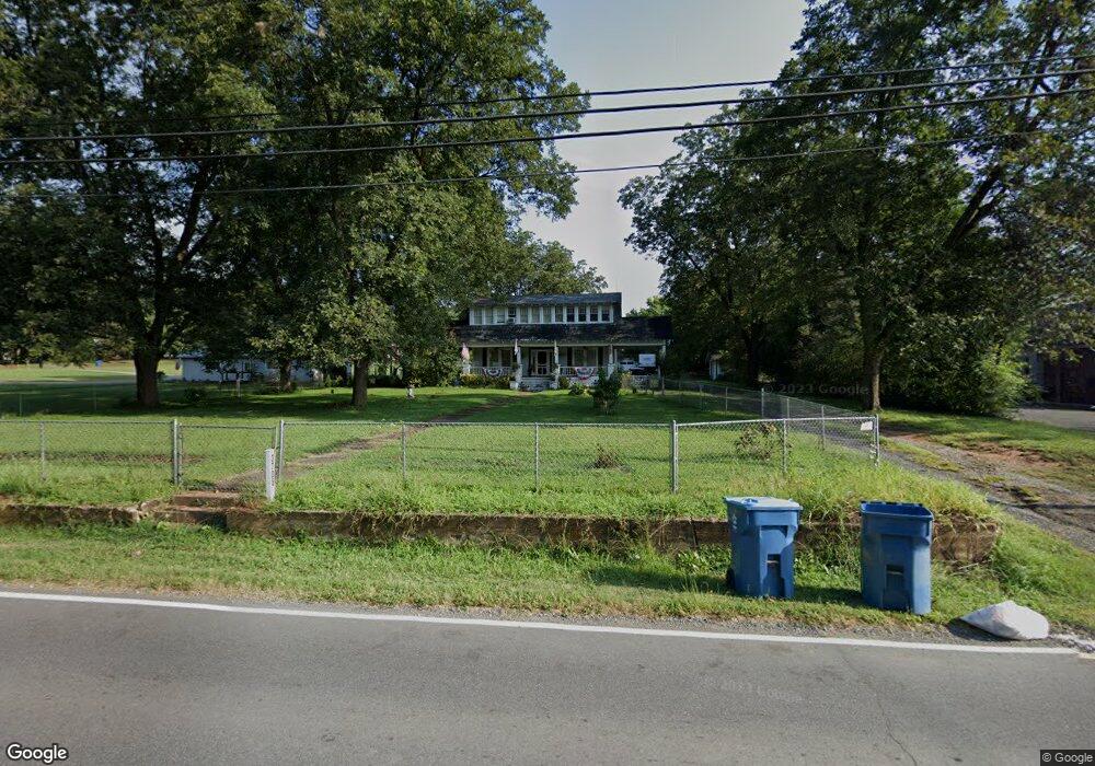
3705 Highway 73 E Concord, NC 28025
Estimated Value: $281,000 - $590,000
4
Beds
2
Baths
3,012
Sq Ft
$142/Sq Ft
Est. Value
About This Home
This home is located at 3705 Highway 73 E, Concord, NC 28025 and is currently estimated at $426,646, approximately $141 per square foot. 3705 Highway 73 E is a home located in Cabarrus County with nearby schools including W.M. Irvin Elementary School, Mount Pleasant Middle School, and Mount Pleasant High School.
Ownership History
Date
Name
Owned For
Owner Type
Purchase Details
Closed on
May 25, 2005
Sold by
Sartin L Hooper and Sartin Betty C
Bought by
Margeson Mark H and Margeson Karen E
Current Estimated Value
Home Financials for this Owner
Home Financials are based on the most recent Mortgage that was taken out on this home.
Original Mortgage
$108,880
Outstanding Balance
$56,625
Interest Rate
5.8%
Mortgage Type
Purchase Money Mortgage
Estimated Equity
$370,021
Purchase Details
Closed on
Oct 1, 1992
Bought by
Sartin Betty L
Create a Home Valuation Report for This Property
The Home Valuation Report is an in-depth analysis detailing your home's value as well as a comparison with similar homes in the area
Home Values in the Area
Average Home Value in this Area
Purchase History
| Date | Buyer | Sale Price | Title Company |
|---|---|---|---|
| Margeson Mark H | $136,500 | -- | |
| Sartin Betty L | $49,500 | -- |
Source: Public Records
Mortgage History
| Date | Status | Borrower | Loan Amount |
|---|---|---|---|
| Open | Margeson Mark H | $108,880 | |
| Closed | Margeson Mark H | $20,415 |
Source: Public Records
Tax History
| Year | Tax Paid | Tax Assessment Tax Assessment Total Assessment is a certain percentage of the fair market value that is determined by local assessors to be the total taxable value of land and additions on the property. | Land | Improvement |
|---|---|---|---|---|
| 2025 | $2,429 | $370,310 | $48,330 | $321,980 |
| 2024 | $2,429 | $370,310 | $48,330 | $321,980 |
| 2023 | $2,196 | $267,840 | $25,430 | $242,410 |
| 2022 | $2,196 | $267,840 | $25,430 | $242,410 |
| 2021 | $2,196 | $267,840 | $25,430 | $242,410 |
| 2020 | $2,143 | $267,840 | $25,430 | $242,410 |
| 2019 | $1,471 | $183,870 | $22,890 | $160,980 |
| 2018 | $1,434 | $183,870 | $22,890 | $160,980 |
| 2017 | $1,397 | $183,870 | $22,890 | $160,980 |
| 2016 | $1,397 | $174,360 | $21,620 | $152,740 |
| 2015 | $1,325 | $174,360 | $21,620 | $152,740 |
| 2014 | $1,325 | $174,360 | $21,620 | $152,740 |
Source: Public Records
Map
Nearby Homes
- 143 Kirkwood Dr
- 4165 Laurelwood Ct
- 3354 Westview Rd
- 3200 Van Tassel Dr
- 348 Pleasant View Ln SE
- 2568 Chelsea Dr
- 1660 Songwood Rd
- 13 Wendall Ln
- 1800 Lake Lynn Rd
- 5423 Arnold Way
- 1695 Lemming Dr
- 4025 Fringewood Dr
- Lot 1 Patience Dr
- 16 Wendall Ln
- 5411 Arnold Way
- 552 Tripolis St SE
- 1144 Tangle Ridge Dr SE
- 1160 Crestmont Dr SE Unit A3
- 1162 Crestmont Dr SE
- 1930 Cold Springs Rd
- 3755 Highway 73 E
- 3755 Highway 73 E
- 4028 Highway 73 E
- 4050 Highway 73 E
- 100 Kirkwood Dr
- 3674 Highway 73 E
- 114 Kirkwood Dr
- 3740 Highway 73 E
- 3700 Highway 73 E
- 3740 Nc-73
- 95 Kirkwood Dr
- 101 Kirkwood Dr
- 3756 Highway 73 E
- 3591 Nc Hwy 73 E
- 120 Kirkwood Dr
- 0001 Irish Potato Rd
- 51 Irish Potato Rd
- 115 Kirkwood Dr
- 0 Cold Springs Rd
- 00 Cold Springs Rd
Your Personal Tour Guide
Ask me questions while you tour the home.