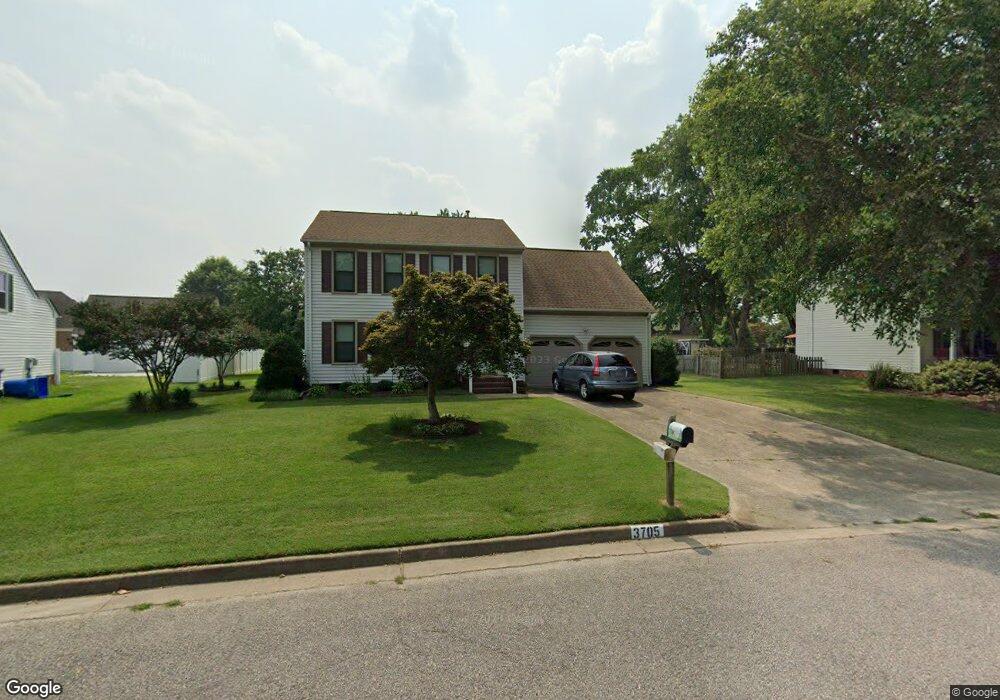
3705 Point Elizabeth Dr Chesapeake, VA 23321
Western Branch NeighborhoodEstimated Value: $430,924 - $446,000
3
Beds
3
Baths
1,888
Sq Ft
$233/Sq Ft
Est. Value
About This Home
This home is located at 3705 Point Elizabeth Dr, Chesapeake, VA 23321 and is currently estimated at $439,731, approximately $232 per square foot. 3705 Point Elizabeth Dr is a home located in Chesapeake City with nearby schools including Western Branch Primary School, Western Branch Intermediate School, and Western Branch Middle School.
Ownership History
Date
Name
Owned For
Owner Type
Purchase Details
Closed on
Aug 16, 2024
Sold by
Rakowski Rose Mary K
Bought by
Creasy Nathaniel K and Creasy April A
Current Estimated Value
Home Financials for this Owner
Home Financials are based on the most recent Mortgage that was taken out on this home.
Original Mortgage
$374,440
Outstanding Balance
$369,885
Interest Rate
6.49%
Mortgage Type
FHA
Estimated Equity
$69,846
Create a Home Valuation Report for This Property
The Home Valuation Report is an in-depth analysis detailing your home's value as well as a comparison with similar homes in the area
Home Values in the Area
Average Home Value in this Area
Purchase History
| Date | Buyer | Sale Price | Title Company |
|---|---|---|---|
| Creasy Nathaniel K | $418,000 | Chicago Title |
Source: Public Records
Mortgage History
| Date | Status | Borrower | Loan Amount |
|---|---|---|---|
| Open | Creasy Nathaniel K | $374,440 |
Source: Public Records
Tax History Compared to Growth
Tax History
| Year | Tax Paid | Tax Assessment Tax Assessment Total Assessment is a certain percentage of the fair market value that is determined by local assessors to be the total taxable value of land and additions on the property. | Land | Improvement |
|---|---|---|---|---|
| 2025 | $3,812 | $404,700 | $150,000 | $254,700 |
| 2024 | $3,812 | $377,400 | $150,000 | $227,400 |
| 2023 | $3,576 | $354,100 | $140,000 | $214,100 |
| 2022 | $3,475 | $344,100 | $130,000 | $214,100 |
| 2021 | $2,946 | $280,600 | $100,000 | $180,600 |
| 2020 | $2,849 | $271,300 | $100,000 | $171,300 |
| 2019 | $2,849 | $271,300 | $100,000 | $171,300 |
| 2018 | $2,693 | $253,200 | $90,000 | $163,200 |
| 2017 | $2,659 | $253,200 | $90,000 | $163,200 |
| 2016 | $2,659 | $253,200 | $90,000 | $163,200 |
| 2015 | $2,659 | $253,200 | $90,000 | $163,200 |
| 2014 | $2,577 | $245,400 | $90,000 | $155,400 |
Source: Public Records
Map
Nearby Homes
- 2935 Bruce Station
- 3826 Whitechapel Arch
- 2929 Tyre Neck Rd
- 3909 Point Elizabeth Dr
- 34 Sandie Point Ln
- 32 Sandie Point Ln
- 22 Sandie Point Ln
- 14 Sandie Point Ln
- 3012 Princess Anne Crescent
- 3037 Tyre Neck Rd
- 330 Thelmar Ln
- 2829 Meadow Wood Dr E
- 5212 Lake Cir
- 2537 Lakewood Ln
- 2922 Replica Ct
- 2935 Sterling Point Dr
- 2944 Replica Ln
- 412 Robin Rd
- 3917 Oak Dr E
- 102 Windsor Rd
- 3707 Point Elizabeth Dr
- 3703 Point Elizabeth Dr
- 3704 Point Elizabeth Dr
- 3700 Point Elizabeth Dr
- 3701 Point Elizabeth Dr
- 3708 Point Elizabeth Dr
- 2913 Luxford Ct
- 2806 Bruce Station Ct
- 2911 Luxford Ct
- 3626 Whitechapel Arch
- 3002 Falmouth Dr
- 3700 Whitechapel Arch
- 3622 Whitechapel Arch
- 3624 Whitechapel Arch
- 3702 Whitechapel Arch
- 3005 Luxford Ct
- 2909 Luxford Ct
- 2804 Bruce Station Ct
- 3704 Whitechapel Arch
- 3620 Whitechapel Arch