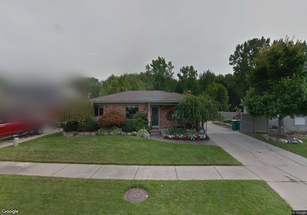
37068 Fox Pointe New Baltimore, MI 48047
Estimated Value: $266,657 - $312,000
--
Bed
1
Bath
1,167
Sq Ft
$245/Sq Ft
Est. Value
About This Home
This home is located at 37068 Fox Pointe, New Baltimore, MI 48047 and is currently estimated at $286,164, approximately $245 per square foot. 37068 Fox Pointe is a home located in Macomb County with nearby schools including Ashley Elementary School, Anchor Bay Middle School North, and Anchor Bay High School.
Ownership History
Date
Name
Owned For
Owner Type
Purchase Details
Closed on
Jul 27, 2006
Sold by
Stankus David and Stankus Sheryl
Bought by
Stankus David and Stankus Sheryl
Current Estimated Value
Home Financials for this Owner
Home Financials are based on the most recent Mortgage that was taken out on this home.
Original Mortgage
$124,052
Interest Rate
6.73%
Mortgage Type
FHA
Purchase Details
Closed on
Jun 18, 1999
Sold by
Bankers Trust Co Of Cali
Bought by
Potvin Gregg T
Create a Home Valuation Report for This Property
The Home Valuation Report is an in-depth analysis detailing your home's value as well as a comparison with similar homes in the area
Home Values in the Area
Average Home Value in this Area
Purchase History
| Date | Buyer | Sale Price | Title Company |
|---|---|---|---|
| Stankus David | -- | None Available | |
| Potvin Gregg T | $113,900 | -- |
Source: Public Records
Mortgage History
| Date | Status | Borrower | Loan Amount |
|---|---|---|---|
| Closed | Stankus David | $124,052 |
Source: Public Records
Tax History Compared to Growth
Tax History
| Year | Tax Paid | Tax Assessment Tax Assessment Total Assessment is a certain percentage of the fair market value that is determined by local assessors to be the total taxable value of land and additions on the property. | Land | Improvement |
|---|---|---|---|---|
| 2025 | $3,620 | $115,100 | $0 | $0 |
| 2024 | $3,029 | $101,000 | $0 | $0 |
| 2023 | $2,882 | $94,900 | $0 | $0 |
| 2022 | $3,284 | $89,300 | $0 | $0 |
| 2021 | $3,161 | $86,100 | $0 | $0 |
| 2020 | $2,666 | $84,300 | $0 | $0 |
| 2019 | $3,011 | $79,900 | $0 | $0 |
| 2018 | $2,962 | $76,100 | $0 | $0 |
| 2017 | $2,945 | $73,100 | $27,700 | $45,400 |
| 2016 | $2,923 | $73,100 | $0 | $0 |
| 2015 | -- | $72,500 | $0 | $0 |
| 2014 | -- | $68,800 | $0 | $0 |
Source: Public Records
Map
Nearby Homes
- 51060 Blackwell St
- 37095 Highview St
- 36465 Main St
- 50759 Holt St
- 53572 Mary Ann Ln
- 53175 Woodland Dr
- 53179 Woodland Dr
- 53561 Mary Ann Ln
- 51435 Base St
- 50697 Elsey St
- 52411 Washington St
- 50627 Elsey St
- 52451 Washington St
- 52511 Washington St
- 50591 Walpole St
- 38088 Main St
- 35990 Windridge Dr Unit 113
- 38199 Murdick Dr
- 52400 Huntley Ave
- 35925 Windridge Dr Unit 82
- 37084 Fox Pointe
- 37052 Fox Pointe
- 37036 Fox Pointe
- 37106 Fox Pointe
- 37018 Fox Pointe
- 51709 Kings Pointe Dr
- 51706 Kings Pointe Dr
- 51728 Fox Pointe Dr
- 37002 Fox Pointe
- 51720 Kings Pointe Dr
- 51725 Kings Pointe Dr
- 51773 Fox Pointe Dr
- 51704 Schnoor St
- 51764 Fox Pointe Dr
- 36906 Schnoor St
- 51730 Kings Pointe Dr
- 51712 Schnoor St
- 51733 Kings Pointe Dr
- 51796 Fox Pointe Dr
- 51801 Fox Pointe Dr