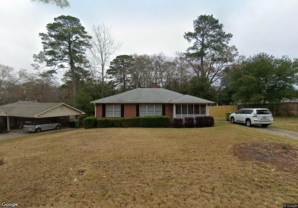
3707 E Britt David Rd Columbus, GA 31909
North Columbus NeighborhoodEstimated Value: $131,123 - $172,000
3
Beds
2
Baths
1,268
Sq Ft
$122/Sq Ft
Est. Value
About This Home
This home is located at 3707 E Britt David Rd, Columbus, GA 31909 and is currently estimated at $154,531, approximately $121 per square foot. 3707 E Britt David Rd is a home located in Muscogee County with nearby schools including Gentian Elementary School, Midland Middle School, and Hardaway High School.
Ownership History
Date
Name
Owned For
Owner Type
Purchase Details
Closed on
Dec 30, 2019
Sold by
Meadows James Alvin V
Bought by
Meadows James Alvin V and Meadows Savannah Smith
Current Estimated Value
Home Financials for this Owner
Home Financials are based on the most recent Mortgage that was taken out on this home.
Original Mortgage
$72,000
Interest Rate
3.65%
Mortgage Type
New Conventional
Purchase Details
Closed on
Nov 1, 2019
Sold by
Corps Realty Llc
Bought by
Meadows James Alvin V
Home Financials for this Owner
Home Financials are based on the most recent Mortgage that was taken out on this home.
Original Mortgage
$72,000
Interest Rate
3.65%
Mortgage Type
New Conventional
Create a Home Valuation Report for This Property
The Home Valuation Report is an in-depth analysis detailing your home's value as well as a comparison with similar homes in the area
Home Values in the Area
Average Home Value in this Area
Purchase History
| Date | Buyer | Sale Price | Title Company |
|---|---|---|---|
| Meadows James Alvin V | -- | -- | |
| Meadows James Alvin V | $94,000 | -- |
Source: Public Records
Mortgage History
| Date | Status | Borrower | Loan Amount |
|---|---|---|---|
| Previous Owner | Meadows James Alvin V | $72,000 |
Source: Public Records
Tax History
| Year | Tax Paid | Tax Assessment Tax Assessment Total Assessment is a certain percentage of the fair market value that is determined by local assessors to be the total taxable value of land and additions on the property. | Land | Improvement |
|---|---|---|---|---|
| 2025 | $16 | $39,852 | $8,020 | $31,832 |
| 2024 | $16 | $39,852 | $8,020 | $31,832 |
| 2023 | $1,570 | $39,852 | $8,020 | $31,832 |
| 2022 | $1,512 | $37,032 | $8,020 | $29,012 |
| 2021 | $1,329 | $32,552 | $8,020 | $24,532 |
| 2020 | $1,329 | $32,552 | $8,020 | $24,532 |
| 2019 | $1,299 | $31,708 | $8,020 | $23,688 |
| 2018 | $1,299 | $31,708 | $8,020 | $23,688 |
| 2017 | $1,303 | $31,708 | $8,020 | $23,688 |
| 2016 | $919 | $22,289 | $3,175 | $19,114 |
| 2015 | $368 | $22,289 | $3,175 | $19,114 |
| 2014 | $922 | $22,289 | $3,175 | $19,114 |
| 2013 | -- | $22,289 | $3,175 | $19,114 |
Source: Public Records
Map
Nearby Homes
- 3630 Vernon Dr
- 3514 Vernon Dr
- 3504 Vernon Dr
- 5502 Southlea Ln
- 4565 Prim Dr
- 4813 Rowland Ct
- 3641 Reese Rd
- 5224 Miller Rd
- 5820 Windsor Dr
- 4230 Carlene Dr
- 4151 Anglin Rd
- 4630 Fairview Dr
- 5836 Sherborne Dr
- 5829 Moon Rd
- 3935 Tifton Dr
- 4133 Pickering Dr
- 5823 Pratt Ave
- 3091 Mustang Dr
- 5921 Canterbury Dr
- 4004 Tifton Dr
- 3701 E Britt David Rd
- 5321 Eugenia Ave
- 5320 Boyd Dr
- 3727 E Britt David Rd
- 5327 Eugenia Ave
- 3712 E Britt David Rd
- 5318 Boyd Dr
- 5333 Eugenia Ave
- 3632 E Britt David Rd
- 3625 E Britt David Rd
- 3720 E Britt David Rd
- 5324 Boyd Dr
- 3804 Conrad Dr
- 0 Boyd Branch Dr Unit 4 8005092
- 0 Boyd Branch Dr Unit 3 8005086
- 0 Boyd Branch Dr Unit 2 8005080
- 0 Boyd Branch Dr Unit 1 8005066
- 0 Boyd Branch Dr Unit 3 8204446
- 0 Boyd Branch Dr Unit 2 8204436
- 0 Boyd Branch Dr Unit 1 8204431
Your Personal Tour Guide
Ask me questions while you tour the home.