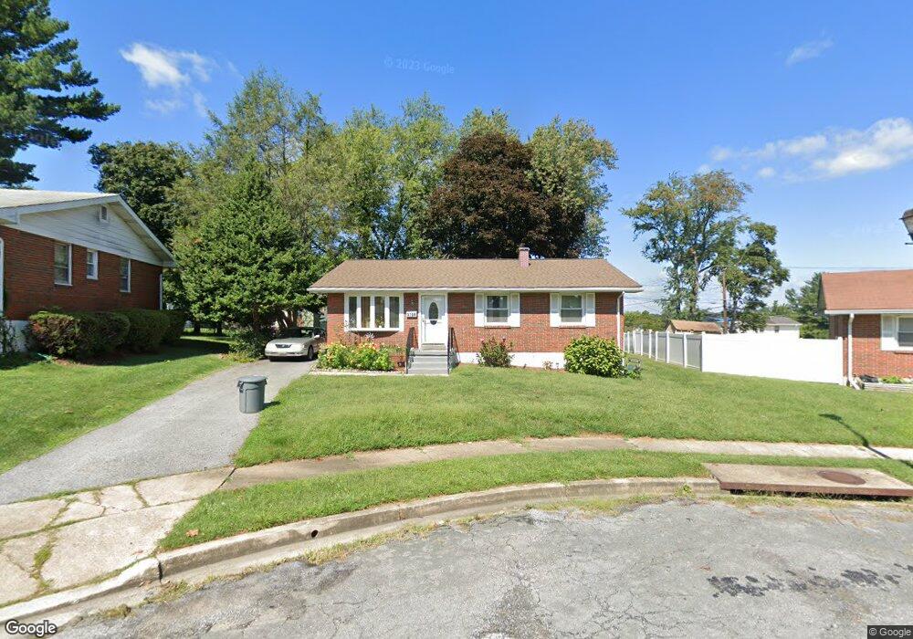
3708 Brownbrook Ct Randallstown, MD 21133
Estimated Value: $309,000 - $340,000
Studio
2
Baths
1,280
Sq Ft
$252/Sq Ft
Est. Value
About This Home
This home is located at 3708 Brownbrook Ct, Randallstown, MD 21133 and is currently estimated at $322,020, approximately $251 per square foot. 3708 Brownbrook Ct is a home located in Baltimore County with nearby schools including Church Lane Elementary Technology School, Northwest Academy of Health Sciences, and Randallstown High School.
Ownership History
Date
Name
Owned For
Owner Type
Purchase Details
Closed on
Jul 26, 2004
Sold by
Ross Coral V
Bought by
Defreitas Tina T and Defreitas Trevor G
Current Estimated Value
Purchase Details
Closed on
Sep 27, 2002
Sold by
Fan Pat Hay
Bought by
Ross Coral
Purchase Details
Closed on
Jun 22, 1971
Sold by
Givotovsky Sidney L
Bought by
Fan Pat Hay
Create a Home Valuation Report for This Property
The Home Valuation Report is an in-depth analysis detailing your home's value as well as a comparison with similar homes in the area
Home Values in the Area
Average Home Value in this Area
Purchase History
| Date | Buyer | Sale Price | Title Company |
|---|---|---|---|
| Defreitas Tina T | $174,000 | -- | |
| Defreitas Tina T | $174,000 | -- | |
| Ross Coral | $132,000 | -- | |
| Fan Pat Hay | $28,500 | -- |
Source: Public Records
Tax History
| Year | Tax Paid | Tax Assessment Tax Assessment Total Assessment is a certain percentage of the fair market value that is determined by local assessors to be the total taxable value of land and additions on the property. | Land | Improvement |
|---|---|---|---|---|
| 2025 | $3,589 | $261,400 | -- | -- |
| 2024 | $3,589 | $241,900 | $74,700 | $167,200 |
| 2023 | $1,739 | $230,433 | $0 | $0 |
| 2022 | $3,299 | $218,967 | $0 | $0 |
| 2021 | $3,333 | $207,500 | $56,700 | $150,800 |
| 2020 | $3,333 | $207,500 | $56,700 | $150,800 |
| 2019 | $3,112 | $207,500 | $56,700 | $150,800 |
| 2018 | $2,932 | $207,700 | $56,700 | $151,000 |
| 2017 | $2,720 | $189,500 | $0 | $0 |
| 2016 | $2,394 | $171,300 | $0 | $0 |
| 2015 | $2,394 | $153,100 | $0 | $0 |
| 2014 | $2,394 | $153,100 | $0 | $0 |
Source: Public Records
Map
Nearby Homes
- 3603 Fieldstone Rd
- 9012 Allenswood Rd
- 8829 Sigrid Rd
- 3506 Bayer Ave
- 9 Greens Landing Ct
- 8541 Lucerne Rd
- 3950 Chaffey Rd
- 3821 Brownhill Rd
- 3729 Offutt Rd
- 8513 Charlton Rd
- 4048 Carthage Rd
- 9202 Samoset Rd
- 3332 Offutt Rd
- 8504 Fieldway Dr
- 5701 Old Court Rd
- 9208A Liberty Rd
- 3320 Offutt Rd
- 3312 Lauri Rd
- 4932 Old Court Rd
- 5713 Old Court Rd
- 3706 Brownbrook Ct
- 3710 Brownbrook Ct
- 3704 Brownbrook Ct
- 3700 Shellbrook Ct
- 8822 Church Ln Unit A
- 8822 Church Ln
- 3711 Brownbrook Ct
- 3702 Shellbrook Ct
- 3702 Brownbrook Ct
- 8822A Church Ln
- 3707 Brownbrook Ct
- 3705 Brownbrook Ct
- 3709 Brownbrook Ct
- 3701 Shellbrook Ct
- 3703 Brownbrook Ct
- 3708 Brenbrook Dr
- 3704 Shellbrook Ct
- 8818 Church Ln
- 8820 Church Ln
- 3711 Stoneybrook Rd