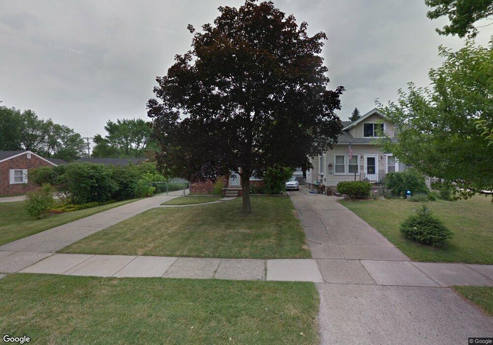
3709 Elmhurst Ave Unit Bldg-Unit Royal Oak, MI 48073
Estimated Value: $217,000 - $313,000
3
Beds
1
Bath
912
Sq Ft
$312/Sq Ft
Est. Value
About This Home
This home is located at 3709 Elmhurst Ave Unit Bldg-Unit, Royal Oak, MI 48073 and is currently estimated at $284,779, approximately $312 per square foot. 3709 Elmhurst Ave Unit Bldg-Unit is a home located in Oakland County with nearby schools including Addams Elementary, Royal Oak Middle School, and Royal Oak High School.
Ownership History
Date
Name
Owned For
Owner Type
Purchase Details
Closed on
Sep 24, 2010
Sold by
Webb Patricia M
Bought by
Rycha Llc
Current Estimated Value
Purchase Details
Closed on
Sep 22, 2009
Sold by
Thomason Ryan L and Thomason Elizabeth N
Bought by
Federal Home Loan Mortgage Corp
Purchase Details
Closed on
Aug 30, 2001
Sold by
Batanian Daniel
Bought by
Thomason Ryan L
Purchase Details
Closed on
Oct 26, 2000
Sold by
Hurwitz Freda R
Bought by
Batanian Daniel
Home Financials for this Owner
Home Financials are based on the most recent Mortgage that was taken out on this home.
Original Mortgage
$138,700
Interest Rate
7.91%
Create a Home Valuation Report for This Property
The Home Valuation Report is an in-depth analysis detailing your home's value as well as a comparison with similar homes in the area
Home Values in the Area
Average Home Value in this Area
Purchase History
| Date | Buyer | Sale Price | Title Company |
|---|---|---|---|
| Rycha Llc | -- | None Available | |
| Federal Home Loan Mortgage Corp | $134,678 | None Available | |
| Thomason Ryan L | $154,800 | -- | |
| Batanian Daniel | $146,000 | -- |
Source: Public Records
Mortgage History
| Date | Status | Borrower | Loan Amount |
|---|---|---|---|
| Previous Owner | Batanian Daniel | $138,700 | |
| Closed | Thomason Ryan L | -- |
Source: Public Records
Tax History Compared to Growth
Tax History
| Year | Tax Paid | Tax Assessment Tax Assessment Total Assessment is a certain percentage of the fair market value that is determined by local assessors to be the total taxable value of land and additions on the property. | Land | Improvement |
|---|---|---|---|---|
| 2024 | $3,303 | $97,610 | $0 | $0 |
| 2022 | $3,603 | $87,340 | $0 | $0 |
| 2020 | $3,186 | $78,410 | $0 | $0 |
| 2018 | $3,603 | $70,190 | $0 | $0 |
| 2017 | $3,272 | $70,190 | $0 | $0 |
| 2015 | -- | $64,360 | $0 | $0 |
| 2014 | -- | $59,730 | $0 | $0 |
| 2011 | -- | $55,230 | $0 | $0 |
Source: Public Records
Map
Nearby Homes
- 3532 Woodland Ave
- 3439 Benjamin Ave Unit 121
- 3601 Durham Rd
- 3927 Woodland Ave
- 3415 Benjamin Ave Unit 505
- 4115 Elmhurst Ave
- 3526 Durham Rd
- 4109 Benjamin Ave Unit 2
- 3402 Woodland Ave
- 4102 Woodland Ave
- 2503 W 13 Mile Rd Unit 18
- 3100 Linwood Ave Unit B, 28
- 2500 Normandy Rd Unit 46
- 2500 Normandy Rd Unit 29
- 2500 Normandy Rd Unit 41
- 3122 Benjamin Ave
- 4101 Devon Rd
- 2511 Massoit Rd
- 4114 Edgeland Ave
- 2614 Essex St
- 3709 Elmhurst Ave
- 3711 Elmhurst Ave
- 3619 Elmhurst Ave
- 3715 Elmhurst Ave
- 3704 Kent Rd
- 3710 Kent Rd Unit Bldg-Unit
- 3710 Kent Rd
- 3721 Elmhurst Ave
- 3615 Elmhurst Ave
- 3714 Kent Rd
- 3614 Kent Rd
- 3708 Elmhurst Ave
- 3704 Elmhurst Ave
- 3720 Kent Rd
- 3609 Elmhurst Ave
- 3712 Elmhurst Ave
- 3618 Elmhurst Ave
- 3718 Elmhurst Ave
- 3614 Elmhurst Ave
- 3801 Elmhurst Ave