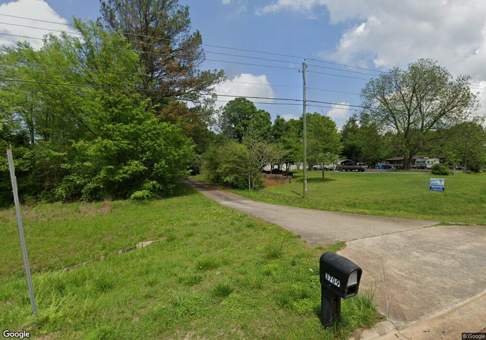
3709 Rockmart Hwy Cedartown, GA 30125
Estimated Value: $439,000 - $1,012,672
4
Beds
4
Baths
4,231
Sq Ft
$170/Sq Ft
Est. Value
About This Home
This home is located at 3709 Rockmart Hwy, Cedartown, GA 30125 and is currently estimated at $718,557, approximately $169 per square foot. 3709 Rockmart Hwy is a home located in Polk County.
Ownership History
Date
Name
Owned For
Owner Type
Purchase Details
Closed on
May 4, 1999
Sold by
Malone Agnes G
Bought by
Malone Timothy I
Current Estimated Value
Purchase Details
Closed on
Mar 2, 1999
Sold by
Malone Timothy I
Bought by
Malone Agnes G
Purchase Details
Closed on
Mar 25, 1998
Sold by
Malone Curtis L
Bought by
Malone Curtis Stephen and Timothy Iva
Purchase Details
Closed on
Feb 28, 1998
Sold by
Malone Curtis L and Malone Agnes G
Bought by
Malone Timothy G
Purchase Details
Closed on
Mar 1, 1983
Sold by
Malone Curtis L
Bought by
Malone Curtis L
Purchase Details
Closed on
Mar 14, 1966
Sold by
Clemons Q M
Bought by
Malone Curtis L
Purchase Details
Closed on
Mar 15, 1965
Bought by
Clemons Q M
Create a Home Valuation Report for This Property
The Home Valuation Report is an in-depth analysis detailing your home's value as well as a comparison with similar homes in the area
Home Values in the Area
Average Home Value in this Area
Purchase History
| Date | Buyer | Sale Price | Title Company |
|---|---|---|---|
| Malone Timothy I | -- | -- | |
| Malone Agnes G | -- | -- | |
| Malone Curtis Stephen | -- | -- | |
| Malone Timothy G | -- | -- | |
| Malone Curtis L | -- | -- | |
| Malone Curtis L | -- | -- | |
| Clemons Q M | -- | -- |
Source: Public Records
Tax History Compared to Growth
Tax History
| Year | Tax Paid | Tax Assessment Tax Assessment Total Assessment is a certain percentage of the fair market value that is determined by local assessors to be the total taxable value of land and additions on the property. | Land | Improvement |
|---|---|---|---|---|
| 2024 | $5,611 | $337,599 | $79,388 | $258,211 |
| 2023 | $4,714 | $267,550 | $79,388 | $188,162 |
| 2022 | $4,281 | $239,742 | $69,078 | $170,664 |
| 2021 | $4,439 | $239,742 | $69,078 | $170,664 |
| 2020 | $4,439 | $239,742 | $69,078 | $170,664 |
| 2019 | $4,856 | $236,674 | $69,078 | $167,596 |
| 2018 | $4,818 | $231,058 | $67,610 | $163,448 |
Source: Public Records
Map
Nearby Homes
- 3825 Rockmart Hwy
- 0 Bethlehem Rd Unit 10622470
- 2020 Old Cedartown Rd
- 1907 Old Cedartown Rd
- 394 Knight Rd
- 0 Pine Mountain Rd Unit 7662185
- 482 Pine Mountain Rd
- 0 Pine Mountain Rd Unit 10478395
- 0 Pine Mountain Rd Unit 7540784
- 600 Grady Rd
- 94 Wimberly Hill Loop
- 2056 Bellview Rd
- 1157 Stringer Rd
- 0 Richard Pullen Rd Unit 7626794
- 0 Richard Pullen Rd Unit 10577442
- 0 Benefield Rd Unit 10405501
- 0 Benefield Rd Unit 7479734
- 1195 Grady Rd
- 93 Clay Rd
- 440 Mcbride Rd
- 134 Acres Sunset Valley St
- 134 Sunset Valley St Unit 86
- 134 Sunset Valley St
- 106 Sunset Valley St
- 120 Sunset Valley St
- 146 Sunset Valley St
- 92 Sunset Valley St
- 0 Sunset Valley St Unit 91 7507390
- 0 Sunset Valley St Unit 91 8096038
- LOT 91 Sunset Valley St
- 0 Sunset Valley St Unit 3278072
- 0 Sunset Valley St Unit 8892289
- 0 Sunset Valley St Unit 134 Acres 8913791
- 0 Sunset Valley St Unit 2967928
- 0 Sunset Valley St Unit 3197629
- 0 Sunset Valley St Unit 7047831
- 0 Sunset Valley St Unit 7064724
- 0 Sunset Valley St Unit 7153814
- 0 Sunset Valley St Unit 7447292
- 0 Sunset Valley St Unit 8054644
