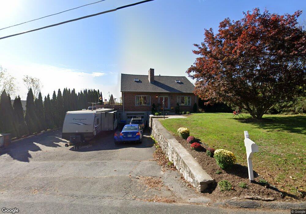
371 Allen Rd Torrington, CT 06790
Estimated Value: $371,362 - $467,000
4
Beds
2
Baths
2,307
Sq Ft
$185/Sq Ft
Est. Value
About This Home
This home is located at 371 Allen Rd, Torrington, CT 06790 and is currently estimated at $426,591, approximately $184 per square foot. 371 Allen Rd is a home located in Litchfield County with nearby schools including Torrington Middle School, Torrington High School, and St. John Paul the Great Academy.
Ownership History
Date
Name
Owned For
Owner Type
Purchase Details
Closed on
Feb 10, 2000
Sold by
Richardone Nicholas and Richardone Jayne
Bought by
Cristiano Vittorio and Cristiano Theresa
Current Estimated Value
Home Financials for this Owner
Home Financials are based on the most recent Mortgage that was taken out on this home.
Original Mortgage
$133,000
Interest Rate
8.25%
Purchase Details
Closed on
Jun 28, 1991
Sold by
Daquila Joseph Est
Bought by
Richardone Nicholas and Moreau Jayne L
Create a Home Valuation Report for This Property
The Home Valuation Report is an in-depth analysis detailing your home's value as well as a comparison with similar homes in the area
Home Values in the Area
Average Home Value in this Area
Purchase History
| Date | Buyer | Sale Price | Title Company |
|---|---|---|---|
| Cristiano Vittorio | $167,000 | -- | |
| Richardone Nicholas | $122,500 | -- |
Source: Public Records
Mortgage History
| Date | Status | Borrower | Loan Amount |
|---|---|---|---|
| Open | Richardone Nicholas | $146,000 | |
| Closed | Richardone Nicholas | $161,000 | |
| Closed | Richardone Nicholas | $133,000 | |
| Previous Owner | Richardone Nicholas | $85,000 |
Source: Public Records
Tax History
| Year | Tax Paid | Tax Assessment Tax Assessment Total Assessment is a certain percentage of the fair market value that is determined by local assessors to be the total taxable value of land and additions on the property. | Land | Improvement |
|---|---|---|---|---|
| 2025 | $8,895 | $231,350 | $30,870 | $200,480 |
| 2024 | $6,547 | $136,480 | $30,870 | $105,610 |
| 2023 | $6,546 | $136,480 | $30,870 | $105,610 |
| 2022 | $6,434 | $136,480 | $30,870 | $105,610 |
| 2021 | $6,301 | $136,480 | $30,870 | $105,610 |
| 2020 | $6,301 | $136,480 | $30,870 | $105,610 |
| 2019 | $6,035 | $130,710 | $34,990 | $95,720 |
| 2018 | $6,035 | $130,710 | $34,990 | $95,720 |
| 2017 | $5,980 | $130,710 | $34,990 | $95,720 |
| 2016 | $5,980 | $130,710 | $34,990 | $95,720 |
| 2015 | $5,980 | $130,710 | $34,990 | $95,720 |
| 2014 | $6,516 | $179,400 | $55,340 | $124,060 |
Source: Public Records
Map
Nearby Homes
- 349 Allen Rd Unit 45D
- 68 Westledge Terrace
- 155 Allen Rd
- 305 Westledge Dr
- 7 Ford Ln
- 85 Ford Ln
- 80 Baron Ln
- 0 Highland Ave Unit 24088105
- 58 Eggleston St
- 95 Colorado Ave N
- 70 Greenfield Dr
- 112 Greenfield Dr
- 398 Funston Ave
- 115 Beechwood Ave
- 146 Beechwood Ave
- 80 Washington Ave
- 163 Beechwood Ave
- 108 Culvert St
- 231 Beechwood Ave
- 329 Church St
- 361 Allen Rd
- 387 Allen Rd
- 53 Homestead Rd
- 362 Allen Rd
- 335 Allen Rd
- 67 Homestead Rd
- 384 Allen Rd
- 405 Allen Rd
- 17 Westledge Terrace
- 349 Allen Rd Unit 12A
- 349 Allen Rd Unit 15A
- 349 Allen Rd Unit 21B
- 349 Allen Rd Unit 43D
- 349 Allen Rd Unit 23B
- 349 Allen Rd Unit 16A
- 349 Allen Rd Unit 35C
- 349 Allen Rd Unit 40D
- 349 Allen Rd Unit 14A
- 349 Allen Rd Unit 10A
- 349 Allen Rd Unit 31C
Your Personal Tour Guide
Ask me questions while you tour the home.