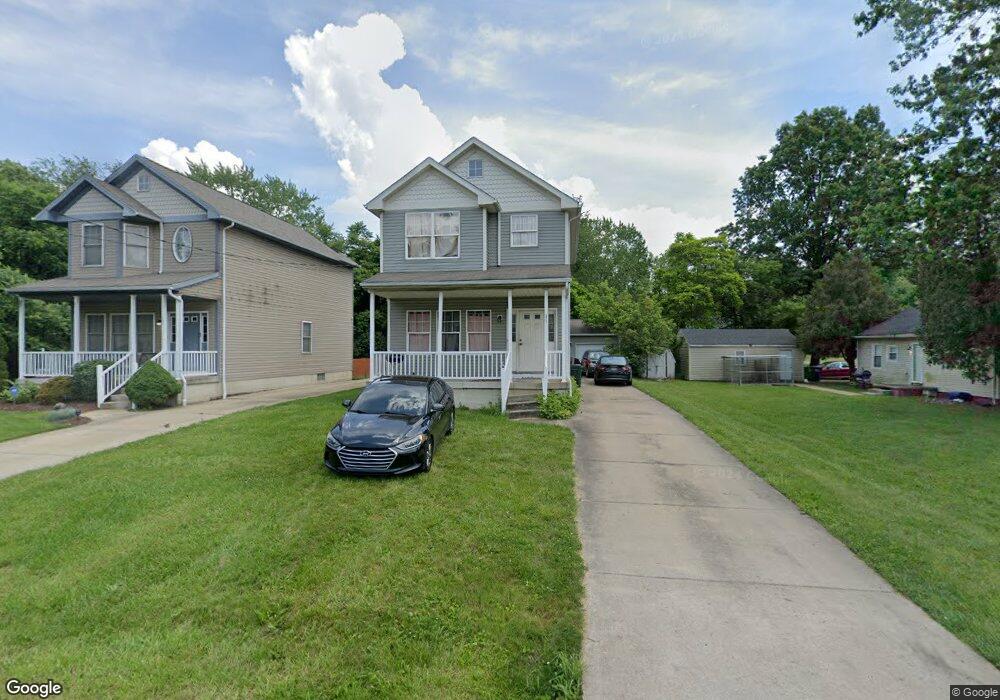
371 College St Barberton, OH 44203
East Barberton NeighborhoodEstimated Value: $161,000 - $221,000
3
Beds
2
Baths
1,465
Sq Ft
$131/Sq Ft
Est. Value
About This Home
This home is located at 371 College St, Barberton, OH 44203 and is currently estimated at $191,722, approximately $130 per square foot. 371 College St is a home located in Summit County with nearby schools including Barberton Middle School, Barberton High School, and St. Francis de Sales School.
Ownership History
Date
Name
Owned For
Owner Type
Purchase Details
Closed on
Mar 6, 2006
Sold by
Evergreen Homes Llc
Bought by
Graham Pearllisa
Current Estimated Value
Home Financials for this Owner
Home Financials are based on the most recent Mortgage that was taken out on this home.
Original Mortgage
$114,320
Outstanding Balance
$74,369
Interest Rate
8.87%
Mortgage Type
Balloon
Estimated Equity
$117,353
Purchase Details
Closed on
Feb 3, 2005
Sold by
New Ro Holdings Llc
Bought by
Evergreen Homes Llc
Purchase Details
Closed on
Apr 26, 2004
Sold by
Tramble Steven and Tramble Patricia A
Bought by
Knox Christopher M
Create a Home Valuation Report for This Property
The Home Valuation Report is an in-depth analysis detailing your home's value as well as a comparison with similar homes in the area
Home Values in the Area
Average Home Value in this Area
Purchase History
| Date | Buyer | Sale Price | Title Company |
|---|---|---|---|
| Graham Pearllisa | $142,900 | First Security Title Corpora | |
| Evergreen Homes Llc | $16,000 | Land America-Lawyers Title | |
| New Ro Holdings Llc | $12,200 | Land America-Lawyers Title | |
| Knox Christopher M | $20,000 | Land America-Lawyers Title |
Source: Public Records
Mortgage History
| Date | Status | Borrower | Loan Amount |
|---|---|---|---|
| Open | Graham Pearllisa | $114,320 |
Source: Public Records
Tax History Compared to Growth
Tax History
| Year | Tax Paid | Tax Assessment Tax Assessment Total Assessment is a certain percentage of the fair market value that is determined by local assessors to be the total taxable value of land and additions on the property. | Land | Improvement |
|---|---|---|---|---|
| 2025 | $2,148 | $44,136 | $6,094 | $38,042 |
| 2024 | $2,148 | $44,136 | $6,094 | $38,042 |
| 2023 | $2,148 | $42,995 | $6,094 | $36,901 |
| 2022 | $1,757 | $30,482 | $4,232 | $26,250 |
| 2021 | $1,755 | $30,482 | $4,232 | $26,250 |
| 2020 | $1,717 | $30,480 | $4,230 | $26,250 |
| 2019 | $1,911 | $30,730 | $3,810 | $26,920 |
| 2018 | $1,882 | $30,730 | $3,810 | $26,920 |
| 2017 | $1,975 | $30,730 | $3,810 | $26,920 |
| 2016 | $2,037 | $28,060 | $3,810 | $24,250 |
| 2015 | $1,975 | $28,060 | $3,810 | $24,250 |
| 2014 | $1,732 | $28,060 | $3,810 | $24,250 |
| 2013 | $1,704 | $28,630 | $3,810 | $24,820 |
Source: Public Records
Map
Nearby Homes
- 43 S Van Buren Ave
- 25 S Van Buren Ave
- 311 Holly Place
- 251 Slate Ridge Dr
- 64 Diamond Ave
- 327 Robinson Ave
- 588 Austin Dr
- 375 Big Bend Cir
- 369 Big Bend Cir
- 6 5th St NE
- 477 Robinson Ave
- 414 E Baird Ave
- 1110 Mansion Dr
- 357 E Paige Ave
- 1742 Turkeyfoot Lake Rd
- 986 S Azalea Blvd
- 673 Wooster Rd W
- 650 E Tuscarawas Ave
- 679 Wooster Rd W
- 349 E Hopocan Ave