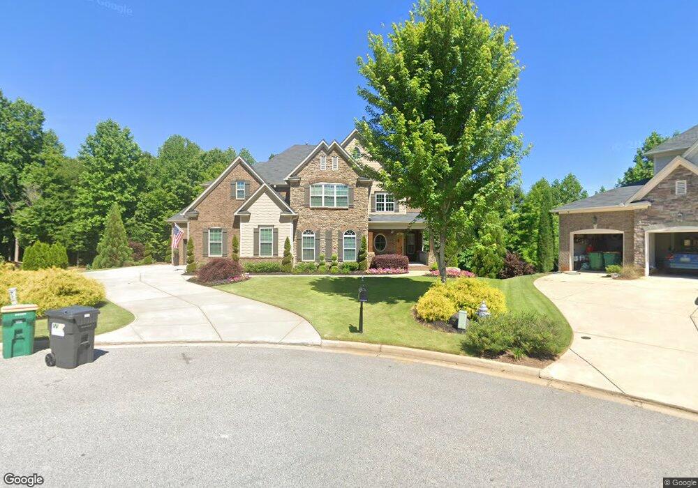
371 Heritage Walk Woodstock, GA 30188
Estimated Value: $809,000
5
Beds
4
Baths
3,588
Sq Ft
$225/Sq Ft
Est. Value
About This Home
This home is located at 371 Heritage Walk, Woodstock, GA 30188 and is currently estimated at $809,000, approximately $225 per square foot. 371 Heritage Walk is a home located in Cherokee County with nearby schools including Woodstock Elementary School, Woodstock Middle School, and Woodstock High School.
Ownership History
Date
Name
Owned For
Owner Type
Purchase Details
Closed on
Sep 18, 2020
Sold by
Peel Natasha M
Bought by
Ellis Joseph J and Ellis Autumn P
Current Estimated Value
Home Financials for this Owner
Home Financials are based on the most recent Mortgage that was taken out on this home.
Original Mortgage
$510,000
Outstanding Balance
$451,752
Interest Rate
2.8%
Mortgage Type
VA
Estimated Equity
$357,248
Purchase Details
Closed on
May 27, 2016
Sold by
Sharp Residential Llc
Bought by
Peel Natasha M
Purchase Details
Closed on
May 26, 2016
Sold by
Peel Natasha M
Bought by
Peel Natasha M and Peel Charlie M
Create a Home Valuation Report for This Property
The Home Valuation Report is an in-depth analysis detailing your home's value as well as a comparison with similar homes in the area
Home Values in the Area
Average Home Value in this Area
Purchase History
| Date | Buyer | Sale Price | Title Company |
|---|---|---|---|
| Ellis Joseph J | $510,000 | -- | |
| Peel Natasha M | $501,575 | -- | |
| Peel Natasha M | $501,575 | -- |
Source: Public Records
Mortgage History
| Date | Status | Borrower | Loan Amount |
|---|---|---|---|
| Open | Ellis Joseph J | $510,000 |
Source: Public Records
Tax History Compared to Growth
Tax History
| Year | Tax Paid | Tax Assessment Tax Assessment Total Assessment is a certain percentage of the fair market value that is determined by local assessors to be the total taxable value of land and additions on the property. | Land | Improvement |
|---|---|---|---|---|
| 2024 | $9,243 | $355,680 | $62,800 | $292,880 |
| 2023 | $8,921 | $343,280 | $60,000 | $283,280 |
| 2022 | $6,635 | $252,440 | $48,000 | $204,440 |
| 2021 | $5,791 | $204,000 | $37,239 | $166,761 |
| 2020 | $5,544 | $197,320 | $37,400 | $159,920 |
| 2019 | $5,505 | $195,960 | $36,000 | $159,960 |
| 2018 | $5,560 | $196,760 | $36,000 | $160,760 |
| 2017 | $0 | $464,400 | $36,000 | $149,760 |
Source: Public Records
Map
Nearby Homes
- 0 Highway 92 Unit 7661901
- 540 Stockwood Dr
- 578 Brashy St
- 704 Morgan Dr
- 591 Brashy St
- 3003 Clayton St
- The Lane A Plan at Grafton Trace
- The Lane C Plan at Grafton Trace
- The Lane B Plan at Grafton Trace
- 4002 Potter Way
- 1000 Fendley St
- 467 Chandler Ln
- 963 S On Main Dr
- 967 S On Main Dr
- 162 Brighton Blvd
- 9244 Main St Unit 102
- 1104 Thomas St
- 583 S Club Dr
- 200 Dawson Dr
- 301 Heritage Walk
- 280 Heritage Walk Unit 262
- 280 Heritage Walk
- 251 Heritage Walk Unit 110
- 251 Heritage Walk
- 9860 Highway 92
- 127 Indian Valley Dr
- 9914 Highway 92
- 9820 Highway 92
- 9820 Highway 92 Unit 150
- 9820 Highway 92 Unit 120
- 9910 Highway 92
- 9910 Highway 92 Unit SUITE 230
- 9910 Highway 92 Unit 200
- 9910 Highway 92 Unit 220
- 125 Indian Valley Dr
- 9910 Georgia 92 Unit 200
- 240 Stockwood Dr
- 248 Stockwood Dr
- 232 Stockwood Dr