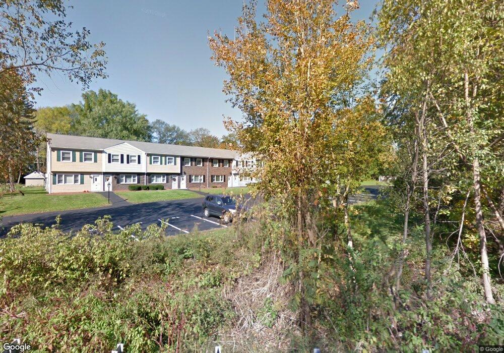
371 Lancaster St Unit 11 West Boylston, MA 01583
Estimated Value: $272,000 - $311,000
2
Beds
2
Baths
1,116
Sq Ft
$259/Sq Ft
Est. Value
About This Home
This home is located at 371 Lancaster St Unit 11, West Boylston, MA 01583 and is currently estimated at $289,422, approximately $259 per square foot. 371 Lancaster St Unit 11 is a home located in Worcester County with nearby schools including Major Edwards Elementary School and West Boylston Junior/Senior High School.
Ownership History
Date
Name
Owned For
Owner Type
Purchase Details
Closed on
Jun 1, 2018
Sold by
Joseph R Pare Ret and Pare
Bought by
Sansoucy Drew P
Current Estimated Value
Purchase Details
Closed on
Nov 13, 2012
Sold by
Pare Joseph R
Bought by
Joseph R Pare Ret and Pare
Purchase Details
Closed on
Mar 9, 1976
Bought by
Joseph R Pare Ret
Create a Home Valuation Report for This Property
The Home Valuation Report is an in-depth analysis detailing your home's value as well as a comparison with similar homes in the area
Home Values in the Area
Average Home Value in this Area
Purchase History
| Date | Buyer | Sale Price | Title Company |
|---|---|---|---|
| Sansoucy Drew P | -- | -- | |
| Sansoucy Drew P | -- | -- | |
| Joseph R Pare Ret | -- | -- | |
| Joseph R Pare Ret | -- | -- | |
| Joseph R Pare Ret | -- | -- |
Source: Public Records
Mortgage History
| Date | Status | Borrower | Loan Amount |
|---|---|---|---|
| Previous Owner | Joseph R Pare Ret | $112,000 | |
| Previous Owner | Joseph R Pare Ret | $20,000 | |
| Previous Owner | Joseph R Pare Ret | $10,000 |
Source: Public Records
Tax History Compared to Growth
Tax History
| Year | Tax Paid | Tax Assessment Tax Assessment Total Assessment is a certain percentage of the fair market value that is determined by local assessors to be the total taxable value of land and additions on the property. | Land | Improvement |
|---|---|---|---|---|
| 2025 | $32 | $230,400 | $0 | $230,400 |
| 2024 | $3,221 | $217,900 | $0 | $217,900 |
| 2023 | $3,066 | $196,800 | $0 | $196,800 |
| 2022 | $2,983 | $168,700 | $0 | $168,700 |
| 2021 | $2,911 | $157,700 | $0 | $157,700 |
| 2020 | $2,436 | $131,100 | $0 | $131,100 |
| 2019 | $2,317 | $122,900 | $0 | $122,900 |
| 2018 | $2,132 | $113,900 | $0 | $113,900 |
| 2017 | $2,141 | $113,900 | $0 | $113,900 |
| 2016 | $2,389 | $129,500 | $0 | $129,500 |
| 2015 | $2,375 | $129,500 | $0 | $129,500 |
Source: Public Records
Map
Nearby Homes
- 21 Myrtle Ave
- 136 Sterling St Unit A3
- 2 Lakeview Ave
- 101 Sterling St
- 12 Winthrop St
- 20 Winthrop St
- 0 Boutelle Rd
- 16 N Main St
- 19 Fitch Farm Rd
- 223 Worcester Rd
- 112 N Main St
- 64 Worcester St
- 61 Boutelle Rd
- 26 Townsend Dr
- 1 Harmony Ln Unit 4
- 2 Harmony Ln Unit 1
- 113 Newton St
- 6 Belmont Dr
- 20 Woodside Dr
- 53 Beach Point Rd
- 371 Lancaster St Unit 12
- 371 Lancaster St Unit 10
- 371 Lancaster St Unit 9
- 371 Lancaster St Unit 8
- 371 Lancaster St Unit 7
- 371 Lancaster St Unit 6
- 371 Lancaster St Unit 5
- 371 Lancaster St Unit 4
- 371 Lancaster St Unit 3
- 371 Lancaster St Unit 2
- 371 Lancaster St Unit 1
- 371 Lancaster St Unit 371
- 30 Campground Rd
- 357 Lancaster St
- 385 Lancaster St
- 393 Lancaster St
- 17 Campground Rd
- 11 Campground Rd
- 40 Campground Rd
- 37 Campground Rd