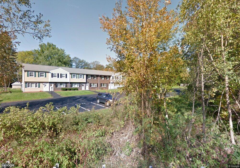
371 Lancaster St Unit 3 West Boylston, MA 01583
Estimated Value: $293,000 - $315,000
2
Beds
2
Baths
1,134
Sq Ft
$265/Sq Ft
Est. Value
About This Home
This home is located at 371 Lancaster St Unit 3, West Boylston, MA 01583 and is currently estimated at $300,766, approximately $265 per square foot. 371 Lancaster St Unit 3 is a home located in Worcester County with nearby schools including Major Edwards Elementary School and West Boylston Junior/Senior High School.
Ownership History
Date
Name
Owned For
Owner Type
Purchase Details
Closed on
Jan 6, 2006
Sold by
Laws Kimberly D
Bought by
Willson Jennifer E
Current Estimated Value
Home Financials for this Owner
Home Financials are based on the most recent Mortgage that was taken out on this home.
Original Mortgage
$140,000
Outstanding Balance
$78,737
Interest Rate
6.28%
Mortgage Type
Purchase Money Mortgage
Estimated Equity
$222,029
Purchase Details
Closed on
Jul 23, 2004
Sold by
Derby Thomas F
Bought by
Laws Kimberly D
Home Financials for this Owner
Home Financials are based on the most recent Mortgage that was taken out on this home.
Original Mortgage
$165,300
Interest Rate
6.28%
Mortgage Type
Purchase Money Mortgage
Create a Home Valuation Report for This Property
The Home Valuation Report is an in-depth analysis detailing your home's value as well as a comparison with similar homes in the area
Home Values in the Area
Average Home Value in this Area
Purchase History
| Date | Buyer | Sale Price | Title Company |
|---|---|---|---|
| Willson Jennifer E | $183,000 | -- | |
| Laws Kimberly D | $174,000 | -- |
Source: Public Records
Mortgage History
| Date | Status | Borrower | Loan Amount |
|---|---|---|---|
| Open | Willson Jennifer E | $140,000 | |
| Previous Owner | Laws Kimberly D | $165,300 |
Source: Public Records
Tax History Compared to Growth
Tax History
| Year | Tax Paid | Tax Assessment Tax Assessment Total Assessment is a certain percentage of the fair market value that is determined by local assessors to be the total taxable value of land and additions on the property. | Land | Improvement |
|---|---|---|---|---|
| 2025 | $35 | $254,500 | $0 | $254,500 |
| 2024 | $3,603 | $243,800 | $0 | $243,800 |
| 2023 | $3,381 | $217,000 | $0 | $217,000 |
| 2022 | $3,046 | $172,300 | $0 | $172,300 |
| 2021 | $2,974 | $161,100 | $0 | $161,100 |
| 2020 | $2,488 | $133,900 | $0 | $133,900 |
| 2019 | $2,366 | $125,500 | $0 | $125,500 |
| 2018 | $2,177 | $116,300 | $0 | $116,300 |
| 2017 | $2,186 | $116,300 | $0 | $116,300 |
| 2016 | $2,439 | $132,200 | $0 | $132,200 |
| 2015 | $2,425 | $132,200 | $0 | $132,200 |
Source: Public Records
Map
Nearby Homes
- 18 Laurel Ave
- 15 Myrtle Ave
- 23 Western Ave
- 136 Sterling St Unit A3
- 43 Chace Hill Rd
- 2 Lakeview Ave
- 20 Winthrop St
- 15 N Cove Rd
- 0 Boutelle Rd
- 31 Cross St
- 16 N Main St
- 19 Fitch Farm Rd
- 223 Worcester Rd
- 127 N Main St
- 61 Boutelle Rd
- 1 Harmony Ln Unit 4
- 2 Harmony Ln Unit 1
- 4 Jewett Rd Unit B
- 4 Jewett Rd Unit A
- 54 Maple St
- 371 Lancaster St Unit 12
- 371 Lancaster St Unit 11
- 371 Lancaster St Unit 10
- 371 Lancaster St Unit 9
- 371 Lancaster St Unit 8
- 371 Lancaster St Unit 7
- 371 Lancaster St Unit 6
- 371 Lancaster St Unit 5
- 371 Lancaster St Unit 4
- 371 Lancaster St Unit 2
- 371 Lancaster St Unit 1
- 371 Lancaster St Unit 371
- 30 Campground Rd
- 357 Lancaster St
- 385 Lancaster St
- 393 Lancaster St
- 17 Campground Rd
- 11 Campground Rd
- 40 Campground Rd
- 37 Campground Rd