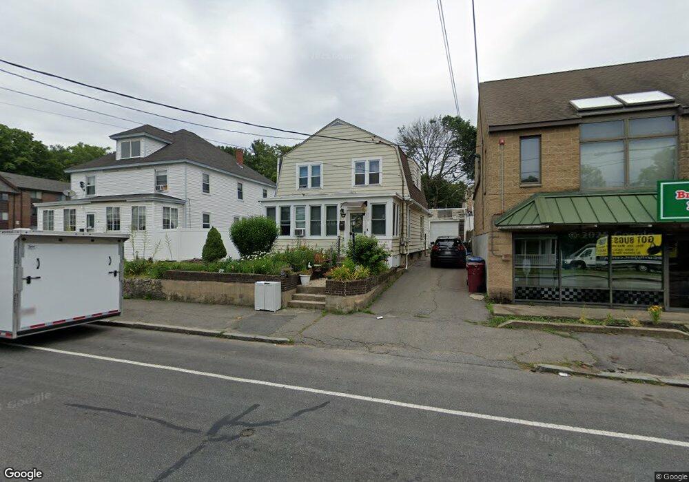
371 Mammoth Rd Lowell, MA 01854
Pawtucketville NeighborhoodEstimated Value: $391,000 - $474,000
3
Beds
1
Bath
1,433
Sq Ft
$311/Sq Ft
Est. Value
About This Home
This home is located at 371 Mammoth Rd, Lowell, MA 01854 and is currently estimated at $445,337, approximately $310 per square foot. 371 Mammoth Rd is a home located in Middlesex County with nearby schools including Joseph McAvinnue Elementary School, Charlotte M. Murkland Elementary School, and Charles W. Morey Elementary School.
Ownership History
Date
Name
Owned For
Owner Type
Purchase Details
Closed on
Nov 1, 1994
Sold by
Narus William and Narus Deborah
Bought by
Mcgee Thomas and Mcgee Doris
Current Estimated Value
Home Financials for this Owner
Home Financials are based on the most recent Mortgage that was taken out on this home.
Original Mortgage
$52,000
Interest Rate
8.65%
Mortgage Type
Purchase Money Mortgage
Purchase Details
Closed on
Feb 9, 1987
Sold by
Proulx Morman
Bought by
Narus William
Home Financials for this Owner
Home Financials are based on the most recent Mortgage that was taken out on this home.
Original Mortgage
$98,500
Interest Rate
9.23%
Mortgage Type
Purchase Money Mortgage
Create a Home Valuation Report for This Property
The Home Valuation Report is an in-depth analysis detailing your home's value as well as a comparison with similar homes in the area
Home Values in the Area
Average Home Value in this Area
Purchase History
| Date | Buyer | Sale Price | Title Company |
|---|---|---|---|
| Mcgee Thomas | $65,000 | -- | |
| Mcgee Thomas | $65,000 | -- | |
| Narus William | $109,500 | -- |
Source: Public Records
Mortgage History
| Date | Status | Borrower | Loan Amount |
|---|---|---|---|
| Closed | Narus William | $52,000 | |
| Previous Owner | Narus William | $98,500 |
Source: Public Records
Tax History
| Year | Tax Paid | Tax Assessment Tax Assessment Total Assessment is a certain percentage of the fair market value that is determined by local assessors to be the total taxable value of land and additions on the property. | Land | Improvement |
|---|---|---|---|---|
| 2025 | $4,271 | $372,000 | $130,600 | $241,400 |
| 2024 | $3,965 | $332,900 | $105,300 | $227,600 |
| 2023 | $3,670 | $295,500 | $86,000 | $209,500 |
| 2022 | $3,354 | $264,300 | $76,200 | $188,100 |
| 2021 | $3,129 | $232,500 | $66,200 | $166,300 |
| 2020 | $3,257 | $243,800 | $85,700 | $158,100 |
| 2019 | $2,947 | $209,900 | $75,200 | $134,700 |
| 2018 | $2,865 | $199,100 | $71,700 | $127,400 |
| 2017 | $2,771 | $185,700 | $65,100 | $120,600 |
| 2016 | $2,632 | $173,600 | $63,400 | $110,200 |
| 2015 | $2,520 | $162,800 | $60,700 | $102,100 |
| 2013 | $2,369 | $157,800 | $67,000 | $90,800 |
Source: Public Records
Map
Nearby Homes
- 2300 Skyline Dr Unit 3
- 1400 Skyline Dr Unit 6
- 105 Columbia Rd
- 67 Glennon Ave
- 30 4th Ave
- 89 Mammoth Rd
- 104 Woodward Ave
- 38 Starbird St
- 101 Donohue Rd Unit 19
- 187 Varnum Ave
- 94 Hampson St
- 28 Sarah Ave
- 39 Phoebe Ave
- 248 Acropolis Rd
- 15 Barbara St
- 15 Louis Farm Rd Unit 15
- 49 Sparks St
- 79 School St Unit 4
- 113 School St Unit 12
- 57 Wannalancit St Unit 6
- 373 Mammoth Rd
- 92 Lamb St
- 96 Lamb St
- 96 & 98 Lamb St
- 374 Mammoth Rd
- 359 Mammoth Rd
- 359 Mammoth Rd
- 359 Mammoth Rd Unit 2
- 24 E Meadow Rd
- 15 Wellworth St
- 15 Wellworth St Unit A
- 17 E Meadow Rd
- 17 E Meadow Rd Unit Varies
- 403 Mammoth Rd
- 97 Lamb St
- 1 W Meadow Rd
- 28 E Meadow Rd
- 15 E Meadow Rd
- 15 E Meadow Rd Unit 15
- 356A Mammoth Raod
Your Personal Tour Guide
Ask me questions while you tour the home.