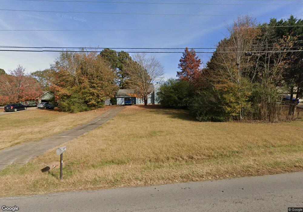
371 Mount Moriah Rd Auburn, GA 30011
Estimated Value: $280,000 - $330,608
3
Beds
2
Baths
1,212
Sq Ft
$245/Sq Ft
Est. Value
About This Home
This home is located at 371 Mount Moriah Rd, Auburn, GA 30011 and is currently estimated at $297,152, approximately $245 per square foot. 371 Mount Moriah Rd is a home located in Barrow County with nearby schools including Auburn Elementary School, Westside Middle School, and Apalachee High School.
Ownership History
Date
Name
Owned For
Owner Type
Purchase Details
Closed on
Jun 10, 2014
Sold by
Treharn Robert E
Bought by
Treharn Tracy Lanore
Current Estimated Value
Purchase Details
Closed on
Apr 28, 1989
Sold by
First Federal Savings Bank Of Georgia
Bought by
Treharn Robert E Iii And
Purchase Details
Closed on
Feb 10, 1989
Sold by
Holder David W and Holder Polly
Bought by
First Federal Savings Bank Of Georgia
Purchase Details
Closed on
May 23, 1986
Sold by
Mulberry & Associates Inc
Bought by
Holder David W and Holder Polly
Purchase Details
Closed on
Jan 24, 1986
Sold by
Mcinnis Hugh A and Martin Jake William
Bought by
Mulberry & Associates Inc
Purchase Details
Closed on
Jun 28, 1985
Sold by
Wood Thoice A and Wood Grace W
Bought by
Mcinnis Hugh A and Martin Jake Willia
Create a Home Valuation Report for This Property
The Home Valuation Report is an in-depth analysis detailing your home's value as well as a comparison with similar homes in the area
Home Values in the Area
Average Home Value in this Area
Purchase History
| Date | Buyer | Sale Price | Title Company |
|---|---|---|---|
| Treharn Tracy Lanore | $90,000 | -- | |
| Treharn Robert E Iii And | $58,000 | -- | |
| First Federal Savings Bank Of Georgia | -- | -- | |
| Holder David W | -- | -- | |
| Mulberry & Associates Inc | -- | -- | |
| Mcinnis Hugh A | -- | -- |
Source: Public Records
Tax History Compared to Growth
Tax History
| Year | Tax Paid | Tax Assessment Tax Assessment Total Assessment is a certain percentage of the fair market value that is determined by local assessors to be the total taxable value of land and additions on the property. | Land | Improvement |
|---|---|---|---|---|
| 2024 | $2,369 | $80,433 | $24,000 | $56,433 |
| 2023 | $1,536 | $80,433 | $24,000 | $56,433 |
| 2022 | $1,640 | $59,076 | $18,000 | $41,076 |
| 2021 | $1,341 | $46,137 | $12,000 | $34,137 |
| 2020 | $1,309 | $44,980 | $12,000 | $32,980 |
| 2019 | $1,290 | $43,824 | $12,000 | $31,824 |
| 2018 | $1,134 | $39,198 | $12,000 | $27,198 |
| 2017 | $188 | $34,088 | $12,000 | $22,088 |
| 2016 | $893 | $32,356 | $12,800 | $19,556 |
| 2015 | $1,065 | $32,898 | $12,800 | $20,098 |
| 2014 | $835 | $26,640 | $6,272 | $20,368 |
| 2013 | -- | $25,760 | $6,272 | $19,488 |
Source: Public Records
Map
Nearby Homes
- 359 Scenic Ln
- 433 Mount Moriah Rd
- 502 Eagles Nest Cir
- 522 Eagles Nest Cir
- 5899 Wheeler Ridge Rd
- 173 Deer Wood Dr
- 494 Courtney Ln Unit 2
- 491 Glen Terrace Rd
- 345 Etheridge Rd
- 1380 Cronic Town Rd
- 1587 Cronic Town Rd Unit 1
- 60 Wood Chuck Ct
- 70 Wood Chuck Ct
- 1923 Westfall Landing
- 280 Etheridge Rd
- 1329 Harmony Grove Church Rd
- 335 Wages Rd
- 1778 Wynfield Ln
- 367 Mount Moriah Rd
- 375 Mount Moriah Rd
- 358 Ridgeview Dr
- 381 Mount Moriah Rd
- 360 Ridgeview Dr
- 361 Mount Moriah Rd
- 356 Ridgeview Dr Unit 3
- 1531 Union Grove Church Rd
- 362 Ridgeview Dr
- 1517 Harmony Grv Ch Rd Unit 1
- 378 Mount Moriah Rd
- 385 Mount Moriah Rd
- 354 Ridgeview Dr Unit 21
- 354 Ridgeview Dr Unit 3
- 364 Ridgeview Dr Unit 3
- 382 Mount Moriah Rd
- 359 Ridgeview Dr
- 389 Mount Moriah Rd
- 386 Mount Moriah Rd
- 350 Ridgeview Dr Unit 3