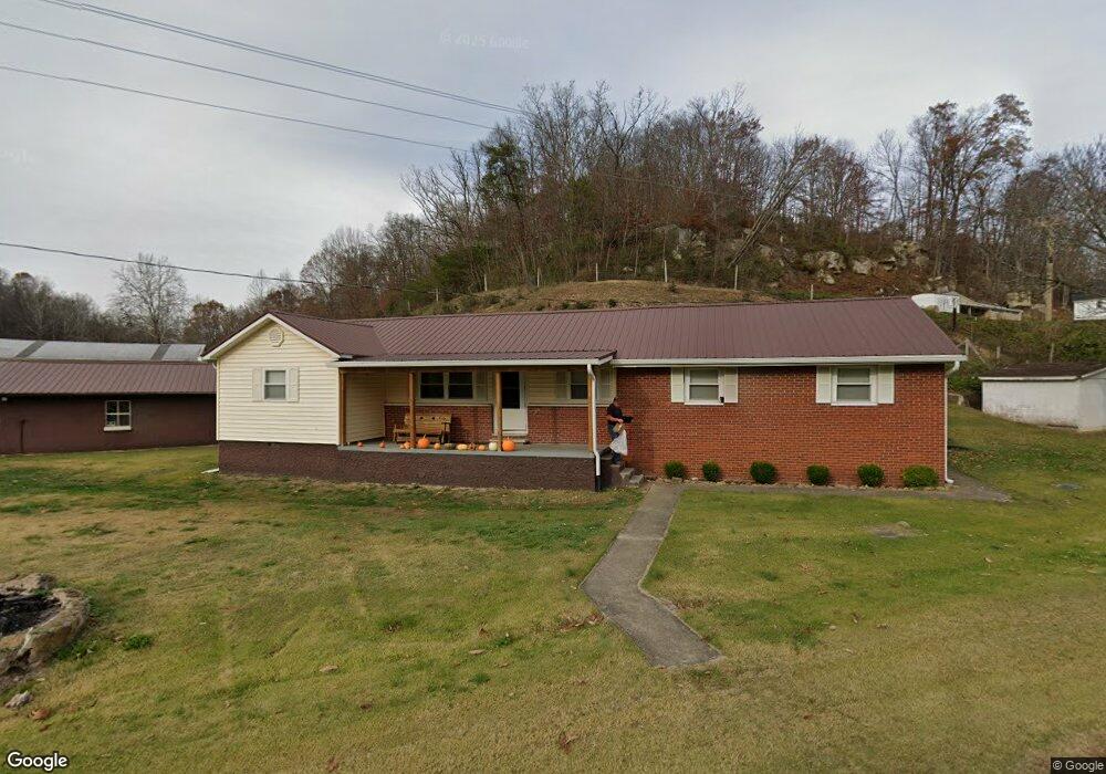
371 State Route 218 Scottown, OH 45678
Estimated Value: $204,000 - $485,623
3
Beds
1
Bath
1,392
Sq Ft
$252/Sq Ft
Est. Value
About This Home
This home is located at 371 State Route 218, Scottown, OH 45678 and is currently estimated at $350,406, approximately $251 per square foot. 371 State Route 218 is a home located in Lawrence County with nearby schools including Fairland East Elementary School, Fairland West Elementary School, and Fairland Middle School.
Ownership History
Date
Name
Owned For
Owner Type
Purchase Details
Closed on
Jun 19, 2013
Sold by
Shoemaker Neal and Shoemaker Debbie
Bought by
Fulks Chad
Current Estimated Value
Home Financials for this Owner
Home Financials are based on the most recent Mortgage that was taken out on this home.
Original Mortgage
$147,283
Outstanding Balance
$105,121
Interest Rate
3.87%
Mortgage Type
FHA
Estimated Equity
$245,285
Purchase Details
Closed on
Oct 21, 2003
Sold by
Shoemaker Neal and Shoemaker Debbi
Bought by
Shoemaker Neal and Shoemaker Debbi
Create a Home Valuation Report for This Property
The Home Valuation Report is an in-depth analysis detailing your home's value as well as a comparison with similar homes in the area
Purchase History
| Date | Buyer | Sale Price | Title Company |
|---|---|---|---|
| Fulks Chad | $213,333 | Title First Agency Inc | |
| Shoemaker Neal | -- | -- |
Source: Public Records
Mortgage History
| Date | Status | Borrower | Loan Amount |
|---|---|---|---|
| Open | Fulks Chad | $147,283 |
Source: Public Records
Tax History
| Year | Tax Paid | Tax Assessment Tax Assessment Total Assessment is a certain percentage of the fair market value that is determined by local assessors to be the total taxable value of land and additions on the property. | Land | Improvement |
|---|---|---|---|---|
| 2025 | $928 | $39,526 | $8,925 | $30,601 |
| 2024 | -- | $33,870 | $7,260 | $26,610 |
| 2023 | $928 | $33,870 | $7,260 | $26,610 |
| 2022 | $926 | $33,870 | $7,260 | $26,610 |
| 2021 | $833 | $30,430 | $5,840 | $24,590 |
| 2020 | $886 | $30,430 | $5,840 | $24,590 |
| 2019 | $885 | $30,430 | $5,840 | $24,590 |
| 2018 | $892 | $30,430 | $5,840 | $24,590 |
| 2017 | $892 | $30,430 | $5,840 | $24,590 |
| 2016 | $826 | $30,430 | $5,840 | $24,590 |
| 2015 | $756 | $27,570 | $5,830 | $21,740 |
| 2014 | $756 | $27,570 | $5,830 | $21,740 |
| 2013 | $520 | $27,570 | $5,830 | $21,740 |
Source: Public Records
Map
Nearby Homes
- 0 County Road 12
- 00 Ohio 217
- 751 County Road 9
- 172 Private Drive 123
- 115 Private Drive 123
- 103 Township Road 1311
- 2202 County Road 66
- 0 Ohio River Rd
- 1080 Tinker Ln
- 146 Williams St
- 1432 County Road 42
- 1024 Amanda St
- 3424 County Road 12
- 168 Township Road 122 W
- 120 County Road 408
- 190 Township Rd
- 477 Township Road 88
- 4754 County Road 36
- 206 Private Drive 5017 Unit State Route 775
- 2789 Left Fork 9 Mile Rd
- 14025 State Route 217
- 14224 State Route 217
- 854 State Route 218
- 13563 Ohio 217 Unit 13535 ST RT 217
- 13563 State Route 217
- 13535 Ohio 217 Unit 13563 ST RT 217
- 13535 State Route 217
- 13535 State Route 217
- 13492 State Route 217
- 532 Township Road 235
- 14614 State Route 217
- 13212 State Route 217
- 14735 State Route 217
- 235 Township Road 235
- 13139 State Route 217
- 79 Private Road 1531 Unit 218
- 153 Township Road 235
- 14874 St Rt 217
- 14874 State Route 217
- 13039 State Route 217
Your Personal Tour Guide
Ask me questions while you tour the home.