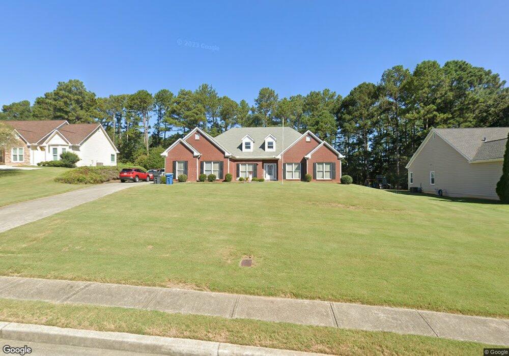
3710 Burnt Hickory Dr Unit 2 Dacula, GA 30019
Estimated Value: $384,000 - $424,000
4
Beds
3
Baths
2,156
Sq Ft
$188/Sq Ft
Est. Value
About This Home
This home is located at 3710 Burnt Hickory Dr Unit 2, Dacula, GA 30019 and is currently estimated at $406,281, approximately $188 per square foot. 3710 Burnt Hickory Dr Unit 2 is a home located in Gwinnett County with nearby schools including Dacula Elementary School, Dacula Middle School, and Dacula High School.
Ownership History
Date
Name
Owned For
Owner Type
Purchase Details
Closed on
Sep 2, 1999
Sold by
K A S Construction Inc
Bought by
Town Robert B and Town Sandra J
Current Estimated Value
Home Financials for this Owner
Home Financials are based on the most recent Mortgage that was taken out on this home.
Original Mortgage
$100,000
Interest Rate
7.16%
Mortgage Type
New Conventional
Create a Home Valuation Report for This Property
The Home Valuation Report is an in-depth analysis detailing your home's value as well as a comparison with similar homes in the area
Home Values in the Area
Average Home Value in this Area
Purchase History
| Date | Buyer | Sale Price | Title Company |
|---|---|---|---|
| Town Robert B | $176,700 | -- |
Source: Public Records
Mortgage History
| Date | Status | Borrower | Loan Amount |
|---|---|---|---|
| Closed | Town Robert B | $100,000 |
Source: Public Records
Tax History Compared to Growth
Tax History
| Year | Tax Paid | Tax Assessment Tax Assessment Total Assessment is a certain percentage of the fair market value that is determined by local assessors to be the total taxable value of land and additions on the property. | Land | Improvement |
|---|---|---|---|---|
| 2025 | $1,190 | $155,920 | $30,000 | $125,920 |
| 2024 | $1,189 | $137,120 | $32,000 | $105,120 |
| 2023 | $1,189 | $137,120 | $32,000 | $105,120 |
| 2022 | $1,140 | $119,400 | $28,000 | $91,400 |
| 2021 | $1,125 | $95,360 | $23,200 | $72,160 |
| 2020 | $1,123 | $90,080 | $23,200 | $66,880 |
| 2019 | $1,043 | $83,600 | $18,800 | $64,800 |
| 2018 | $1,025 | $83,600 | $18,800 | $64,800 |
| 2016 | $1,061 | $62,280 | $16,000 | $46,280 |
| 2015 | $1,078 | $62,280 | $16,000 | $46,280 |
| 2014 | -- | $59,200 | $14,000 | $45,200 |
Source: Public Records
Map
Nearby Homes
- 689 Rodeo Dr
- 405 Rodeo Dr
- 395 Rodeo Dr
- 596 Rodeo Dr
- 58 Longhorn Way
- 306 Rodeo Dr
- 108 Longhorn Way
- 325 Rodeo Dr
- 315 Rodeo Dr
- 636 Rodeo Dr
- 811 Rock Elm Dr
- 947 Tama Hill Ct
- Chestnut Plan at Kentmere - Single Family Homes
- Coleford Plan at Kentmere - Single Family Homes
- Pembrooke Plan at Kentmere - Single Family Homes
- Hawthorn-II Plan at Kentmere - Single Family Homes
- Jackson Plan at Kentmere - Single Family Homes
- Holly Plan at Kentmere - Single Family Homes
- 3449 Mulberry Cove Way
- 44 Avian Way
- 3700 Burnt Hickory Dr
- 3720 Burnt Hickory Dr
- 3725 Burnt Hickory Dr
- 825 Burnt Hickory Way Unit 1
- 3730 Burnt Hickory Dr
- 3705 Burnt Hickory Dr
- 3695 Burnt Hickory Dr
- 139 Auburn Rd Unit 106
- 139 Auburn Rd
- 820 Burnt Hickory Way Unit 1
- 3685 Burnt Hickory Dr
- 153 Auburn Rd Unit 7
- 153 Auburn Rd Unit 370
- 153 Auburn Rd
- 3675 Burnt Hickory Dr Unit 1
- 103 Auburn Rd
- 177 Auburn Rd Unit 1
- 177 Auburn Rd
- 175 Auburn Rd
- 0 Burnt Hickory Dr Unit 3192115