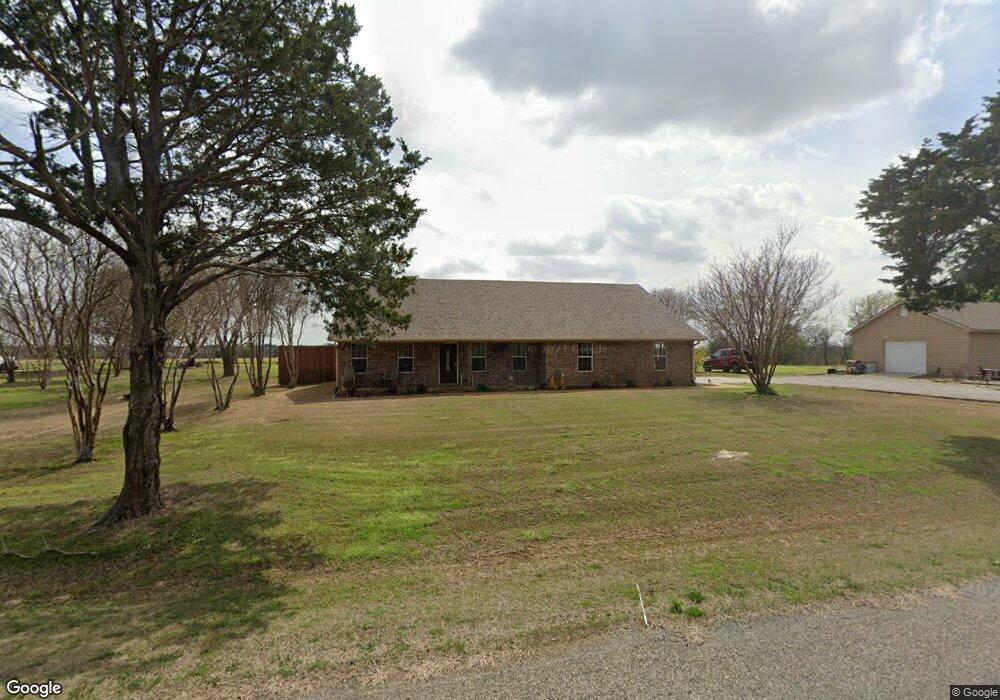
3710 Cemetery Rd Pottsboro, TX 75076
Estimated Value: $436,000 - $460,139
--
Bed
--
Bath
1,663
Sq Ft
$269/Sq Ft
Est. Value
About This Home
This home is located at 3710 Cemetery Rd, Pottsboro, TX 75076 and is currently estimated at $448,070, approximately $269 per square foot. 3710 Cemetery Rd is a home with nearby schools including Pottsboro Elementary School, Pottsboro Middle School, and Pottsboro High School.
Ownership History
Date
Name
Owned For
Owner Type
Purchase Details
Closed on
Jan 12, 2011
Sold by
Shields Christopher and Shields Shelli
Bought by
Brown Jimmy D and Brown Anna M
Current Estimated Value
Home Financials for this Owner
Home Financials are based on the most recent Mortgage that was taken out on this home.
Original Mortgage
$25,200
Outstanding Balance
$16,899
Interest Rate
4.44%
Mortgage Type
Purchase Money Mortgage
Estimated Equity
$431,171
Purchase Details
Closed on
Mar 23, 2010
Sold by
Janson Ronald L and Janson Sharon M
Bought by
Shields Christopher and Shields Shelli
Home Financials for this Owner
Home Financials are based on the most recent Mortgage that was taken out on this home.
Original Mortgage
$17,600
Interest Rate
4.93%
Mortgage Type
Purchase Money Mortgage
Purchase Details
Closed on
Oct 31, 2007
Sold by
Napier Jenny Pearl and Andrews Micaela C
Bought by
Janson Ronald L and Janson Sharon M
Create a Home Valuation Report for This Property
The Home Valuation Report is an in-depth analysis detailing your home's value as well as a comparison with similar homes in the area
Home Values in the Area
Average Home Value in this Area
Purchase History
| Date | Buyer | Sale Price | Title Company |
|---|---|---|---|
| Brown Jimmy D | -- | Grayson County Title | |
| Shields Christopher | -- | Grayson County Title | |
| Janson Ronald L | -- | Chapin Title Co Inc |
Source: Public Records
Mortgage History
| Date | Status | Borrower | Loan Amount |
|---|---|---|---|
| Open | Brown Jimmy D | $25,200 | |
| Previous Owner | Shields Christopher | $17,600 |
Source: Public Records
Tax History Compared to Growth
Tax History
| Year | Tax Paid | Tax Assessment Tax Assessment Total Assessment is a certain percentage of the fair market value that is determined by local assessors to be the total taxable value of land and additions on the property. | Land | Improvement |
|---|---|---|---|---|
| 2025 | $1,934 | $393,454 | -- | -- |
| 2024 | $4,956 | $357,685 | $0 | $0 |
| 2023 | $1,939 | $325,168 | $0 | $0 |
| 2022 | $4,653 | $295,607 | $0 | $0 |
| 2021 | $4,370 | $280,908 | $48,710 | $232,198 |
| 2020 | $4,124 | $244,304 | $32,000 | $212,304 |
| 2019 | $4,077 | $230,459 | $32,000 | $198,459 |
| 2018 | $3,971 | $223,134 | $32,000 | $191,134 |
| 2017 | $3,657 | $228,822 | $32,000 | $196,822 |
| 2016 | $3,202 | $178,909 | $26,500 | $152,409 |
| 2015 | $2,315 | $149,150 | $26,500 | $122,650 |
| 2014 | $598 | $32,110 | $31,500 | $610 |
Source: Public Records
Map
Nearby Homes
- 1050 Cooks Corner Rd
- 283 Cooks Corner Rd
- Lot 48 Spout Springs Rd
- 0000 Reeves Rd
- TBD Hagerman Rd
- Lot 16 White Tail Way
- Lot 76 Buck Trail Way
- Lot 55 Doe Crossing
- 344 Castle Dr
- 34 Cambridge Dr
- 229 Clountz Ln
- Lot 4 Locust Rd
- 9+ AC Locust Rd
- Lot 2 Locust Rd
- 288 Locust Rd
- Lot 3 Locust Rd
- Lot 1 Locust Rd
- 900 Locust Rd
- 81 Windsor Dr
- 207 Wales Dr
- 3648 Cemetery Rd
- 3770 Cemetery Rd
- TBD Cemetery Anchor Ranch Rd
- 3805 Cemetery Rd
- 2222 Keefer Rd
- 2264 Keefer Rd
- 2186 Keefer Rd
- 2116 Keefer Rd
- 2220 Keefer Rd
- 3909 Cemetery Rd
- 2068 Keefer Rd
- 2040 Keefer Rd
- 2047 Keefer Rd
- 3971 Cemetery Rd
- 27 Sam Roy Ln
- 3286 Cemetery Rd
- 4118 Cemetery Rd
- 87 Sam Roy Ln
- 191 Circle s Dr
- 1995 Keefer Rd