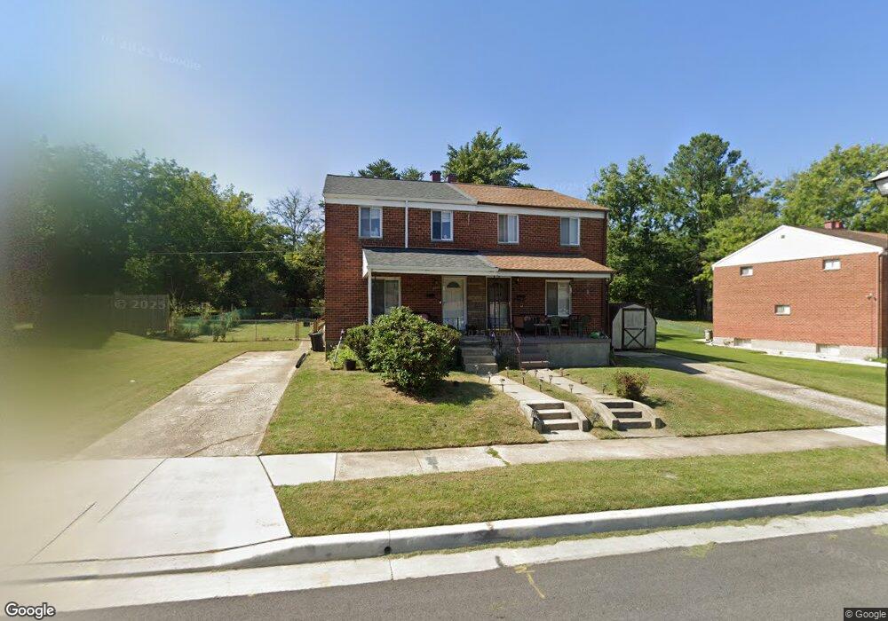
3710 Trent Rd Randallstown, MD 21133
Estimated Value: $252,000 - $289,000
--
Bed
3
Baths
1,152
Sq Ft
$235/Sq Ft
Est. Value
About This Home
This home is located at 3710 Trent Rd, Randallstown, MD 21133 and is currently estimated at $270,165, approximately $234 per square foot. 3710 Trent Rd is a home located in Baltimore County with nearby schools including Randallstown Elementary School, Deer Park Middle Magnet School, and Randallstown High School.
Ownership History
Date
Name
Owned For
Owner Type
Purchase Details
Closed on
Jan 31, 2008
Sold by
Gold Leonard E
Bought by
Jerow Mary
Current Estimated Value
Home Financials for this Owner
Home Financials are based on the most recent Mortgage that was taken out on this home.
Original Mortgage
$170,000
Outstanding Balance
$107,903
Interest Rate
6.18%
Mortgage Type
Purchase Money Mortgage
Estimated Equity
$162,263
Purchase Details
Closed on
Jan 17, 2008
Sold by
Gold Leonard E
Bought by
Jerow Mary
Home Financials for this Owner
Home Financials are based on the most recent Mortgage that was taken out on this home.
Original Mortgage
$170,000
Outstanding Balance
$107,903
Interest Rate
6.18%
Mortgage Type
Purchase Money Mortgage
Estimated Equity
$162,263
Purchase Details
Closed on
May 10, 2001
Sold by
Gold Leonard E
Bought by
Gold Leonard E
Create a Home Valuation Report for This Property
The Home Valuation Report is an in-depth analysis detailing your home's value as well as a comparison with similar homes in the area
Home Values in the Area
Average Home Value in this Area
Purchase History
| Date | Buyer | Sale Price | Title Company |
|---|---|---|---|
| Jerow Mary | $170,000 | -- | |
| Jerow Mary | $170,000 | -- | |
| Gold Leonard E | -- | -- |
Source: Public Records
Mortgage History
| Date | Status | Borrower | Loan Amount |
|---|---|---|---|
| Open | Jerow Mary | $170,000 | |
| Closed | Jerow Mary | $170,000 |
Source: Public Records
Tax History Compared to Growth
Tax History
| Year | Tax Paid | Tax Assessment Tax Assessment Total Assessment is a certain percentage of the fair market value that is determined by local assessors to be the total taxable value of land and additions on the property. | Land | Improvement |
|---|---|---|---|---|
| 2025 | $2,542 | $196,100 | -- | -- |
| 2024 | $2,542 | $167,800 | $40,000 | $127,800 |
| 2023 | $1,260 | $163,967 | $0 | $0 |
| 2022 | $2,441 | $160,133 | $0 | $0 |
| 2021 | $2,336 | $156,300 | $40,000 | $116,300 |
| 2020 | $2,336 | $152,900 | $0 | $0 |
| 2019 | $2,229 | $149,500 | $0 | $0 |
| 2018 | $2,177 | $146,100 | $37,400 | $108,700 |
| 2017 | $2,168 | $139,100 | $0 | $0 |
| 2016 | $2,143 | $132,100 | $0 | $0 |
| 2015 | $2,143 | $125,100 | $0 | $0 |
| 2014 | $2,143 | $125,100 | $0 | $0 |
Source: Public Records
Map
Nearby Homes
- 9406 Painted Tree Dr
- 9202 Samoset Rd
- 9208A Liberty Rd
- 9210 Liberty Rd
- 3816 Cassandra Rd
- 9401 Summer Squal Dr
- 3805 Terka Cir
- 9112 Meadow Heights Rd
- 3854 Terka Cir
- 9302 Silver Charm Dr
- 9044 Allenswood Rd
- 9012 Allenswood Rd
- 3705 Allenswood Ct
- 3506 Bayer Ave
- 4108 Brown Bark Cir
- 9519 Branchleigh Rd
- 3418 Carroll Ave
- 3332 Offutt Rd
- 20 Sunrise Ct
- 1205/99 Winands Rd