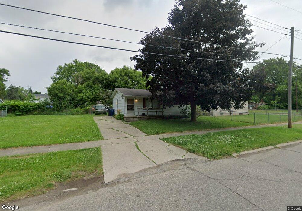
3711 Branch Rd Flint, MI 48506
Potter Longway NeighborhoodEstimated Value: $46,000 - $75,000
2
Beds
1
Bath
930
Sq Ft
$64/Sq Ft
Est. Value
About This Home
This home is located at 3711 Branch Rd, Flint, MI 48506 and is currently estimated at $59,427, approximately $63 per square foot. 3711 Branch Rd is a home located in Genesee County with nearby schools including Potter School, Richfield Public School Academy, and Richfield Early Learning Center.
Ownership History
Date
Name
Owned For
Owner Type
Purchase Details
Closed on
Jun 7, 2017
Sold by
Partridge Ann M and Partridge Glenn
Bought by
Mas Schanrtz Properties And Rentals Llc
Current Estimated Value
Purchase Details
Closed on
Oct 22, 1999
Sold by
First Finance Company
Bought by
Partridge Ann M
Home Financials for this Owner
Home Financials are based on the most recent Mortgage that was taken out on this home.
Original Mortgage
$24,000
Interest Rate
10.62%
Mortgage Type
Purchase Money Mortgage
Purchase Details
Closed on
Jun 4, 1999
Sold by
Vanhouten C Vanhouten D and Vanhouten Dana M
Bought by
Firststar Finance Company and Star Bank Na
Create a Home Valuation Report for This Property
The Home Valuation Report is an in-depth analysis detailing your home's value as well as a comparison with similar homes in the area
Home Values in the Area
Average Home Value in this Area
Purchase History
| Date | Buyer | Sale Price | Title Company |
|---|---|---|---|
| Mas Schanrtz Properties And Rentals Llc | $2,500 | None Available | |
| Partridge Ann M | $31,000 | First American Title Ins Co | |
| Firststar Finance Company | -- | -- |
Source: Public Records
Mortgage History
| Date | Status | Borrower | Loan Amount |
|---|---|---|---|
| Previous Owner | Partridge Ann M | $24,000 |
Source: Public Records
Tax History
| Year | Tax Paid | Tax Assessment Tax Assessment Total Assessment is a certain percentage of the fair market value that is determined by local assessors to be the total taxable value of land and additions on the property. | Land | Improvement |
|---|---|---|---|---|
| 2025 | $798 | $20,200 | $0 | $0 |
| 2024 | $747 | $16,400 | $0 | $0 |
| 2023 | $737 | $12,800 | $0 | $0 |
| 2022 | $0 | $9,800 | $0 | $0 |
| 2021 | $743 | $9,300 | $0 | $0 |
| 2020 | $692 | $9,200 | $0 | $0 |
| 2019 | $682 | $8,300 | $0 | $0 |
| 2018 | $994 | $6,200 | $0 | $0 |
| 2017 | $655 | $0 | $0 | $0 |
| 2016 | $652 | $0 | $0 | $0 |
| 2015 | -- | $0 | $0 | $0 |
| 2014 | -- | $0 | $0 | $0 |
| 2012 | -- | $11,400 | $0 | $0 |
Source: Public Records
Map
Nearby Homes
- 3006 Agree Ave
- 3010 Wyoming Ave
- 3118 Wyoming Ave
- 3210 Wyoming Ave
- 2935 Richfield Rd
- 00 Richfield Rd
- 3018 Dakota Ave
- 2719 Branch Rd
- 3705 Aldon Ln
- 3314 Dakota Ave
- 3413 Dakota Ave
- 2701 Branch Rd
- 3602 Dakota Ave
- 3734 Craig Dr
- 2217 Maryland Ave
- 3294 Huggins Ave
- 2426 Hoff St
- 3149 Whittier Ave
- 3301 N Center Rd
- 1805 Montana Ave
Your Personal Tour Guide
Ask me questions while you tour the home.