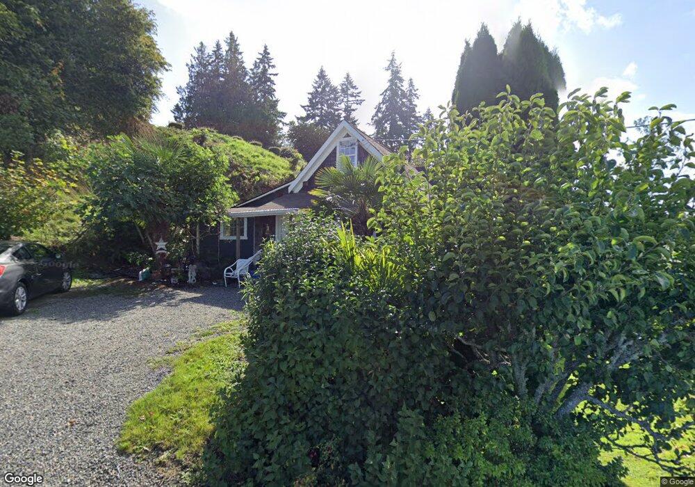
3712 Bancroft Rd E Port Orchard, WA 98366
Estimated Value: $796,000 - $886,530
--
Bed
2
Baths
2,111
Sq Ft
$404/Sq Ft
Est. Value
About This Home
This home is located at 3712 Bancroft Rd E, Port Orchard, WA 98366 and is currently estimated at $853,633, approximately $404 per square foot. 3712 Bancroft Rd E is a home located in Kitsap County with nearby schools including Orchard Heights Elementary School, Marcus Whitman Middle School, and South Kitsap High School.
Ownership History
Date
Name
Owned For
Owner Type
Purchase Details
Closed on
Aug 14, 2000
Sold by
Buresh Melvin D and Buresh Aubryn G
Bought by
Houston James Lee and Houston Maria G A
Current Estimated Value
Home Financials for this Owner
Home Financials are based on the most recent Mortgage that was taken out on this home.
Original Mortgage
$50,000
Outstanding Balance
$18,091
Interest Rate
8.19%
Mortgage Type
Purchase Money Mortgage
Estimated Equity
$835,542
Purchase Details
Closed on
Aug 2, 2000
Sold by
Beach Ervin L and Beach Madonna Jean
Bought by
Buresh Melvin D
Home Financials for this Owner
Home Financials are based on the most recent Mortgage that was taken out on this home.
Original Mortgage
$50,000
Outstanding Balance
$18,091
Interest Rate
8.19%
Mortgage Type
Purchase Money Mortgage
Estimated Equity
$835,542
Create a Home Valuation Report for This Property
The Home Valuation Report is an in-depth analysis detailing your home's value as well as a comparison with similar homes in the area
Home Values in the Area
Average Home Value in this Area
Purchase History
| Date | Buyer | Sale Price | Title Company |
|---|---|---|---|
| Houston James Lee | $85,000 | Transnation Title Insurance | |
| Buresh Melvin D | -- | -- |
Source: Public Records
Mortgage History
| Date | Status | Borrower | Loan Amount |
|---|---|---|---|
| Open | Houston James Lee | $50,000 |
Source: Public Records
Tax History Compared to Growth
Tax History
| Year | Tax Paid | Tax Assessment Tax Assessment Total Assessment is a certain percentage of the fair market value that is determined by local assessors to be the total taxable value of land and additions on the property. | Land | Improvement |
|---|---|---|---|---|
| 2026 | $6,806 | $811,570 | $260,970 | $550,600 |
| 2025 | $6,806 | $777,120 | $260,080 | $517,040 |
| 2024 | $6,600 | $777,120 | $260,080 | $517,040 |
| 2023 | $6,075 | $718,150 | $235,800 | $482,350 |
| 2022 | $6,098 | $604,180 | $215,000 | $389,180 |
| 2021 | $5,738 | $537,930 | $199,400 | $338,530 |
| 2020 | $5,263 | $477,960 | $168,960 | $309,000 |
| 2019 | $3,379 | $331,190 | $98,440 | $232,750 |
| 2018 | $3,603 | $279,220 | $98,440 | $180,780 |
| 2017 | $3,128 | $279,220 | $98,440 | $180,780 |
| 2016 | $3,116 | $255,160 | $98,440 | $156,720 |
| 2015 | $3,027 | $251,360 | $98,440 | $152,920 |
| 2014 | -- | $247,570 | $98,440 | $149,130 |
| 2013 | -- | $244,070 | $107,820 | $136,250 |
Source: Public Records
Map
Nearby Homes
- 1341 Salt Point Place E
- 3140 E Washington St
- 0 E Washington St Unit NWM2337936
- 0 Beach Dr E Unit NWM2448019
- 0 Beach Dr E Unit NWM2139946
- 22 Lots E Washington St
- 1200 Baby Doll Rd E
- 1811 Bay St
- 3817 SE Horstman Rd
- 4798 E Stable Ln
- 4233 SE Horsehead Way
- 123 E 4th St
- 343 Farragut Ave N
- 0 Wendell Ave SE
- 4010 SE Lovell St
- 4305 SE Elijah Ct
- 2949 SE Mile Hill Dr Unit C-2
- 3900 SE Mile Hill Dr
- 3930 SE Mile Hill Dr
- 1663 Harrison Ave SE
- 1847 Beach Dr E
- 3740 Bancroft Rd E
- 1751 Beach Dr E
- 3764 Bancroft Rd E
- 3812 Bancroft Rd E
- 1913 Beach Dr E
- 3767 Bancroft Rd E
- 1723 Beach Dr E
- 1695 Beach Dr E
- 1951 Beach Dr E
- 3794 Bancroft Rd E
- 2717 E Lidstrom Hill Rd
- 2685 E Lidstrom Hill Rd
- 2685 E Lindstrom Hill Rd
- 3804 Bancroft Rd E
- 3779 Bancroft Rd E
- 1647 Beach Dr E
- 1975 Beach Dr E
- 1734 Vista Rama Dr E
- 1762 Vista Rama Dr E