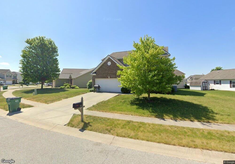
3713 Golden Grain Dr Whitestown, IN 46075
Estimated Value: $348,000 - $374,929
4
Beds
3
Baths
2,951
Sq Ft
$123/Sq Ft
Est. Value
About This Home
This home is located at 3713 Golden Grain Dr, Whitestown, IN 46075 and is currently estimated at $361,732, approximately $122 per square foot. 3713 Golden Grain Dr is a home located in Boone County with nearby schools including Perry Worth Elementary School, Lebanon Middle School, and Lebanon Senior High School.
Ownership History
Date
Name
Owned For
Owner Type
Purchase Details
Closed on
Oct 9, 2009
Sold by
Beazer Homes Indiana Llp
Bought by
Rollins Yoskisha C
Current Estimated Value
Home Financials for this Owner
Home Financials are based on the most recent Mortgage that was taken out on this home.
Original Mortgage
$172,346
Outstanding Balance
$112,197
Interest Rate
5.1%
Mortgage Type
New Conventional
Estimated Equity
$249,535
Create a Home Valuation Report for This Property
The Home Valuation Report is an in-depth analysis detailing your home's value as well as a comparison with similar homes in the area
Home Values in the Area
Average Home Value in this Area
Purchase History
| Date | Buyer | Sale Price | Title Company |
|---|---|---|---|
| Rollins Yoskisha C | -- | -- |
Source: Public Records
Mortgage History
| Date | Status | Borrower | Loan Amount |
|---|---|---|---|
| Open | Rollins Yoskisha C | $172,346 |
Source: Public Records
Tax History Compared to Growth
Tax History
| Year | Tax Paid | Tax Assessment Tax Assessment Total Assessment is a certain percentage of the fair market value that is determined by local assessors to be the total taxable value of land and additions on the property. | Land | Improvement |
|---|---|---|---|---|
| 2025 | $3,891 | $354,700 | $30,800 | $323,900 |
| 2024 | $3,891 | $337,800 | $30,800 | $307,000 |
| 2023 | $4,006 | $341,400 | $30,800 | $310,600 |
| 2022 | $3,765 | $304,000 | $30,800 | $273,200 |
| 2021 | $2,993 | $259,800 | $30,800 | $229,000 |
| 2020 | $2,883 | $248,000 | $30,800 | $217,200 |
| 2019 | $2,692 | $229,400 | $30,800 | $198,600 |
| 2018 | $2,445 | $210,400 | $30,800 | $179,600 |
| 2017 | $2,385 | $202,100 | $30,800 | $171,300 |
| 2016 | $2,353 | $200,700 | $30,800 | $169,900 |
| 2014 | $2,034 | $182,500 | $30,800 | $151,700 |
| 2013 | $1,951 | $174,100 | $30,800 | $143,300 |
Source: Public Records
Map
Nearby Homes
- 3696 White Cliff Way
- 3511 Firethorn Dr
- 6328 Dusty Laurel Dr
- 3822 Limelight Ln
- 3743 Indigo Blue Blvd
- 3391 Roundlake Ln
- 3413 Roundlake Ln
- Hendricks Plan at Haven at Whitestown
- Waveland Plan at Haven at Whitestown
- Dawson Plan at Haven at Whitestown
- Sutcliffe Plan at Haven at Whitestown
- Hampton Plan at Haven at Whitestown
- Addison Plan at Haven at Whitestown
- Buckner Plan at Haven at Whitestown
- Sheffield Plan at Haven at Whitestown
- Payton Plan at Haven at Whitestown
- 3421 Firethorn Dr
- 6831 Orchard Run Cir
- 3830 Indigo Blue Blvd
- 3784 Dusty Sands Rd
- 3762 Tartan Trail
- 3493 Limesprings Ln
- 3717 Golden Grain Dr
- 3766 Tartan Trail
- 3495 Limesprings Ln
- 3714 Golden Grain Dr
- 3716 Golden Grain Dr
- 3718 Golden Grain Dr
- 3712 Golden Grain Dr
- 3768 Tartan Trail
- 3490 Limesprings Ln
- 3763 Tartan Trail
- 3497 Limesprings Ln
- 3761 Tartan Trail
- 3765 Tartan Trail
- 3767 Tartan Trail
- 3492 Limesprings Ln
- 3770 Tartan Trail
- 3720 Golden Grain Dr
- 3494 Limesprings Ln