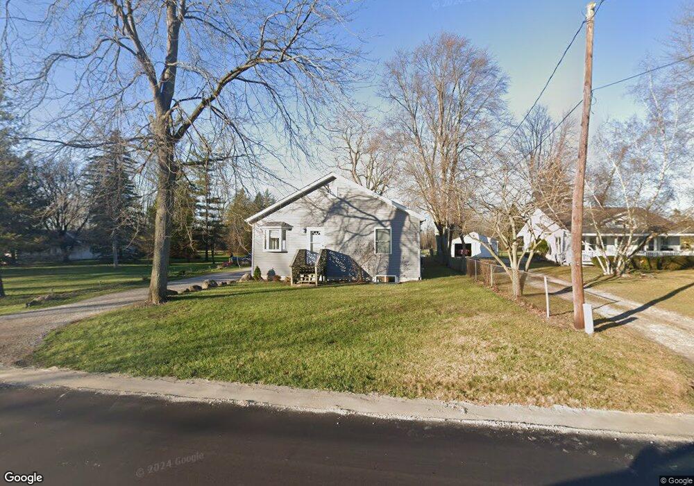
3716 Ravenswood Rd Port Huron, MI 48060
Estimated Value: $269,000 - $336,139
3
Beds
4
Baths
1,783
Sq Ft
$175/Sq Ft
Est. Value
About This Home
This home is located at 3716 Ravenswood Rd, Port Huron, MI 48060 and is currently estimated at $312,785, approximately $175 per square foot. 3716 Ravenswood Rd is a home located in St. Clair County with nearby schools including Kimball Elementary School, Central Middle School, and Port Huron High School.
Ownership History
Date
Name
Owned For
Owner Type
Purchase Details
Closed on
Apr 15, 2021
Sold by
Lapka Michael R
Bought by
Lapka Michael R and Lapka Donna
Current Estimated Value
Home Financials for this Owner
Home Financials are based on the most recent Mortgage that was taken out on this home.
Original Mortgage
$138,000
Interest Rate
3%
Mortgage Type
Stand Alone Refi Refinance Of Original Loan
Create a Home Valuation Report for This Property
The Home Valuation Report is an in-depth analysis detailing your home's value as well as a comparison with similar homes in the area
Home Values in the Area
Average Home Value in this Area
Purchase History
| Date | Buyer | Sale Price | Title Company |
|---|---|---|---|
| Lapka Michael R | -- | Amrock Inc |
Source: Public Records
Mortgage History
| Date | Status | Borrower | Loan Amount |
|---|---|---|---|
| Closed | Lapka Michael R | $138,000 |
Source: Public Records
Tax History Compared to Growth
Tax History
| Year | Tax Paid | Tax Assessment Tax Assessment Total Assessment is a certain percentage of the fair market value that is determined by local assessors to be the total taxable value of land and additions on the property. | Land | Improvement |
|---|---|---|---|---|
| 2025 | $2,498 | $152,400 | $0 | $0 |
| 2024 | $1,186 | $128,300 | $0 | $0 |
| 2023 | $1,095 | $118,900 | $0 | $0 |
| 2022 | $2,123 | $107,200 | $0 | $0 |
| 2021 | $1,960 | $103,200 | $0 | $0 |
| 2020 | $1,960 | $99,100 | $99,100 | $0 |
| 2019 | $2,006 | $70,500 | $0 | $0 |
| 2018 | $1,891 | $70,500 | $0 | $0 |
| 2017 | $1,855 | $69,200 | $0 | $0 |
| 2016 | $899 | $69,200 | $0 | $0 |
| 2015 | -- | $58,400 | $58,400 | $0 |
| 2014 | -- | $51,700 | $51,700 | $0 |
| 2013 | -- | $49,800 | $0 | $0 |
Source: Public Records
Map
Nearby Homes
- 0 39th St Unit 25046693
- 0 39th St Unit 20251028136
- V/L Michigan
- 00 Moak St
- 3333 Ravenswood Rd Unit 4A
- 3333 Ravenswood Rd
- 104 Oldbrook Ln
- 0000 Wisconsin Ave
- 153 Meadow Ln
- 42 Liberty Ave
- 174 Meadow Ln
- 260 Capitol Dr
- 277 Liberty Ave
- 720 Arlington Cir
- 0 Busha Hwy Unit 50194246
- 000 Gratiot Blvd
- 00 Gratiot Blvd
- 3548 Cleveland St
- 69 Gratiot Blvd
- 3369 Dove Rd
- 3706 Ravenswood Rd
- 3754 Ravenswood Rd
- 3717 Ravenswood Rd
- 3703 Ravenswood Rd
- 3731 Ravenswood Rd
- 3768 Ravenswood Rd
- 3666 Ravenswood Rd
- 3666 Ravenswood Rd
- 3672 Ravenswood Rd
- 3681 Ravenswood Rd
- 3741 Ravenswood Rd
- 3755 Ravenswood Rd
- 3644 Ravenswood Rd
- 3665 Ravenswood Rd
- 3796 Ravenswood Rd
- 3771 Ravenswood Rd
- 3636 Ravenswood Rd
- 3693 Ravenswood Rd
- 3797 Ravenswood Rd
- 3814 Ravenswood Rd