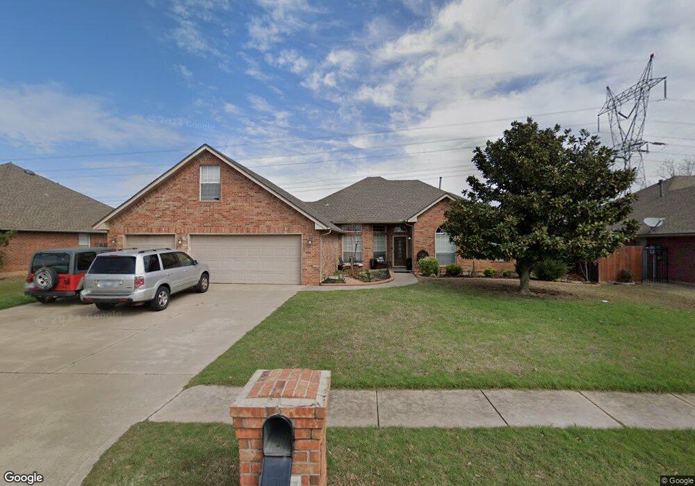
3717 Bridgeport Rd Norman, OK 73072
Northwest Norman NeighborhoodEstimated Value: $312,268 - $348,000
4
Beds
3
Baths
2,157
Sq Ft
$152/Sq Ft
Est. Value
About This Home
This home is located at 3717 Bridgeport Rd, Norman, OK 73072 and is currently estimated at $327,817, approximately $151 per square foot. 3717 Bridgeport Rd is a home located in Cleveland County with nearby schools including Roosevelt Elementary School, Whittier Middle School, and Norman North High School.
Ownership History
Date
Name
Owned For
Owner Type
Purchase Details
Closed on
Apr 20, 2007
Sold by
Clark Dera J
Bought by
Snyder James L and Snyder Lynette A
Current Estimated Value
Home Financials for this Owner
Home Financials are based on the most recent Mortgage that was taken out on this home.
Original Mortgage
$155,000
Outstanding Balance
$20,298
Interest Rate
6.15%
Mortgage Type
New Conventional
Estimated Equity
$307,519
Purchase Details
Closed on
Nov 22, 2005
Sold by
Clark Donna J and Clark Dera J
Bought by
Clark Donna J and Donna J Clark Living Trust
Create a Home Valuation Report for This Property
The Home Valuation Report is an in-depth analysis detailing your home's value as well as a comparison with similar homes in the area
Home Values in the Area
Average Home Value in this Area
Purchase History
| Date | Buyer | Sale Price | Title Company |
|---|---|---|---|
| Snyder James L | $194,000 | None Available | |
| Clark Donna J | -- | None Available | |
| Clark Dera J | -- | None Available |
Source: Public Records
Mortgage History
| Date | Status | Borrower | Loan Amount |
|---|---|---|---|
| Open | Snyder James L | $155,000 |
Source: Public Records
Tax History Compared to Growth
Tax History
| Year | Tax Paid | Tax Assessment Tax Assessment Total Assessment is a certain percentage of the fair market value that is determined by local assessors to be the total taxable value of land and additions on the property. | Land | Improvement |
|---|---|---|---|---|
| 2024 | $3,204 | $26,749 | $4,185 | $22,564 |
| 2023 | $3,059 | $25,475 | $4,123 | $21,352 |
| 2022 | $2,795 | $24,262 | $4,849 | $19,413 |
| 2021 | $2,805 | $23,107 | $4,200 | $18,907 |
| 2020 | $2,745 | $23,107 | $4,200 | $18,907 |
| 2019 | $2,792 | $23,107 | $4,200 | $18,907 |
| 2018 | $2,708 | $23,107 | $4,200 | $18,907 |
| 2017 | $2,737 | $23,107 | $0 | $0 |
| 2016 | $2,782 | $23,107 | $4,200 | $18,907 |
| 2015 | $2,699 | $23,107 | $4,200 | $18,907 |
| 2014 | $2,726 | $23,107 | $4,200 | $18,907 |
Source: Public Records
Map
Nearby Homes
- 3917 Nicole Cir
- 4112 Moorgate Cir
- 4116 Carrington Ln
- 4205 Ridgeline Cir
- 4311 Moorgate Dr
- 4312 Moorgate Dr
- 3705 Dalston Cir
- 4401 Cannon Dr
- 3812 Ridgeline Dr
- Preston Plan at Carrington Lakes
- Logan Plan at Carrington Lakes
- Collin Plan at Carrington Lakes
- Ellie Plan at Carrington Lakes
- Emma Plan at Carrington Lakes
- Saddie Plan at Carrington Lakes
- Hudson Plan at Carrington Lakes
- Patrick Plan at Carrington Lakes
- Elle Plan at Carrington Lakes
- Lyla Plan at Carrington Lakes
- Ledger Plan at Carrington Lakes
- 3713 Bridgeport Rd
- 3721 Bridgeport Rd
- 3709 Bridgeport Rd
- 4024 Pleasant Grove
- 3801 Bridgeport Rd
- 4021 Worthington Dr
- 3705 Bridgeport Rd
- 4020 Pleasant Grove
- 3805 Bridgeport Rd
- 4025 Pleasant Grove
- 3720 Lorings Rd
- 3716 Lorings Rd
- 4017 Worthington Dr
- 3712 Lorings Rd
- 3724 Lorings Rd
- 4017 Pleasant Grove
- 4020 Worthington Dr
- 4016 Pleasant Grove
- 3800 Lorings Rd
- 3708 Lorings Rd