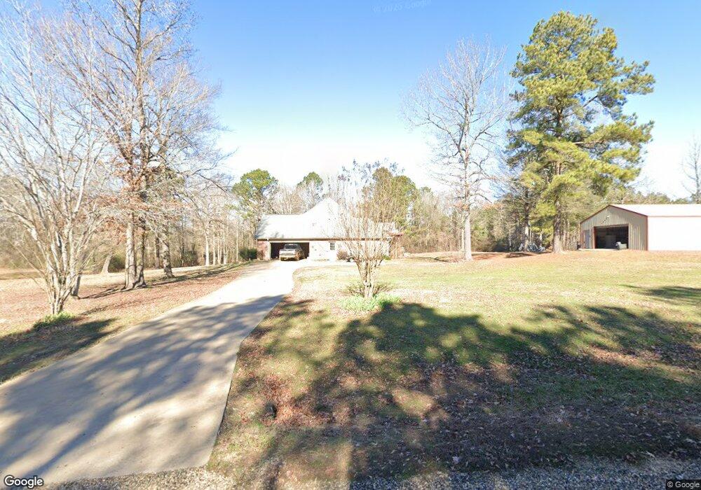
3717 Calhoon Trail Texarkana, AR 71854
Estimated Value: $345,000 - $500,000
--
Bed
2
Baths
2,819
Sq Ft
$145/Sq Ft
Est. Value
About This Home
This home is located at 3717 Calhoon Trail, Texarkana, AR 71854 and is currently estimated at $409,870, approximately $145 per square foot. 3717 Calhoon Trail is a home located in Miller County with nearby schools including Arkansas High School, Trinity Christian School, and Veritas Academy.
Ownership History
Date
Name
Owned For
Owner Type
Purchase Details
Closed on
Apr 16, 2025
Sold by
Kennedy Brandon and Kennedy Lauren
Bought by
Lauren And Brandon Kennedy Joint Revocable Tr and Kennedy
Current Estimated Value
Purchase Details
Closed on
Apr 20, 2022
Sold by
Gail Perry Sarah
Bought by
Perry Daniel Lee
Purchase Details
Closed on
Apr 4, 2016
Sold by
Ponder Levi T
Bought by
Perry Daniel and Perry Sarah
Home Financials for this Owner
Home Financials are based on the most recent Mortgage that was taken out on this home.
Original Mortgage
$267,300
Interest Rate
3.64%
Mortgage Type
New Conventional
Create a Home Valuation Report for This Property
The Home Valuation Report is an in-depth analysis detailing your home's value as well as a comparison with similar homes in the area
Home Values in the Area
Average Home Value in this Area
Purchase History
| Date | Buyer | Sale Price | Title Company |
|---|---|---|---|
| Lauren And Brandon Kennedy Joint Revocable Tr | -- | Southwest Title | |
| Perry Daniel Lee | -- | Kemp Karlton H | |
| Perry Daniel | $297,000 | -- |
Source: Public Records
Mortgage History
| Date | Status | Borrower | Loan Amount |
|---|---|---|---|
| Previous Owner | Perry Daniel | $267,300 |
Source: Public Records
Tax History Compared to Growth
Tax History
| Year | Tax Paid | Tax Assessment Tax Assessment Total Assessment is a certain percentage of the fair market value that is determined by local assessors to be the total taxable value of land and additions on the property. | Land | Improvement |
|---|---|---|---|---|
| 2024 | $2,569 | $53,460 | $6,370 | $47,090 |
| 2023 | $2,510 | $53,460 | $6,370 | $47,090 |
| 2022 | $2,560 | $53,460 | $6,370 | $47,090 |
| 2021 | $2,560 | $53,460 | $6,370 | $47,090 |
| 2020 | $2,560 | $53,460 | $6,370 | $47,090 |
| 2019 | $2,440 | $51,280 | $6,370 | $44,910 |
| 2018 | $2,465 | $51,280 | $6,370 | $44,910 |
| 2017 | $2,465 | $51,280 | $6,370 | $44,910 |
| 2016 | $2,465 | $51,280 | $6,370 | $44,910 |
| 2015 | $2,465 | $51,280 | $6,370 | $44,910 |
| 2014 | $2,521 | $52,290 | $7,960 | $44,330 |
Source: Public Records
Map
Nearby Homes
- TBD Old Post Rd
- 0 Old Post Rd Unit 24065762
- 5339 Mandeville Rd
- 5999 E Broad
- TBD 6 Joey Ln
- TBD 4 Joey Ln
- TBD 3 Joey Ln
- 6601 Country Hills Dr
- 5610 Cedar Ridge Trail
- 5609 Cedar Ridge Trail
- TBD Dooley Ferry Rd
- TBD 5 Dooley Ferry Rd
- TBD 2 Dooley Ferry Rd
- TBD 1 Dooley Ferry Rd
- TBD U S Highway 82
- 6323 E 9th St
- 5600 Spearhead Ln
- 0 E 58th St Unit 117077
- 8.44 Acr E 58th St
- TBD Mc 65
- TBD Calhoon Trail
- 5745 Calhoon Trail
- 5735 Calhoon Trail
- 5725 Calhoon Trail
- 4154 Calhoon Trail
- 5701 Calhoon Trail
- 3926 Calhoon Trail
- 4260 Calhoon Trail
- 5611 Calhoon Trail
- 3750 N Rondo Rd
- 3702 N Rondo Rd
- 4330 Parker Ln
- 3894 N Rondo Rd
- 3600 N Rondo Rd
- 3805 N Rondo Rd
- 3138 N Rondo Rd
- 5429 E Heights Rd
- 4200 N Rondo Rd
- 5416 E Heights Rd
- 5421 E Heights Rd